Catalogue Search | MBRL


Are you sure you want to remove the book from the shelf?

{{itemTitle}}
12
result(s) for
"Venice, Florida"
Sort by:
John Nolen and the Metropolitan Landscape
\"A model city, the hope of democracy\" - John Nolen on his suggested plans for Madison, Wisconsin
This book connects John Nolen's political and social visions with his design proposals by analyzing his extensive writings, personal correspondence and some of his most significant works. While John Nolen is best known as a city planner, he trained as a landscape architect and used the titles 'landscape architect' and 'city planner' interchangeably throughout his career. A prolific practitioner, he was engaged in nearly 400 projects throughout the United States between 1905 and 1936, including town planning, industrial housing, state and city parks, new towns and regional planning.
Focusing particularly on several projects central to Nolen's career including Madison (WI), Mariemont (OH), Venice (FL) and Penderlea (NC), Beck investigates the ideologies that underpinned Nolen's work. This is a rare look at a key figure in the development of 20th century American cities.
eBook
Coast lines
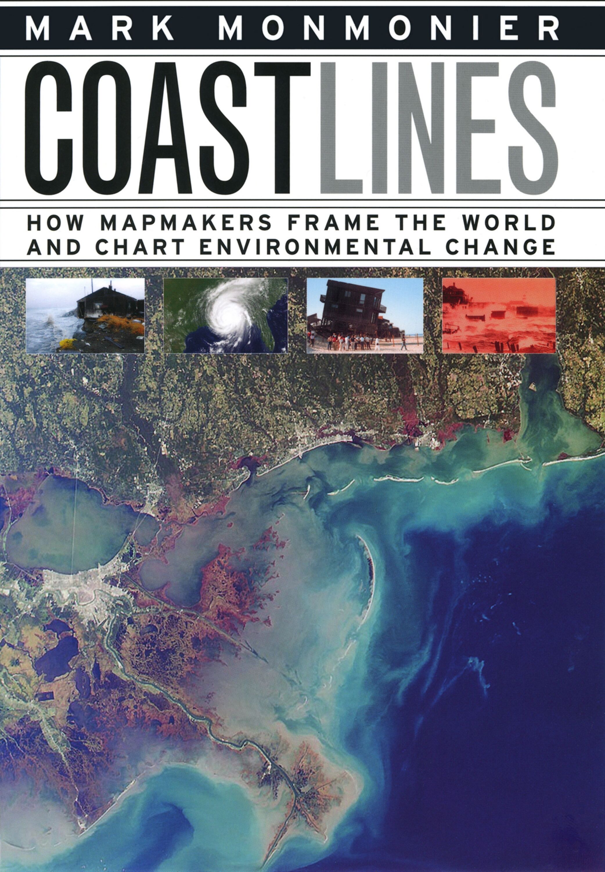
In the next century, sea levels are predicted to rise at unprecedented rates, causing flooding around the world, from the islands of Malaysia and the canals of Venice to the coasts of Florida and California. These rising water levels pose serious challenges to all aspects of coastal existence—chiefly economic, residential, and environmental—as well as to the cartographic definition and mapping of coasts. It is this facet of coastal life that Mark Monmonier tackles in Coast Lines. Setting sail on a journey across shifting landscapes, cartographic technology, and climate change, Monmonier reveals that coastlines are as much a set of ideas, assumptions, and societal beliefs as they are solid black lines on maps. Whether for sailing charts or property maps, Monmonier shows, coastlines challenge mapmakers to capture on paper a highly irregular land-water boundary perturbed by tides and storms and complicated by rocks, wrecks, and shoals. Coast Lines is peppered with captivating anecdotes about the frustrating effort to expunge fictitious islands from nautical charts, the tricky measurement of a coastline’s length, and the contentious notions of beachfront property and public access. Combing maritime history and the history of technology, Coast Lines charts the historical progression from offshore sketches to satellite images and explores the societal impact of coastal cartography on everything from global warming to homeland security. Returning to the form of his celebrated Air Apparent, Monmonier ably renders the topic of coastal cartography accessible to both general readers and historians of science, technology, and maritime studies. In the post-Katrina era, when the map of entire regions can be redrawn by a single natural event, the issues he raises are more important than ever.
eBook

Sharks' teeth, beaches on a slice of old Florida
Venice is known as the shark tooth capital of the world. Sharks are rare here now, rarer than the black, brown, and gray teeth the waves uncover or toss onto the beach. It is appropriate that these relics turn up along Venice's shoreline because this community and its neighboring towns in Sarasota County along the Gulf Coast still retain much of old Florida itself - from the ice cream stand at Nokomis Groves to the pink Italian Renaissance and Mediterranean-style shops and restaurants that line downtown Venice Avenue under umbrella-topped Canary Island date palms. If life seems calmer and less artificial in this region of the state, it's because the residents, the Venice Area Historical Society, and the chamber of commerce have long made a commitment to value the old and the natural. Venice is one of the few cities on Florida's west coast that's not separated from the gulf by a barrier island. Instead, construction of the Intracoastal Waterway in 1963 made an \"island\" of the Venice commercial district and its shoreline. At Venice Municipal Beach, the busiest of Venice's beaches, the service building has a fabulous \"flying roof,\" built in the Sarasota design, and the last full-length pier on Florida's west coast. Don't miss Sharky's restaurant on the pier, where the conch fritters and grouper wrap are perfect accompaniments to a walk on the pier.
Newspaper Article

Inlet Evolution Modeling of Multiple Inlet Systems in Southwest and Central Florida
This paper describes a methodology for modeling long-term evolution of multiple inlet systems in southwest and central Florida. The paper discusses the application of this methodology to two inlets within Sarasota Bay system in southwest Florida. The case studies of Longboat Pass and Venice Inlet demonstrate the importance of considering large temporal and spatial scales in multiple inlet systems. The results describe the evolution of Longboat Pass and Venice Inlet from 1880 to present. The analysis begins with natural conditions that existed before dredging or inlet modifications and investigates how inlet evolution can be influenced by navigation improvements or mining of ebb shoals for beach nourishment.
Journal Article