Catalogue Search | MBRL


Are you sure you want to remove the book from the shelf?

{{itemTitle}}
212
result(s) for
"Flint, Colin"
Sort by:


Seapower, geostrategic relations, and islandness: The World War II Destroyers for Bases deal
The Destroyers for Bases deal was signed on March 27, 1941, and transferred fifty aging US destroyers to Great Britain in exchange for 99-year leases of bases on the British controlled islands of Newfoundland, Bermuda, Trinidad, Jamaica, Antigua, St. Lucia, the Bahamas, and one in British Guiana. The deal highlights how US strategic planners came to see the value of the islands because of their relationality. Three forms of relationality are discussed: the land/sea dialectic; spatial connectivity; and the changing geopolitical balance of power. Relationality is a factor in four strategic calculations: other islands; other continents; other oceans; and the conjuncture of long-term historical processes of hegemonic decline and rise. The relationality of the islands is understood through the lens of seapower as both input (the military bases) and output (the projection of force). Media representations of the deal are discussed to illustrate how islandness was implicit in the narration of the islands as being of strategic benefit to the US. The conclusions drawn emphasize the need to see strategic and military actors as agents who are aware of and construct island relationality; and the need for islands to be included as one of the inputs of seapower.
Journal Article

جغرافية الحرب والسلام من معسكرات الموت إلى الحراك الدبلوماسي
في عالم يموج بالحرب والصراعات يقدم هذا الكتاب قراءة للخلفيات المكانية (الجغرافية) التي تقف وراء موجات الحرب ونوبات السلام، يستعين الكتاب بالأسس المنهجية وحزمة من المذاهب الفلسفية والأبعاد التاريخية لفهم أسباب وتداعيات الحرب والسلام، يعرج الكتاب على أقاليم جغرافية ومشكلات متنوعة من إندونيسيا وكمبوديا والهند والصين في الشرق إلى المكسيك في الغرب مرورا بأفغانستان والشيشان وفلسطين والبوسنة وكوسوفو.
BOOK
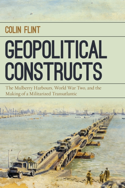
Geopolitical Constructs
This innovative book tells a unique story about D-Day, one that does not concentrate on the soldiers who hit the beaches or the admirals and generals who commanded them. Instead, Colin Flint brings engineers, businessmen, and bureaucrats to center stage. Through them, he offers a different way of thinking about war, one that sees war as an ongoing set of processes in which seemingly isolated acts are part of broader historical developments. Developing the concept of geopolitical constructs to understand wars, the author connects specific events to long-term and global geopolitical arrangements. Focusing on the construction of the Mulberry Harbours—massive artificial structures dragged across the English Channel in the immediate wake of the invading force—Flint illustrates how the process of making war links a vast array of people, institutions, and places, as well as past events and future outcomes. He argues that the people who designed and built the Harbours became geopolitical subjects by producing pieces of engineering that helped shape the course of World War Two and the Cold War that followed, which created a militarized trans-Atlantic that remains today. Using previously unpublished archival material to give voice to those who made the Mulberry Harbours and wartime strategy, this original study broadens the historical and geographical scope of how we understand war, showing how the everyday actions of individuals made, and were made by, geopolitical settings.
eBook

Spatializing Social Networks: Using Social Network Analysis to Investigate Geographies of Gang Rivalry, Territoriality, and Violence in Los Angeles
Social network analysis is an increasingly prominent set of techniques used in a number of social sciences, but the use of the techniques of social network analysis in geography has been challenged because of a perceived lack of geographic nuance or consideration of spatialities of context in social networks. The concept of social position and the associated technique of structural equivalence in social network analysis are explored as a means to integrate two different kinds of embeddedness: relative location in geographic space and structural position in network space. Using spatialized network data, this article compares the geography of rivalry relations that connect territorially based criminal street gangs in a section of Los Angeles with a geography of the location of gang-related violence. The technique of structural equivalence uses the two different spatialities of embeddedness to identify gangs that are similarly embedded in the territorial geography and positioned in the rivalry network, which aids in understanding the overall context of gang violence. The technique demonstrated here has promise beyond this one study of gang crime as it operationalizes spatialities of embeddedness in a way that allows simultaneous systematic evaluation of the way in which social actors' positions in network relationships and spatial settings provide constraints on and possibilities for their behavior.
Journal Article

Putting the “geo” into geopolitics: a heuristic framework and the example of Australian foreign policy
This paper aims to contribute to the understanding of geopolitics by offering a heuristic framework to understand the “geo” in geopolitics. The approach integrates economic and strategic processes with transformations of physical geography by emphasizing the role of context and the mutual construction of geography and politics. Understanding foreign policy choices requires a theorized contextualization that sees all geopolitical decisions being limited by the interaction of economic, strategic, and physical contexts. Geopolitics is situated within the structures and imperatives of the capitalist world-economy and defined as the process of controlling geographic entities; specifically, regions, networks, and places. Geopolitical activity occurs within three related contexts; specifically, geostructural, geostrategic, and geophysical. The geographic entities and contexts are constructed by geopolitical activity, and frame such activity, in a non-deterministic and mutually constitutive fashion. The framework is illustrated by a brief discussion of Australia’s foreign policy orientations in the Indo-Pacific region.
Journal Article

Spaces of Hate
First published in 2004. Routledge is an imprint of Taylor & Francis, an informa company.
Colin Flint is Assistant Professor of Geography at Penn State University. He is co-author of Political Geography, 4th Ed. (Longman).
eBook
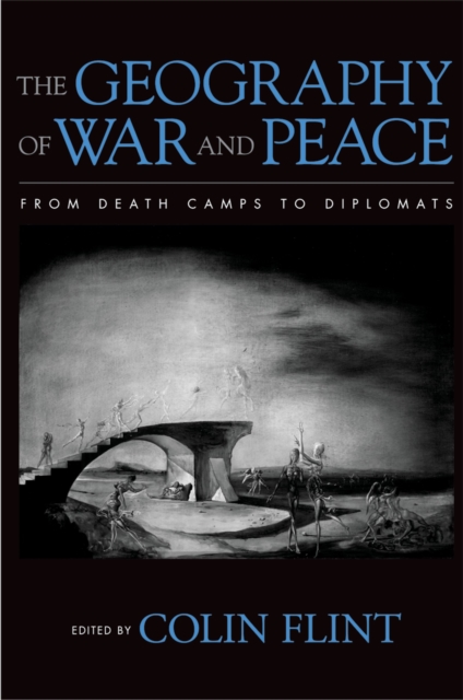
The geography of war and peace : from death camps to diplomats
How and why war and peace occur cannot be understood without realizing that those who make war and peace must negotiate a complex world political map of sovereign spaces, borders, networks, and scales. This book takes advantage of a diversity of perspectives as it analyzes the political processes of war and their spatial expression.
eBook
A Relational Geography of War: Actor-Context Interaction and the Spread of World War I
Claims by geographers that the geopolitical context of international politics matters requires that context be defined and operationalized in a way that enables analyses illustrating that actors' behavior varies across different contextual settings. A geographic understanding of embeddedness and relational power is meshed with a well-established contextual theory of international politics to create an operationalization of context that helps to explain the diffusion of war. Using the case of World War I, we investigate the expansion of the war from a localized political crisis in Austria-Hungary to a disastrous global scale conflict involving dozens of states. We integrate contemporary geographic thinking on context with the foundational texts of the war diffusion literature to hypothesize that war-joining behavior is explained by a political entity's relative position in a simultaneously spatial and social network context. Using social network analysis-based methodologies to develop measures of context and evaluate our hypothesis, we find that context had an important impact on states' war-joining behavior during World War I. An understanding of context that fuses simultaneous embeddedness in network and geographic space with relational power and the methodology of blockmodeling can be used to explore the diffusion of other wars and even other phenomena across geographically situated actors.
Journal Article
Standing different ground: the spatial heterogeneity of territorial disputes
Recent developments in spatial analysis and spatial data have allowed researchers to investigate various geographical factors in the quantitative analysis of conflict and war (Ward in Polit Geogr 21(2):155–158, 2002). Despite the importance of territory in interstate conflict, there has been a limited interest in the application of spatial analysis to the study of territorial conflict. Using geographically weighted regression (GWR) we evaluated the existing explanations of territorial conflict provided by a global scale analysis that assumes a spatial consistency in the explanatory variables. Specifically, we revisited Paul Huth's foundational work by using GWR to examine the spatial pattern in the sign and significance of the variables. The result of GWR shows that the escalation of territorial conflict cannot be fully explained by one universal model. There is a high level of spatial variation in the regression parameters and the explanatory power of the model varies over space. A k-means cluster analysis was implemented for a further investigation of the regional pattern of the underlying causes of territorial disputes. The result of our GWR suggests the necessity and possibility to pursue a local or regional scale approach to the study of territorial conflict, an approach that challenges an epistemology of seeking a single explanation for the causes of conflict that neglects regional context. The spatial heterogeneity in the causes of territorial conflict escalation we find is framed within a narrative of the intertwined processes of colonialism, Cold War legacies, and competition for resources.
Journal Article