Catalogue Search | MBRL


Are you sure you want to remove the book from the shelf?

{{itemTitle}}
83
result(s) for
"Mickey, Ruth"
Sort by:

Landscape composition mediates movement and habitat selection in bobcats (Lynx rufus): implications for conservation planning
ContextThe analysis of individual movement choices can be used to better understand population-level resource selection and inform management.ObjectivesWe investigated movements and habitat selection of 13 bobcats in Vermont, USA, under the assumption individuals makes choices based upon their current location. Results were used to identify “movement-defined” corridors.MethodsWe used GPS-collars and GIS to estimate bobcat movement paths, and extracted statistics on land cover proportions, topography, fine-scale vegetation, roads, and streams within “used” and “available” space surrounding each movement path. Compositional analyses were used to determine habitat preferences with respect to landcover and topography; ratio tests were used to determine if used versus available ratios for vegetation, roads, and streams differed from 1. Results were used to create travel cost maps, a primary input for corridor analysis.ResultsForested and scrub-rock land cover were most preferred for movement, while developed land cover was least preferred. Preference depended on the composition of the “available” landscape: Bobcats moved > 3 times more quickly through forest and scrub-rock habitat when these habitats were surrounded by agriculture or development than when the available buffer was similarly composed. Overall, forest edge, wetland edge and higher stream densities were selected, while deep forest core and high road densities were not selected. Landscape-scale connectivity maps differed depending on whether habitat suitability, preference, or selection informed the travel cost map.ConclusionsBoth local and landscape scale land cover characteristics affect habitat preferences and travel speed of bobcats, which in turn can inform management and conservation activities.
Journal Article

Landscape connectivity for bobcat (Lynx rufus) and lynx (Lynx canadensis) in the Northeastern United States
Landscape connectivity is integral to the persistence of metapopulations of wide ranging carnivores and other terrestrial species. The objectives of this research were to investigate the landscape characteristics essential to use of areas by lynx and bobcats in northern New England, map a habitat availability model for each species, and explore connectivity across areas of the region likely to experience future development pressure. A Mahalanobis distance analysis was conducted on location data collected between 2005 and 2010 from 16 bobcats in western Vermont and 31 lynx in northern Maine to determine which variables were most consistent across all locations for each species using three scales based on average 1) local (15 minute) movement, 2) linear distance between daily locations, and 3) female home range size. The bobcat model providing the widest separation between used locations and random study area locations suggests that they cue into landscape features such as edge, availability of cover, and development density at different scales. The lynx model with the widest separation between random and used locations contained five variables including natural habitat, cover, and elevation-all at different scales. Shrub scrub habitat-where lynx's preferred prey is most abundant-was represented at the daily distance moved scale. Cross validation indicated that outliers had little effect on models for either species. A habitat suitability value was calculated for each 30 m2 pixel across Vermont, New Hampshire, and Maine for each species and used to map connectivity between conserved lands within selected areas across the region. Projections of future landscape change illustrated potential impacts of anthropogenic development on areas lynx and bobcat may use, and indicated where connectivity for bobcats and lynx may be lost. These projections provided a guide for conservation of landscape permeability for lynx, bobcat, and species relying on similar habitats in the region.
Journal Article
Predicting effects of future development on a territorial forest songbird: methodology matters
ContextProjected increases in human population size are expected to increase forest loss and fragmentation in the next century at the expense of forest-dwelling species.ObjectivesWe estimated landscape carrying capacity (Nk) for Ovenbirds in urban, suburban, exurban, and rural areas for the years 2000 and 2050, and compared changes in Nk with changes in occupancy probability.MethodsMaximum clique analysis, a branch of mathematical graph theory, was used to estimate landscape carrying capacity, the maximum potential number of territories a given landscape is capable of supporting (Nk). We used occupancy probability maps as inputs for calculating Ovenbird Nk in the northeastern USA and a spatially explicit growth model to forecast future development patterns in 2050. We compared occupancy probability with estimates of Nk for urban, suburban, exurban, and rural areas for the years 2000 and 2050.ResultsIn response to human population growth and development, Ovenbird Nk was predicted to decrease 23% in urban landscapes, 28% in suburban landscapes, 43% in exurban landscapes, and 20% in rural landscapes. These decreases far exceeded decreases in mean occupancy probabilities that ranged between 2 and 5% across the same development categories. Thus, small decreases in occupancy probability between 2000 and 2050 translated to much larger decreases in Nk.ConclusionsFor the first time, our study compares occupancy probability with a species population metric, Nk, to assess the impact of future development. Maximum clique analysis is a tool that can be used to estimate Nk and inform landscape management and communication with stakeholders.
Journal Article
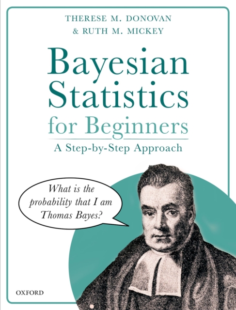
Bayesian statistics for beginners : a step-by-step approach
Bayesian Statistics for Beginners is an entry-level book on Bayesian statistics. It is like no other math book you’ve read. It is written for readers who do not have advanced degrees in mathematics and who may struggle with mathematical notation, yet need to understand the basics of Bayesian inference for scientific investigations. Intended as a “quick read,” the entire book is written as an informal, humorous conversation between the reader and writer—a natural way to present material for those new to Bayesian inference. The most impressive feature of the book is the sheer length of the journey, from introductory probability to Bayesian inference and applications, including Markov Chain Monte Carlo approaches for parameter estimation, Bayesian belief networks, and decision trees. Detailed examples in each chapter contribute a great deal, where Bayes’ Theorem is at the front and center with transparent, step-by-step calculations. A vast amount of material is covered in a lighthearted manner; the journey is relatively pain-free. The book is intended to jump-start a reader’s understanding of probability, inference, and statistical vocabulary that will set the stage for continued learning. Other features include multiple links to web-based material, an annotated bibliography, and detailed, step-by-step appendices.
eBook

A Comparison of Acoustic Monitoring Methods for Common Anurans of the Northeastern United States
Many anuran monitoring programs now include autonomous recording units (ARUs). These devices collect audio data for extended periods of time with little maintenance and at sites where traditional call surveys might be difficult. Additionally, computer software programs have grown increasingly accurate at automatically identifying the calls of species. However, increased automation may cause increased error. We collected 435 min of audio data with 2 types of ARUs at 10 wetland sites in Vermont and New York, USA, from 1 May to 1 July 2010. For each minute, we determined presence or absence of 4 anuran species (Hyla versicolor, Pseudacris crucifer, Anaxyrus americanus, and Lithobates clamitans) using 1) traditional human identification versus 2) computer-mediated identification with software package, Song Scope® (Wildlife Acoustics, Concord, MA). Detections were compared with a data set consisting of verified calls in order to quantify false positive, false negative, true positive, and true negative rates. Multinomial logistic regression analysis revealed a strong (P <0.001) 3-way interaction between the ARU recorder type, identification method, and focal species, as well as a trend in the main effect of rain (P = 0.059). Overall, human surveyors had the lowest total error rate (<2%) compared with 18–31% total errors with automated methods. Total error rates varied by species, ranging from 4% for A. americanus to 26% for L. clamitans. The presence of rain may reduce false negative rates. For survey minutes where anurans were known to be calling, the odds of a false negative were increased when fewer individuals of the same species were calling.
Journal Article


Predicting Minimum Habitat Characteristics for the Indiana Bat in the Champlain Valley
Predicting potential habitat across a landscape for rare species is extremely challenging. However, partitioned Mahalanobis D2 methods avoid pitfalls commonly encountered when surveying rare species by using data collected only at known species locations. Minimum habitat requirements are then determined by examining a principal components analysis to find consistent habitat characteristics across known locations. We used partitioned D2 methods to examine minimum habitat requirements of Indiana bats (Myotis sodalis) in the Champlain Valley of Vermont and New York, USA, across 7 spatial scales and map potential habitat for the species throughout the same area. We radiotracked 24 female Indiana bats to their roost trees and across their nighttime foraging areas to collect habitat characteristics at 7 spatial scales: 1) roost trees, 2) 0.1-ha circular plots surrounding the roost trees, 3) home ranges, and 4–7) 0.5-km, 1-km, 2-km, and 3-km buffers surrounding the roost tree. Roost trees (n = 50) typically were tall, dead, large-diameter trees with exfoliating bark, located at low elevations and close to water. Trees surrounding roosts typically were smaller in diameter and shorter in height, but they had greater soundness than the roost trees. We documented 14 home ranges in areas of diverse, patchy land cover types that were close to water with east-facing aspects. Across all landscape extents, area of forest within roost-tree buffers and the aspect across those buffers were the most consistent features. Predictive maps indicated that suitable habitat ranged from 4.7–8.1% of the area examined within the Champlain Valley. These habitat models further understanding of Indiana bat summer habitat by indicating minimum habitat characteristics at multiple scales and can be used to aid management decisions by highlighting potential habitat. Nonetheless, information on juvenile production and recruitment is lacking; therefore, assessments of Indiana bat habitat quality in the region are still incomplete.
Journal Article

Brothers and Sisters of Lesbians, Gay Men, and Bisexuals as a Demographic Comparison Group
This study provides an innovative methodology to study social issues across sexual orientations. Lesbians, gay men, and bisexualwomen and men (LGB) were recruited via LGB periodicals and organizations, and they in turn recruited their siblings. Results of female participants indicate that lesbians are more highly educated, have occupations with greater status, are less religious, and are more geographically mobile than are heterosexual women. Heterosexual women are more similar to census data in terms of marriage, children, religion, and homemaker status. Gay men have moved to large cities and are more highly educated than are heterosexual men. In general, bisexual women are more comparable demographically to lesbians, whereas bisexual men are more similar to heterosexual men. Limiting the sample to paired comparisons between lesbian-heterosexual sisters and gay-heterosexual brothers generally yielded similar means on demographic variables.
Journal Article
Landscape connectivity for bobcat in the Northeastern United States
Landscape connectivity is integral to the persistence of metapopulations of wide ranging carnivores and other terrestrial species. The objectives of this research were to investigate the landscape characteristics essential to use of areas by lynx and bobcats in northern New England, map a habitat availability model for each species, and explore connectivity across areas of the region likely to experience future development pressure. A Mahalanobis distance analysis was conducted on location data collected between 2005 and 2010 from 16 bobcats in western Vermont and 31 lynx in northern Maine to determine which variables were most consistent across all locations for each species using three scales based on average 1) local (15 minute) movement, 2) linear distance between daily locations, and 3) female home range size. The bobcat model providing the widest separation between used locations and random study area locations suggests that they cue into landscape features such as edge, availability of cover, and development density at different scales. The lynx model with the widest separation between random and used locations contained five variables including natural habitat, cover, and elevation-all at different scales. Shrub scrub habitat-where lynx's preferred prey is most abundant-was represented at the daily distance moved scale. Cross validation indicated that outliers had little effect on models for either species. A habitat suitability value was calculated for each 30 m.sup.2 pixel across Vermont, New Hampshire, and Maine for each species and used to map connectivity between conserved lands within selected areas across the region. Projections of future landscape change illustrated potential impacts of anthropogenic development on areas lynx and bobcat may use, and indicated where connectivity for bobcats and lynx may be lost. These projections provided a guide for conservation of landscape permeability for lynx, bobcat, and species relying on similar habitats in the region.
Journal Article
Landscape connectivity for bobcat
Landscape connectivity is integral to the persistence of metapopulations of wide ranging carnivores and other terrestrial species. The objectives of this research were to investigate the landscape characteristics essential to use of areas by lynx and bobcats in northern New England, map a habitat availability model for each species, and explore connectivity across areas of the region likely to experience future development pressure. A Mahalanobis distance analysis was conducted on location data collected between 2005 and 2010 from 16 bobcats in western Vermont and 31 lynx in northern Maine to determine which variables were most consistent across all locations for each species using three scales based on average 1) local (15 minute) movement, 2) linear distance between daily locations, and 3) female home range size. The bobcat model providing the widest separation between used locations and random study area locations suggests that they cue into landscape features such as edge, availability of cover, and development density at different scales. The lynx model with the widest separation between random and used locations contained five variables including natural habitat, cover, and elevation-all at different scales. Shrub scrub habitat-where lynx's preferred prey is most abundant-was represented at the daily distance moved scale. Cross validation indicated that outliers had little effect on models for either species. A habitat suitability value was calculated for each 30 m.sup.2 pixel across Vermont, New Hampshire, and Maine for each species and used to map connectivity between conserved lands within selected areas across the region. Projections of future landscape change illustrated potential impacts of anthropogenic development on areas lynx and bobcat may use, and indicated where connectivity for bobcats and lynx may be lost. These projections provided a guide for conservation of landscape permeability for lynx, bobcat, and species relying on similar habitats in the region.
Journal Article