Catalogue Search | MBRL


Are you sure you want to remove the book from the shelf?

{{itemTitle}}
11
result(s) for
"Cartography Turkey History."
Sort by:

Printing a Mediterranean world : Florence, Constantinople, and the renaissance of geography
In 1482 Francesco Berlinghieri produced the Geographia, a book of over 100 folio leaves describing the world in Italian verse interleaved with lavishly engraved maps. Roberts demonstrates that the Geographia represents the moment of transition between printing and manuscript culture, while forming a critical base for the rise of modern cartography.
eBook

Mapping the Ottomans : sovereignty, territory, and identity in the early modern Mediterranean
\"Simple paradigms of Muslim-Christian confrontation and the rise of Europe in the seventeenth century do not suffice to explain the ways in which European mapping envisioned the \"Turks\" in image and narrative. Rather, maps, travel accounts, compendia of knowledge, and other texts created a picture of the Ottoman Empire through a complex layering of history, ethnography, and eyewitness testimony, which juxtaposed current events to classical and biblical history; counted space in terms of peoples, routes, and fortresses; and used the land and seascapes of the map to assert ownership, declare victory, and embody imperial power's reach. Enriched throughout by examples of Ottoman self-mapping, this book examines how Ottomans and their empire were mapped in the narrative and visual imagination of early modern Europe's Christian kingdoms. The maps serve as centerpieces for discussions of early modern space, time, borders, stages of travel, information flows, invocations of authority, and cross-cultural relations\"-- Provided by publisher.
Book
Printing a Mediterranean World
In 1482, the Florentine humanist and statesman Francesco Berlinghieri produced the Geographia, a book of over one hundred folio leaves describing the world in Italian verse, inspired by the ancient Greek geography of Ptolemy. The poem, divided into seven books (one for each day of the week the author \"travels\" the known world), is interleaved with lavishly engraved maps to accompany readers on this journey.
Sean Roberts demonstrates that the Geographia represents the moment of transition between printing and manuscript culture, while forming a critical base for the rise of modern cartography. Simultaneously, the use of the Geographia as a diplomatic gift from Florence to the Ottoman Empire tells another story. This exchange expands our understanding of Mediterranean politics, European perceptions of the Ottomans, and Ottoman interest in mapping and print. The envoy to the Sultan represented the aspirations of the Florentine state, which chose not to bestow some other highly valued good, such as the city's renowned textiles, but instead the best example of what Florentine visual, material, and intellectual culture had to offer.
eBook
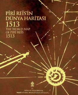

The Piri Reis map of 1513
One of the most beautiful maps to survive the Great Age of Discoveries, the 1513 world map drawn by Ottoman admiral Piri Reis is also one of the most mysterious. Gregory McIntosh has uncovered new evidence in the map that shows it to be among the most important ever made.
This detailed study offers new commentary and explication of a major milestone in cartography. Correcting earlier work of Paul Kahle and pointing out the traps that have caught subsequent scholars, McIntosh disproves the dubious conclusion that the Reis map embodied Columbus's Third Voyage map of 1498, showing that it draws instead on the Second Voyage of 1493-1496. He also refutes the popular misinterpretation that Reis's depictions of Antarctica are evidence of either ancient civilizations or extraterrestrial visitation. McIntosh brings together all that has been previously known about the map and also assembles for the first time the translations of all inscriptions on the map and analyzes all place-names given for New World and Atlantic islands. His work clarifies long-standing mysteries and opens up new ways of looking at the history of exploration.
eBook

Printing a Mediterranean World
In 1482 Francesco Berlinghieri produced the Geographia, a book of over 100 folio leaves describing the world in Italian verse interleaved with lavishly engraved maps. Roberts demonstrates that the Geographia represents the moment of transition between printing and manuscript culture, while forming a critical base for the rise of modern cartography.
eBook

Misreading and Mobility in Constitutional Texts: A Nineteenth Century Case
This article explores the case of the adoption of Southeast Asia's first constitution (Johor, 1895) to articulate a fundamental problem of translation—the ambiguity and multiplicity of law's language. Closer attention to this problem helps raise a number of possibilities for rethinking the relationship between law, language, and mobility: firstly, polyphony, dissonance, and divergence in law's language reveals a plethora of political possibilities, audiences, and actors in the making of law; secondly, these ambiguities and multiplicities are integral to law's mobility; thirdly, rather than transmissions of law from center to periphery, law moves in circulations that are iterative, contingent, and patterned. Finally, tracing the movement of law in time and space reveals that each project of translation is also a project of political transformation: as such, analysis of law's translations also requires analyses of how, why, and with whom, law travels.
Journal Article

Representations of the Frontier in Ottoman Town Views of the Sixteenth Century
City views, one of the most distinctive and ubiquitous features of sixteenth-century Ottoman manuscript illustration, were used to document the territorial expansion of the Ottoman Empire and to map its expanding frontiers. This study examines the portrayal of the frontiers of the Ottoman Empire in one famous group of manuscripts from the mid-sixteenth century, Matrakçı Nasuh's Histories of the House of Osman. This body of work, which includes four unique illustrated volumes, was the first to use city views and topographical paintings as a means of representing the geographical limits of the Ottoman state. The idea of representing the frontier through town views was in some respects well suited to the geopolitical realities of the Ottoman borderlands, which were fluid, discontinuous and defined mostly by claims on frontier towns. City views offered a vision of the Ottoman Empire as the sum of its territorial acquisitions and allowed members of the ruling elite who collected the images to imagine their empire in these terms.
Journal Article

Constructing the Image of a City: The Representation of Constantinople in Christopher Buondelmonti's Liber Insularum Archipelagi
An unusual sequence of manuscript maps of Constantinople that accompany Christopher Buondelmonti's Liber Insularum Archipelagi provides insight into the ways in which this city was viewed and represented in Western Europe during the fifteenth and sixteenth centuries. As a result of cartographic developments during this period, the city's topography and features could be portrayed and located with greater accuracy than ever; yet as actually constructed the maps continue to be imbued both deliberately and unconsciously with symbolic meanings and silences. More particularly, these maps, as cultural constructions, play a role in the reappropriation of the city for Christianity. Despite its capture by the Ottoman Turks in 1453, it is suggested that this is still a contested city, at least in the minds of fifteenth-century mapmakers and their patrons. Subsequent generations of maps, drawing on these sources, create through copying and borrowing, reworking and repetition, a composite view of the city that for all the mapmakers' claims for truthfulness and accuracy, is quite at odds with the actual appearance of the Ottoman city. By way of contrast, the discussion draws attention to a hitherto overlooked copy of Buondelmonti's map that differs markedly from the dominant tradition by including details, clearly derived from first-hand experience, of the rebuilding and transformation of the city under Ottoman rule. The analysis is linked to the awakening within the Renaissance world of Europe to ideas of perspective, scale, distance, and location, and to the preoccupation of fifteenth- and sixteenth-century society with the visual image; more specifically, the development of the perspective plan as a \"representational language\" is shown to be rooted in a tradition that predates the appearance of the printed map.
Journal Article