Catalogue Search | MBRL


Are you sure you want to remove the book from the shelf?

{{itemTitle}}
237
result(s) for
"Cascade Range"
Sort by:

Mixed-conifer forests of central Oregon: effects of logging and fire exclusion vary with environment
Twentieth-century land management has altered the structure and composition of mixed-conifer forests and decreased their resilience to fire, drought, and insects in many parts of the Interior West. These forests occur across a wide range of environmental settings and historical disturbance regimes, so their response to land management is likely to vary across landscapes and among ecoregions. However, this variation has not been well characterized and hampers the development of appropriate management and restoration plans. We identified mixed-conifer types in central Oregon based on historical structure and composition, and successional trajectories following recent changes in land use, and evaluated how these types were distributed across environmental gradients. We used field data from 171 sites sampled across a range of environmental settings in two subregions: the eastern Cascades and the Ochoco Mountains.
We identified four forest types in the eastern Cascades and four analogous types with lower densities in the Ochoco Mountains. All types historically contained ponderosa pine, but differed in the historical and modern proportions of shade-tolerant vs. shade-intolerant tree species. The Persistent Ponderosa Pine and Recent Douglas-fir types occupied relatively hot-dry environments compared to Recent Grand Fir and Persistent Shade Tolerant sites, which occupied warm-moist and cold-wet environments, respectively. Twentieth-century selective harvesting halved the density of large trees, with some variation among forest types. In contrast, the density of small trees doubled or tripled early in the 20th century, probably due to land-use change and a relatively cool, wet climate. Contrary to the common perception that dry ponderosa pine forests are the most highly departed from historical conditions, we found a greater departure in the modern composition of small trees in warm-moist environments than in either hot-dry or cold-wet environments. Furthermore, shade-tolerant trees began infilling earlier in cold-wet than in hot-dry environments and also in topographically shaded sites in the Ochoco Mountains. Our new classification could be used to prioritize management that seeks to restore structure and composition or create resilience in mixed-conifer forests of the region.
Journal Article
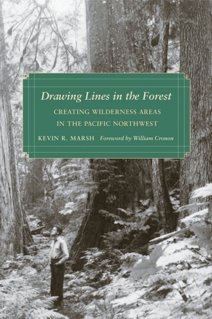
Drawing lines in the forest
Drawing boundaries around wilderness areas often serves a double purpose: protection of the land within the boundary and release of the land outside the boundary to resource extraction and other development. In Drawing Lines in the Forest, Kevin R. Marsh discusses the roles played by various groups the Forest Service, the timber industry, recreationists, and environmentalists in arriving at these boundaries. He shows that pragmatic, rather than ideological, goals were often paramount, with all sides benefiting.
After World War II, representatives of both logging and recreation use sought to draw boundaries that would serve to guarantee access to specific areas of public lands. The logging industry wanted to secure a guaranteed supply of timber, as an era of stewardship of the nation's public forests gave way to an emphasis on rapid extraction of timber resources. This spawned a grassroots preservationist movement that ultimately challenged the managerial power of the Forest Service. The Wilderness Act of 1964 provided an opportunity for groups on all sides to participate openly and effectively in the political process of defining wilderness boundaries.
The often contentious debates over the creation of wilderness areas in the Cascade Mountains in Oregon and Washington represent the most significant stages in the national history of wilderness conservation since World War II: Three Sisters, North Cascades and Glacier Peak, Mount Jefferson, Alpine Lakes, French Pete, and the state-wide wilderness acts of 1984.
eBook

Oxygen isotope geochemistry of mafic phenocrysts in primitive mafic lavas from the southernmost Cascade Range, California
Previously reported whole-rock δ18O values (5.6-7.8 ppm) for primitive quaternary mafic lavas from the southernmost Cascades (SMC) are often elevated (up to 1 ppm) relative to δ18O values expected for mafic magmas in equilibrium with mantle peridotite. Olivine, clinopyroxene, and plagioclase crystals were separated from 29 geochemically well-characterized mafic lavas for δ18O measurements by laser fluorination to assess modification of the mantle sources by ancient and modern subducted components. Oxygen isotope values of olivine phenocrysts in calc-alkaline lavas and contemporaneous high alumina olivine tholeiitic (HAOT) lavas generally exceed depleted mantle olivine values (∼4.9-5.3 ppm). Modern addition of up to 6 wt% slab-derived fluid from Gorda serpentinized peridotite dehydration (∼15 ppm) or chlorite dehydration (∼10 ppm) within the serpentinized peridotite can provide the 18O enrichment detected in olivine phenocrysts (δ18Oolivine = 5.3-6.3 ppm) in calc-alkaline mafic lavas, and elevate 18O in overlying mantle lithosphere, as well. Specifically, although HAOT δ18Oolivine values (5.5-5.7 ppm) may reflect partial melting in heterogeneous 18O enriched mantle source domains that developed during multiple subduction events associated with terrane accretion (e.g., <1 wt% of ∼15 ppm materials), an additional 18O enrichment of up to 2 wt% of 10-15 ppm slab-derived hydrous fluids might be accommodated. The calc-alkaline primitive magmas appear to have experienced a continuous range of open system processes, which operate in the mantle and during rapid magma ascent to eruption, and occasionally post quench. Textural relationships and geochemistry of these lava samples are consistent with blends of mafic phenocrysts and degassed melts in varying states of 18O disequilibrium. In lenses of accumulated melt within peridotite near the base of the crust, coexisting olivine and clinopyroxene δ18O values probably are not at isotopic equilibrium because fluids introduced into the system perturbed the δ18Omelt values. A \"sudden\" melt extraction event interrupts 18O equilibration in phenocrysts and poorly mixed melt(s). Rapid ascent of volatile oversaturated primitive mafic magma through the crust appears to be accompanied by devolatilization and crystallization of anorthite-rich plagioclase with elevated δ18Oplag values. The (Sr/P)N values for the whole rock geochemistry are consistent with a 87Sr/86Sr ∼0.7027 slab-derived fluid addition into the infertile peridotite source of magmas, and melt devolatilization is recorded in the mixture of disequilibrium δ18O values for the constituent phases of lavas. Morbidity of the Gorda Plate as it undergoes intense deformation from the spreading ridge to the trench is likely a key factor to developing the carrying capacity of hydrous fluids and mineral phases in the slab subducting into the SMC mantle.
Journal Article
The Transition From Melt Accumulation to Eruption Initiation Recorded by Orthopyroxene Fe‐Mg Diffusion Timescales in Late Holocene Rhyolites, South Sister Volcano, Oregon Cascade Range
South Sister volcano, Oregon Cascade Range, USA, has repeatedly erupted rhyolite since ca. 40 ka. The youngest such eruptions are the ca. 2 ka Rock Mesa and Devils Chain rhyolites, erupted several hundred years apart from two multi‐vent complexes separated by 3–6 km. Fe‐Mg interdiffusion models of orthopyroxene rims from both rhyolites produce timescales up to several‐thousand years, but dominantly decades‐to‐centuries. Notably, the timescales of step‐normal zoned orthopyroxene rims (i.e., normally zoned with a steep chemical gradient) from the Rock Mesa rhyolite are longer than those of reversely zoned crystals, whereas the Devils Chain produced mostly decadal timescales for both zoning types. Despite the proximity and broadly similar products of these episodes, their respective timescales indicate distinct sequences of events leading up to each eruption. The Rock Mesa timescales record centuries of magma chamber growth followed by decades of predominantly magma rejuvenation, reorganization, and destabilization. In contrast, the Devils Chain episode was preceded by a single episode of coupled rhyolite extraction, rejuvenation, and hybridization. Rare, high‐An plagioclase cores and evidence of reheating implicate cryptic emplacement of mafic magma at the base of the rhyolite reservoirs. However, the diffusion timescales do not unequivocally support a single magma recharge event that affected both. Fluid fluxing and the reorganization of melt into buoyant magma chambers likely provided the source of increasing pressurization that initiated each eruption after several decades. Geodetic models of ongoing deformation west of South Sister could consider these processes in addition to magma emplacement.
Journal Article

High‐severity burned area and proportion exceed historic conditions in Sierra Nevada, California, and adjacent ranges
Although fire is a fundamental ecological process in western North American forests, climate warming and accumulating forest fuels due to fire suppression have led to wildfires that burn at high severity across larger fractions of their footprint than were historically typical. These trends have spiked upwards in recent years and are particularly pronounced in the Sierra Nevada–Southern Cascades ecoregion of California, USA, and neighboring states. We assessed annual area burned (AAB) and percentage of area burned at high and low‐to‐moderate severity for seven major forest types in this region from 1984 to 2020. We compared values for this period against estimates for the pre‐Euro‐American settlement (EAS) period prior to 1850 and against a previous study of trends from 1984 to 2009. Our results show that the total average AAB remained below pre‐EAS levels, but that gap is decreasing (i.e., ~14% of pre‐EAS for 1984–2009, but 39% for 2010–2020 [including ~150% in 2020]). Although the average AAB has remained low compared with pre‐EAS, both the average annual area burned at high severity (AAHS) and the percentage of wildfire area burned at high severity have increased rapidly. The percentage of area burned at high severity, which was already above pre‐EAS average for the 1984–2009 period, has continued to rise for five of seven forest types. Notably, between 2010 and 2020, the average AAHS exceeded the pre‐EAS average for the first time on record. By contrast, the percentage of area that burned at low‐to‐moderate severity decreased, particularly in the lower elevation oak and mixed conifer forest types. These findings underline how forests historically adapted to frequent low‐to‐moderate severity fire are being reshaped by novel proportions and extents of high‐severity burning. The shift toward a high‐severity‐dominated fire regime is associated with ecological disruptions, including changes in forest structure, species composition, carbon storage, wildlife habitat, ecosystem services, and resilience. Our results underscore the importance of finding a better balance between the current management focus on fire suppression and one that puts greater emphasis on proactive fuel reduction and increased forest resilience to climate change and ecological disturbance.
Journal Article
Corralling a black swan
The natural range of variation (NRV) is an important reference for ecosystem management, but has been scarcely quantified for forest landscapes driven by infrequent, severe disturbances. Extreme events such as large, stand-replacing wildfires at multi-century intervals are typical for these regimes; however, data on their characteristics are inherently scarce, and, for land management, these events are commonly considered too large and unpredictable to integrate into planning efforts (the proverbial “Black Swan”). Here, we estimate the NRV of late-seral (mature/old-growth) and early-seral (post-disturbance, pre-canopy-closure) conditions in a forest landscape driven by episodic, large, stand-replacing wildfires: the Western Cascade Range of Washington, USA (2.7 million ha). These two seral stages are focal points for conservation and restoration objectives in many regions. Using a state-and-transition simulation approach incorporating uncertainty, we assess the degree to which NRV estimates differ under a broad range of literature-derived inputs regarding (1) overall fire rotations and (2) how fire area is distributed through time, as relatively frequent smaller events (less episodic), or fewer but larger events (more episodic). All combinations of literature-derived fire rotations and temporal distributions (i.e., “scenarios”) indicate that the largest wildfire events (or episodes) burned up to 10⁵–10⁶ ha. Under most scenarios, wildfire dynamics produced 5th–95th percentile ranges for late-seral forests of ~47–90% of the region (median 70%), with structurally complex early-seral conditions composing ~1–30% (median 6%). Fire rotation was the main determinant of NRV, but temporal distribution was also important, with more episodic (temporally clustered) fire yielding wider NRV. In smaller landscapes (20,000 ha; typical of conservation reserves and management districts), ranges were 0–100% because fires commonly exceeded the landscape size. Current conditions are outside the estimated NRV, with the majority of the region instead covered by dense mid-seral forests (i.e., a regional landscape with no historical analog). Broad consistency in NRV estimates among widely varied fire regime parameters suggests these ranges are likely relevant even under changing climatic conditions, both historical and future. These results indicate management-relevant NRV estimates can be derived for seral stages of interest in extreme-event landscapes, even when incorporating inherent uncertainties in disturbance regimes.
Journal Article

Spatial aspects of tree mortality strongly differ between young and old-growth forests
Rates and spatial patterns of tree mortality are predicted to change during forest structural development. In young forests, mortality should be primarily density dependent due to competition for light, leading to an increasingly spatially uniform pattern of surviving trees. In contrast, mortality in old-growth forests should be primarily caused by contagious and spatially autocorrelated agents (e.g., insects, wind), causing spatial aggregation of surviving trees to increase through time. We tested these predictions by contrasting a three-decade record of tree mortality from replicated mapped permanent plots located in young (<60-year-old) and old-growth (>300-year-old)
Abies amabilis
forests. Trees in young forests died at a rate of 4.42% per year, whereas trees in old-growth forests died at 0.60% per year. Tree mortality in young forests was significantly aggregated, strongly density dependent, and caused live tree patterns to become more uniform through time. Mortality in old-growth forests was spatially aggregated, but was density independent and did not change the spatial pattern of surviving trees. These results extend current theory by demonstrating that density-dependent competitive mortality leading to increasingly uniform tree spacing in young forests ultimately transitions late in succession to a more diverse tree mortality regime that maintains spatial heterogeneity through time.
Journal Article
High‐severity and short‐interval wildfires limit forest recovery in the Central Cascade Range
Increasing forest fuel aridity with climate change may be expanding mid‐to‐high‐elevation forests' vulnerability to large, severe, and frequent wildfire. Long‐lasting changes in forests' structure and composition may occur if dominant tree species are poorly adapted to shifting wildfire patterns. We hypothesized that altered fire activity may lower existing forest resilience and disrupt the recovery of upper‐montane and subalpine conifer forest types. We empirically tested this hypothesis by quantifying post‐fire forest structure and conifer tree regeneration after spatially large, severe, and rapidly repeated wildfires (<12‐yr interval) in the Central Cascade Range in the U.S. Pacific Northwest. Post‐fire conifer regeneration was generally very poor among plots that experienced either a single high‐severity fire or rapid reburn, driven primarily by lack of proximate seed source. Pre‐fire dominant, shade‐tolerant species' abundance was highly negatively correlated with increasing seed source distances and dry, exposed post‐fire environmental conditions. In rapidly reburned plots, the order of burn severity was critical and promoted establishment of all conifer species, if low‐then‐high severity, or primarily fire‐adapted pines, if high‐then‐low severity. Our findings suggest that these forests, affected by expansive high‐severity and/or short‐interval wildfire, may transition into a patchy, low‐density, pine‐dominated forest state under future warming trends. These emerging, early seral ecosystems will incorporate more fire‐adapted tree species, lower tree densities, and more non‐forest patches than prior forests, likely expanding their resilience to anticipated increases in fire frequency. If future larger, more severe, and more frequent wildfire patterns manifest as expected in the Cascade Range, previously denser, moist mid‐to‐high‐elevation forests may begin resembling their drier, lower‐elevation mixed‐conifer counterparts in structure and composition.
Journal Article
The role of magma mixing, identification of mafic magma inputs, and structure of the underlying magmatic system at Mount St. Helens
Mount St. Helens (MSH) volcano, in the southern Washington Cascades arc, has produced dominantly dacitic to andesitic magmatic products over the last 300 ka. Basaltic to basaltic andesitic magmas erupted only during the relatively brief (ca. 2100-1800 yr B.P.) Castle Creek period from vents separated by no more than a few kilometers. They provide a unique perspective on the evolution of this volcano. Despite close temporal and spatial proximity, these mafic magmas define two distinct compositional lineages: (1) low-K tholeiites (LKT) and (2) basalts of \"oceanic island\" or intraplate affinity (or IPB). Both lack typical arc geochemical signatures and appear to derive from distinct mantle sources, neither of which has been significantly modified by slab-derived fluid or melt components. No true calc-alkalic basalts have erupted from MSH despite its obvious arc setting. Each lineage includes derivative lavas that range from ∼7 to 5 wt% MgO and ∼49 to 55 wt% SiO2, and both are slightly porphyritic with dominantly olivine and plagioclase, minor spinel, and trace clinopyroxene in some but not all samples. With respect to incompatible elements (e.g., K, La, Nb, Th, etc.), compositional trends for the two lineages are dramatically different and inconsistent with simple fractional crystallization processes. The data instead suggest that each lineage was produced dominantly by mixing between distinct parental LKT and IPB basaltic magmas and material of intermediate composition roughly similar to average MSH andesite. Mineralogical characteristics of macrocrysts in MSH basalts indicate that they do not represent equilibrium assemblages. Olivine compositions and textures in some samples implicate accumulation of crystals formed from multiple magmas, and evidence for magma mixing is reinforced by the rare presence of \"blebs\" of rhyolitic glass. These assemblages of crystals presumably are derived from different magmas and/or older MSH magmatic products (including crystal mush zones) within crustal conduit systems. Extrapolation of compositional trends (\"mixing arrays\") to higher MgO content implicates the involvement of three types of parental magma: primitive LKT as well as distinct nepheline- and hypersthene-normative IPBs (or ne-IPB and hy-IPB), variants of which have erupted repeatedly from monogenetic vents in this sector of the Cascades. Such magmas are interpreted to form from distinct lherzolitic mantle sources (less fertile, with lower clinopyroxene content for LKT) at depths on the order of 80 (LKT) and 50-60 (IPBs) kilometers, under near-anhydrous conditions, in response to decompression rather than flux-melting. We also report a set of self-consistent estimates of temperature, pressure, water content, magma density, and weight fraction of \"andesitic\" mixing component for samples of each lineage. These parameters are highly correlated and serve to constrain the structure of the magma feeder system beneath MSH. A dynamic continuum of melt compositions is likely present, controlled principally by temperature and density gradients within the system. We envisage that during Castle Creek time the most primitive basaltic magmas formed distinct reservoirs in the deep crust, with the ne-IPB variant near 28 km depth and the LKT variant near 23 km. More silicic members of these lineages appear to have evolved at depths between ∼20-15 km. We suggest that reservoir depths were controlled mainly by magma density that, in turn, is largely determined by the degree of mixing with \"andesitic\" components at crustal depths. This configuration implies a vertical magmatic plexus with connections extending well into the upper mantle. The sharp chemical distinction between the LKT and IPB mixing arrays suggests that the respective feeder systems were isolated and rarely interacted despite their close proximity. Finally, it appears that the presence of large, complex, and long-lived conduit systems beneath stratovolcanoes can act as \"magma traps,\" within which deeper-seated (mantle) inputs are prone to modification by interaction with stored magmas and their differentiation products. In contrast, the occurrence of relatively primitive basalts from monogenetic vents distal from stratovolcanoes implies that diverse basaltic magmas ascend beneath virtually the entire arc segment and that the true complexity of this \"mantle wind\" is locally masked by modifications within the crust.
Journal Article

Contribution of Glacier Runoff during Heat Waves in the Nooksack River Basin USA
The thirty-eight-year record (1984–2021) of glacier mass balance measurement indicates a significant glacier response to climate change in the North Cascades, Washington that has led to declining glacier runoff in the Nooksack Basin. Glacier runoff in the Nooksack Basin is a major source of streamflow during the summer low-flow season and mitigates both low flow and warm water temperatures; this is particularly true during summer heat waves. Synchronous observations of glacier ablation and stream discharge immediately below Sholes Glacier from 2013–2017, independently identify daily discharge during the ablation season. The identified ablation rate is applied to glaciers across the North Fork Nooksack watershed, providing daily glacier runoff discharge to the North Fork Nooksack River. This is compared to observed daily discharge and temperature data of the North Fork Nooksack River and the unglaciated South Fork Nooksack River from the USGS. The ameliorating role of glacier runoff on discharge and water temperature is examined during 24 late summer heat wave events from 2010–2021. The primary response to these events is increased discharge in the heavily glaciated North Fork, and increased stream temperature in the unglaciated South Fork. During the 24 heat events, the discharge increased an average of +24% (±17%) in the North Fork and decreased an average of 20% (±8%) in the South Fork. For water temperature the mean increase was 0.7 °C (±0.4 °C) in the North Fork and 2.1 °C (±1.2 °C) in the South Fork. For the North Fork glacier runoff production was equivalent to 34% of the total discharge during the 24 events. Ongoing climate change will likely cause further decreases in summer baseflow and summer baseflow, along with an increase in water temperature potentially exceeding tolerance levels of several Pacific salmonid species that would further stress this population.
Journal Article