Catalogue Search | MBRL


Are you sure you want to remove the book from the shelf?

{{itemTitle}}
229
result(s) for
"Civilization, Ancient Maps"
Sort by:
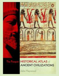
The Penguin historical atlas of ancient civilisations
The Penguin Historical Atlas of Ancient Civilizations explores the world's earliest cultures, from the farming settlements of Mesopotamia to the Americas and Polynesia, via the birth of Greek city states and the foundation of Rome. It examines the development of civilizations in the Near East - Babylonian, Assyrian, Persian - as well as those in Europe - the Minoans, Etruscans and Celts. Across the continents of Africa, Asia and America it covers subjects including Egypt from its pre-dynastic roots to the age of the Pharaohs, China during the Shang and Zhou dynasties, and the great cities of the Incas and Aztecs. Vivid descriptions of individual civilizations are complemented by discussion of such key topics as colonization, agriculture and technology, and the rise of empires. Richly illustrated with photographs, artwork re-creations and full-colour maps, this is an illuminating and multi-faceted one-volume introduction to early peoples and the worlds they created.
Book

Insights into the composition of ancient Egyptian red and black inks on papyri achieved by synchrotron-based microanalyses
A hitherto unknown composition is highlighted in the red and black inks preserved on ancient Egyptian papyri from the Roman period (circa 100 to 200 CE). Synchrotron-based macro–X-ray fluorescence (XRF) mapping brings to light the presence of iron (Fe) and lead (Pb) compounds in the majority of the red inks inscribed on 12 papyrus fragments from the Tebtunis temple library. The iron-based compounds in the inks can be assigned to ocher, notably due to the colocalization of Fe with aluminum, and the detection of hematite (Fe₂O₃) by micro–X-ray diffraction. Using the same techniques together with micro-Fourier transform infrared spectroscopy, Pb is shown to be associated with fatty acid phosphate, sulfate, chloride, and carboxylate ions. Moreover, micro-XRF maps reveal a peculiar distribution and colocalization of Pb, phosphorus (P), and sulfur (S), which are present at the micrometric scale resembling diffused “coffee rings” surrounding the ocher particles imbedded in the red letters, and at the submicrometric scale concentrated in the papyrus cell walls. A similar Pb, P, and S composition was found in three black inks, suggesting that the same lead components were employed in the manufacture of carbon-based inks. Bearing in mind that pigments such as red lead (Pb₃O₄) and lead white (hydrocerussite [Pb₃(CO₃)₂(OH)₂] and/or cerussite [PbCO₃]) were not detected, the results presented here suggest that the lead compound in the ink was used as a drier rather than as a pigment. Accordingly, the study calls for a reassessment of the composition of lead-based components in ancient Mediterranean pigments.
Journal Article

Historical atlas of the ancient world
This new atlas of the ancient world illustrates the political, economic, social and cultural developments in the ancient Near East, the Mediterranean world, the Byzantine Empire, the Islamic world and the Holy Roman Empire from the 3rd millennium BC until the 15th century AD. The atlas has 170 large color maps that document the main historical developments. Each map is accompanied by a text that outlines the main historical developments. These texts include bibliographies and 65 additional maps, tables, and stemmata that provide further elucidation.
Book

Anthropogenic Land Use and Land Cover Changes—A Review on Its Environmental Consequences and Climate Change
The global demand for food and bioenergy changes associated with land use and land cover change (LULCC) has raised concerns about the environment, global warming, and climate change. There is enough evidence that we are passing through human-induced changes which may lead to sixth mass extinction. Information of spatial representation of land use and land cover and its dynamics of landscape pattern and habitat organisation are vital for developing land use policy, adapting, and mitigating climate change impacts and nature-based solutions, including proposing areas for conservation. Spatial data is also a leading way of providing geographically linked or located data with the help of remote sensing (including drones), geographical information systems, Global Positioning Systems, and real-time in situ measurements. This article attempts to critically review the current research on the congruence of LULCC with climate and its processes. The article discusses current research on LULCC, its environmental consequences, and its impact on regulatory systems of the terrestrial biosphere, ecosystem services, atmospheric chemistry, and climate. Finally, it emphasises the need to evolve land use policy based on scientific analysis of LULCC to achieve sustainability goals and overall socioeconomic development with a special focus on climate change. The commitments of international agreements and protocols also require land use policy which accounts for concerns of climate change.
Journal Article

Discovering Potential Settlement Areas around Archaeological Tells Using the Integration between Historic Topographic Maps, Optical, and Radar Data in the Northern Nile Delta, Egypt
The primary objective of this study is to leverage the integration of surface mapping data derived from optical, radar, and historic topographical studies with archaeological sampling to identify ancient settlement areas in the Northern Nile Delta, Egypt. This study employed the following methods: digitization of topographic maps, band indices techniques on optical data, the creation of a 3D model from SRTM data, and Sentinel-1 interferometric wide swath (IW) analysis. This type of study is particularly relevant to the search for evidence of otherwise hidden ancient settlements. Due to its geographical situation and the fertility of the Nile, Egypt witnessed the autochthonous development of predynastic and dynastic civilizations, as well as an extensive history of external influences due to Greek, Roman, Coptic, Islamic, and Colonial-era interventions. Excavation work at Buto (Tell el-Fara’in) in 2017–18, carried out by the Kafrelsheikh University (KFS) in cooperation with the Ministry of Antiquities, demonstrated that remote sensing data offers considerable promise as a tool for developing regional settlement studies and excavation strategies. This study integrates the mission work in Buto with the satellite imagery in and around the area of the excavation. The results of the initial Buto area research serve as a methodological model to expand the study area to the North Delta with the goal of detecting the extent of the ancient kingdoms of Buto and Sakha. The results of this research include the creation of a composite historical database using ancient references and early topographical maps (1722, 1941, 1950, and 1997), Optical Corona (1965), Landsat MSS (Multispectral Scanner System) (1973, 1978, and 1988), TM (Thematic Mapper) (2005) data, and Radar SRTM (2014) and Sentinel1 (2018 and 2019) data. The data in this study have been analyzed using the ArcMap, Envi, and SNAP software. The results from the current investigation highlight the rapid changes in the land use/land cover in the last century in which many ancient sites were lost due to agriculture and urban development. Three potential settlement areas have been identified with the Sentinel1 Radar data, and have been integrated with the early maps. These discoveries will help develop excavation strategies aimed at elucidating the ancient settlement dynamics and history of the region during the next phase of research.
Journal Article


Mapping Gerasa: a new and open data map of the site
This article presents a new and accurate map of Gerasa/Jerash, an important site located in modern northern Jordan, which displays urban development spread across more than two millennia.
Journal Article

Aspects of Ancient Institutions and Geography
Aspects of Ancient Institutions and Geography honors Richard J.A. Talbert through a collection of original and useful examinations focused around the core theme of Talbert's work - how ancient individuals and groups organized their world, through their institutions and geography.
eBook
Four colours and the visual separation of adjacent areas: lessons from mapping and ancient paintings
The four-color problem is very simply stated and has to do with the coloring of maps. Naturally, when coloring a map we wish to color neighboring countries differently so that we can tell them apart. So how many colors do we need to color the entire map?This question was first posed about 150 years ago by the mathematician Francis Guthrie, and the history of providing the answer is an intriguing one. Writing over half a century ago, the mathematician and historian of mathematics, Kenneth May, provided one of the earliest of several historical accounts in 'The Origin of the Four-color Conjecture', concluding 'Rarely is a mathematical invention the work of a single individual, and assigning names to results is generally unjust. In this case, however, it would seem that the four-color conjecture belongs uniquely to Francis Guthrie and could fairly be called Guthrie's problem.'2 That the answer to the problem is four colours was initially reportedly 'found by experience',3 probably just two years after the question was first raised in 1854. But it took over a century for the work of many highly talented mathematicians and many hours of computer time to prove indeed that Four Colors Suffice.1 The proof was published in 1996, although even then with a mild disclaimer.4But the four-colour problem represents more than solely a mathematical conundrum dealing with the delineation of boundaries and separateness and involving a limited palette, for the use of such a limited palette has featured in an entirely different context in the visual arts dating back many centuries. Yet although the mathematical and artistic spheres appear seemingly unrelated, a story recounted by Pliny and cited below similarly features just three or four colours - but here employed for the depiction and separation of individual lines rather than different areas which relate to the four-colour mapping conjecture of today.
Journal Article
Excavations at the Jahānnamā complex: urban archaeology at Isfahan, Iran
Isfahan in central Iran was selected as a capital city by both the Seljuk (AD 1040–1157) and the Safavid (AD 1501–1722) dynasties. During the Safavid period, and under Shah Abbas I (AD 1571–1629) in particular, the city was greatly expanded with important new quarters including Naqsh-e Jahan Square (AD 1590–1595). Running north to south, a new avenue or boulevard called the Charbagh (Ḵiyābān-e Čahārbāğ) was also constructed (AD 1595–1596) (Figure 1), serving as both a leisure or tourist attraction outside the city walls, and to connect some of the new capital's institutions.
Journal Article