Catalogue Search | MBRL


Are you sure you want to remove the book from the shelf?

{{itemTitle}}
19,097
result(s) for
"Environmental monitoring Remote sensing."
Sort by:


Program Earth
Sensors are everywhere. Small, flexible, economical, and computationally powerful, they operate ubiquitously in environments. They compile massive amounts of data, including information about air, water, and climate. Never before has such a volume of environmental data been so broadly collected or so widely available.
Grappling with the consequences of wiring our world,Program Earthexamines how sensor technologies are programming our environments. As Jennifer Gabrys points out, sensors do not merely record information about an environment. Rather, they generate new environments and environmental relations. At the same time, they give a voice to the entities they monitor: to animals, plants, people, and inanimate objects. This book looks at the ways in which sensors converge with environments to map ecological processes, to track the migration of animals, to check pollutants, to facilitate citizen participation, and to program infrastructure. Through discussing particular instances where sensors are deployed for environmental study and citizen engagement across three areas of environmental sensing, from wild sensing to pollution sensing and urban sensing,Program Earthasks how sensor technologies specifically contribute to new environmental conditions. What are the implications for wiring up environments? How do sensor applications not only program environments, but also program the sorts of citizens and collectives we might become?
Program Earthsuggests that the sensor-based monitoring of Earth offers the prospect of making new environments not simply as an extension of the human but rather as new \"technogeographies\" that connect technology, nature, and people.
eBook


Earth Science and Applications from Space
Natural and human-induced changes in Earth's interior, land surface, biosphere, atmosphere, and oceans affect all aspects of life. Understanding these changes requires a range of observations acquired from land-, sea-, air-, and space-based platforms. To assist NASA, NOAA, and USGS in developing these tools, the NRC was asked to carry out a \"decadal strategy\" survey of Earth science and applications from space that would develop the key scientific questions on which to focus Earth and environmental observations in the period 2005-2015 and beyond, and present a prioritized list of space programs, missions, and supporting activities to address these questions. This report presents a vision for the Earth science program; an analysis of the existing Earth Observing System and recommendations to help restore its capabilities; an assessment of and recommendations for new observations and missions for the next decade; an examination of and recommendations for effective application of those observations; and an analysis of how best to sustain that observation and applications system.
eBook

Environmental remote sensing and systems analysis
\"Preface: In the last few decades, rapid urbanization and industrialization have altered the priority of environmental protection and restoration of air, soil, and water quality many times. Yet it is recognized that the sustainable management of human society is necessary at all phases of impact from the interactions between energy, environment, ecology, public health, and socioeconomic paradigms. The multidisciplinary nature of this concern for sustainability is truly a challenging task that requires employing a systems analysis approach. Such a systems analysis approach links several disciplinary areas with each other to promote the concept of sustainable management. Just as a sophisticated piece of music involves many different instruments played in unison, systems analysis requires a holistic viewpoint and a plethora of tools in sensing, monitoring, and modeling that have to be woven together to explore the state and function of air, water, and land resources at all levels. With the aid of systems analysis, this comprehensive collection includes a variety of research work that results from years of experience and that reflects the contemporary advances of remote sensing technologies. This unique publication presents and applies the most recent synergy of remote sensing technologies that will advance the overall understanding of the sensitivity of key environmental quality issues in relation to human perturbations. These perturbations can be caused by collective or individual impacts of economic development and globalization, population growth and migration, and climate change on atmospheric, terrestrial, and aquatic environmental systems\"-- Provided by publisher.
Book
Spectral sensing research for surface and air monitoring in chemical, biological and radiological defense and security applications
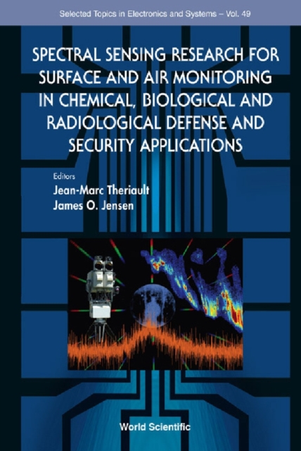
This book provides unique perspectives on the state of the art in multispectral/hyperspectral techniques for early-warning monitoring against chemical, biological and radiological (CB&R) contamination of both surface (e.g. land) and air (e.g. atmospheric) environments through the presentation of a comprehensive survey of the novel spectroscopic methodologies and technologies that are emerging to address the CB&R defense and security challenges of the future. The technical content in this book lends itself to the non-traditional requirements for point and stand-off detection that have evolved out of the US joint services programs over many years. In particular, the scientific and technological work presented seeks to enable hyperspectral-based sensing and monitoring that is in real time and in-line; low in cost and labor requirements; and easy to support, maintain and use in military and security-relevant scenarios.
eBook


Principles and practice of variable pressure/environmental scanning electron microscopy (VP-ESEM)
Offers a simple starting point to VPSEM, especially for new users, technicians and students containing clear, concise explanations Crucially, the principles and applications outlined in this book are completely generic: i.e. applicable to all types of VPSEM, irrespective of manufacturer. Information presented will enable reader to turn principles into practice Published in association with the Royal Microscopical Society (RMS) -www.rms.org.uk
eBook

Fundamentals of capturing and processing drone imagery and data
\"Unmanned Aircraft Systems are rapidly emerging as flexible platforms for capturing imagery and other data across sciences. Many colleges and universities are developing courses on UAS-based data acquisition. This book is a comprehensive, introductory text on how to use unmanned aircraft systems for data capture and analysis. It provides best practices for planning data capture missions and hands-on learning modules geared toward UAS data collection, processing, and applications. Readers will learn how to process different types of UAS imagery for applications such as Precision Agriculture, Forestry, Urban Landscapes, and apply this knowledge in environmental monitoring and land-use studies\"-- Provided by publisher.
Book

A Review of Environmental Monitoring for Land Desertification Using Geospatial Analysis and Remote Sensing
Studying and evaluating desertification is essential due to its potential occurrence as a result of both natural and anthropogenic processes. Precise forecasting of forthcoming climate change perils is crucial for devising policies, action strategies, and mitigation measures at both the local and global scales. Remote sensing facilitates the examination, monitoring, and forecasting of several aspects of desertification. Throughout the years, many methodologies have been employed to investigate desertification through the utilization of Remote Sensing (RS). This study investigated the worldwide prevalence and temporal sequence of research that utilized remote sensing (RS) to investigate desertification. In addition, the study assessed the primary approaches and factors employed in the examination of desertification through the analysis of remote sensing data. The application of remote sensing (RS) in the investigation of desertification can be traced back to 1991. Between 2015 and 2020, an annual average of over 40 publications were published, indicating a substantial rise in the utilization and accessibility of remote sensing (RS) technology to monitor desertification. However, there is a significant disparity in the amount of research conducted in different fields. Asia demonstrates a substantially higher quantity of studies in contrast to America or Africa. China has conducted the highest number of research on desertification using remote sensing (RS) techniques. The Thematic Mapper (TM) sensor is the principal source of satellite data, specifically Landsat pictures. The primary techniques utilized for studying desertification are classification and monitoring of alterations. Furthermore, remote sensing methods commonly employ land cover/land use change and vegetation, together with its attributes such as the Normalised Difference Vegetation Index (NDVI), as the primary factors for studying desertification.
Journal Article