Catalogue Search | MBRL


Are you sure you want to remove the book from the shelf?

{{itemTitle}}
19,128
result(s) for
"GEOLOGICAL SURVEY"
Sort by:

Landslide monitoring techniques in the Geological Surveys of Europe
Landslide monitoring is a mandatory step in landslide risk assessment. It requires collecting data on landslide conditions (e.g., areal extent, landslide kinematics, surface topography, hydrogeometeorological parameters, and failure surfaces) from different time periods and at different scales, from site-specific to local, regional, and national, to assess landslide activity. In this analysis, we collected information on landslide monitoring techniques from 17 members of the Earth Observation and Geohazards Expert Group (from EuroGeoSurveys) deployed between 2005 and 2021. We examined the types of the 75 recorded landslides, the landslide techniques, spatial resolution, temporal resolution, status of the technique (operational, non-operational), time of using (before the event, during the event, after the event), and the applicability of the technique in early warning systems. The research does not indicate the accuracy of each technique but, rather, the extent to which Geological Surveys conduct landslide monitoring and the predominant techniques used. Among the types of landslides, earth slides predominate and are mostly monitored by geological and engineering geological mapping. The results showed that Geological Surveys mostly utilized more traditional monitoring techniques since they have a broad mandate to collect geological data. In addition, this paper provides new insights into the role of the Geological Surveys on landslide monitoring in Europe and contributes to landslide risk reduction initiatives and commitments (e.g., the Kyoto Landslide Commitment 2020).
Journal Article

Validation of ICESat-2 ATLAS Bathymetry and Analysis of ATLAS’s Bathymetric Mapping Performance
NASA’s Ice, Cloud, and Land Elevation Satellite-2 (ICESat-2) was launched in September, 2018. The satellite carries a single instrument, ATLAS (Advanced Topographic Laser Altimeter System), a green wavelength, photon-counting lidar, enabling global measurement and monitoring of elevation with a primary focus on the cryosphere. Although bathymetric mapping was not one of the design goals for ATLAS, pre-launch work by our research team showed the potential to map bathymetry with ICESat-2, using data from MABEL (Multiple Altimeter Beam Experimental Lidar), NASA’s high-altitude airborne ATLAS emulator, and adapting the laser-radar equation for ATLAS specific parameters. However, many of the sensor variables were only approximations, which limited a full assessment of the bathymetric mapping capabilities of ICESat-2 during pre-launch studies. Following the successful launch, preliminary analyses of the geolocated photon returns have been conducted for a number of coastal sites, revealing several salient examples of seafloor detection in water depths of up to ~40 m. The geolocated seafloor photon returns cannot be taken as bathymetric measurements, however, since the algorithm used to generate them is not designed to account for the refraction that occurs at the air–water interface or the corresponding change in the speed of light in the water column. This paper presents the first early on-orbit validation of ICESat-2 bathymetry and quantification of the bathymetric mapping performance of ATLAS using data acquired over St. Thomas, U.S. Virgin Islands. A refraction correction, developed and tested in this work, is applied, after which the ICESat-2 bathymetry is compared against high-accuracy airborne topo-bathymetric lidar reference data collected by the U.S. Geological Survey (USGS) and the National Oceanic and Atmospheric Administration (NOAA). The results show agreement to within 0.43—0.60 m root mean square error (RMSE) over 1 m grid resolution for these early on-orbit data. Refraction-corrected bottom return photons are then inspected for four coastal locations around the globe in relation to Visible Infrared Imaging Radiometer Suite (VIIRS) K(d)(490) data to empirically determine the
maximum depth mapping capability of ATLAS as a function of water clarity. It is demonstrated that ATLAS has a maximum depth mapping capability of nearly 1 Secchi in depth for water depths up to 38 m and K(d)(490) in the range of 0.05–0.12 per m. Collectively, these results indicate the great potential
for bathymetric mapping with ICESat-2, offering a promising new tool to assist in filling the global void in nearshore bathymetry.
Journal Article

A Synthesis of Evidence of Drivers of Amphibian Declines
Early calls for robust long-term time series of amphibian population data, stemming from discussion following the first World Congress of Herpetology, are now being realized after 25 yr of focused research. Inference from individual studies and locations have contributed to a basic consensus on drivers of amphibian declines. Until recently there were no large-scale syntheses of long-term time series data to test hypotheses about the generality of factors driving population dynamics at broad spatial scales. Through the U.S. Geological Survey's Powell Center for Analysis and Synthesis, we brought together a group of scientists to elucidate mechanisms underlying amphibian declines in North America and Europe. We used time series of field data collected across dozens of study areas to make inferences with these combined data using hierarchical and spatial models. We bring together results from four syntheses of these data to summarize our state of knowledge of amphibian declines, identify commonalities that suggest further avenues of study, and suggest a way forward in addressing amphibian declines—by looking beyond specific drivers to how to achieve stability in remaining populations. The common thread of the syntheses is that declines are real but not ubiquitous, and that multiple factors drive declines but the relative importance of each factor varies among species, populations, and regions. We also found that climate is an important driver of amphibian population dynamics. However, the direction and magnitude of sensitivity to change vary among species in ways unlikely to explain overall rates of decline. Thirty years after the initial identification of a major catastrophe for global biodiversity, the scientific community has empirically demonstrated the reality of the problem, identified putative causes, provided evidence of their impacts, invested in broader-scale actions, and attempted meta-analyses to search out global drivers. We suggest an approach that focuses on key demographic rates that may improve amphibian population trends at multiple sites across the landscape.
Journal Article
Remote Sensing of Sea Surface Artificial Floating Plastic Targets with Sentinel-2 and Unmanned Aerial Systems (Plastic Litter Project 2019)
Remote sensing is a promising tool for the detection of floating marine plastics offering extensive area coverage and frequent observations. While floating plastics are reported in high concentrations in many places around the globe, no referencing dataset exists either for understanding the spectral behavior of floating plastics in a real environment, or for calibrating remote sensing algorithms and validating their results. To tackle this problem, we initiated the Plastic Litter Projects (PLPs), where large artificial plastic targets were constructed and deployed on the sea surface. The first such experiment was realised in the summer of 2018 (PLP2018) with three large targets of 10 × 10 m. Hereafter, we present the second Plastic Litter Project (PLP2019), where smaller 5 × 5 m targets were constructed to better simulate near-real conditions and examine the limitations of the detection with Sentinel-2 images. The smaller targets and the multiple acquisition dates allowed for several observations, with the targets being connected in a modular way to create different configurations of various sizes, material composition and coverage. A spectral signature for the PET (polyethylene terephthalate) targets was produced through modifying the U.S. Geological Survey PET signature using an inverse spectral unmixing calculation, and the resulting signature was used to perform a matched filtering processing on the Sentinel-2 images. The results provide evidence that under suitable conditions, pixels with a PET abundance fraction of at least as low as 25% can be successfully detected, while pinpointing several factors that significantly impact the detection capabilities. To the best of our knowledge, the 2018 and 2019 Plastic Litter Projects are to date the only large-scale field experiments on the remote detection of floating marine litter in a near-real environment and can be used as a reference for more extensive validation/calibration campaigns.
Journal Article

Using unmanned aerial vehicle photogrammetry for digital geological surveys: case study of Selmun promontory, northern of Malta
In recent years, we have been witnessing the widespread use of low-cost, increasingly high-performance Unmanned Aerial Vehicles, or UAVs, equipped with a large number of sensors capable of extracting detailed information on several scales and in an immediate manner. This study was motivated by the need to perform a geological survey in an area with difficult physical access, and to compare the results with those from conventional surveys. Here we used a Multirotor UAV equipped with a high definition RGB camera and the digital photogrammetry technique to reconstruct a three-dimensional model of the Selmun promontory, located in the northern part of the island of Malta (central Mediterranean Sea). In this area, the evident cliff retreat is linked to landslide processes involving the outcropping geological succession, characterized by the over position of stiff limestones on ductile clays. Such an instability process consists of a lateral spreading associated with toppling and fall of different-size rock blocks. Starting from the 3D model obtained from the UAV-photogrammetry, a digital geological-structural survey was performed in which we identified the spatial geometry of the fractures that characterize the area of the Selmun promontory by measuring strike, dip and dip direction of the fractures with semi-automatic digital tools. Furthermore, we were able to measure the size and volume of singularized rock masses as well as cracks, and their sizes were mapped in a GIS environment that contains a large number of digital structural measures. It is the first application of this type for the Maltese islands and the results obtained with this innovative digital methodology were then compared with those of the traditional field survey of the same area acquired during a previous campaign. This study demonstrated how the innovation of digital geological surveying lies in the possibility of mapping areas and geological features not detectable with traditional methods, mainly due to the high risk associated with the stability of the cliff or, more generally, the inaccessibility of some sites, therefore allowing the user to operate in safety and to detect in detail the most remote rocky outcrops.
Journal Article

Assessment of Undiscovered Oil and Gas in the Arctic
Among the greatest uncertainties in future energy supply and a subject of considerable environmental concern is the amount of oil and gas yet to be found in the Arctic. By using a probabilistic geology-based methodology, the United States Geological Survey has assessed the area north of the Arctic Circle and concluded that about 30% of the world's undiscovered gas and 13% of the world's undiscovered oil may be found there, mostly offshore under less than 500 meters of water. Undiscovered natural gas is three times more abundant than oil in the Arctic and is largely concentrated in Russia. Oil resources, although important to the interests of Arctic countries, are probably not sufficient to substantially shift the current geographic pattern of world oil production.
Journal Article

Evaluation of the Use of UAV Photogrammetry for Rock Discontinuity Roughness Characterization
This paper describes the results of a field investigation with the objective of evaluating the possibility to produce drone-derived 3D digital point clouds sufficiently dense and accurate to determine discontinuity surface roughness characteristics. A discontinuous rock mass in Italy was chosen as the investigation site and Structure from Motion and Multi-View Stereo techniques adopted for producing three-dimensional point clouds from the two-dimensional image sequences. Since the roughness of discontinuities depends on direction, scale and resolution of the sampling, data were always collected along the maximum slope gradient. The scale effect was evaluated by analysing discontinuity profiles of different lengths (10 cm, 30 cm, 60 cm and 100 cm), with measurements taken from drone flights flown at different distances from the rocky slopes (10 m, 20 m and 30 m). The accuracy of the derived joint roughness coefficients was evaluated by direct comparison with discontinuity profiles measured during fieldwork using conventional techniques and from contemporaneous terrestrial laser scanning. Results from this research show that 3D digital point clouds, derived from the processing of drone-flight images, were successfully used for reliable representation of discontinuity roughness for profiles longer than 60 cm, whereas less reliable results were achieved for shorter profile lengths. This, even if strictly related to this case study since several factors can affect the minimum profile length, represents a significant contribution to improve the knowledge on the use of remotely captured data for characterising the discontinuities in natural or man-made rock outcrops, particularly where access difficulties do not allow conventional engineering-geological surveys to be undertaken.
Journal Article
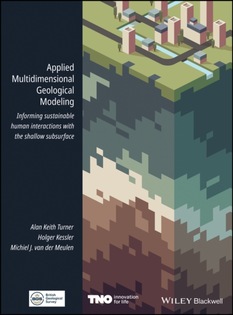
Applied Multidimensional Geological Modeling
Over the past decades, geological survey organizations have digitized their data handling and holdings, unlocking vast amounts of data and information for computer processing. They have undertaken 3-D modeling alongside, and in some cases instead of, conventional geological mapping and begun delivering both data and interpretations to increasingly diverse stakeholder communities. Applied Multidimensional Geological Modeling provides a citable central source that documents the current capabilities and contributions of leading geological survey organization and other practitioners in industry and academia that are producing multidimensional geological models. This book focuses on applications related to human interactions with conditions in the shallow subsurface, within 100-200 m of the surface. The 26 chapters, developed by 100 contributors associated with 37 organizations, discuss topics relevant to any geologist, scientist, engineer, urban planner, or decision maker whose practice includes assessment or planning of underground space.
eBook

Streamflow Response to Glacier Mass Loss Varies With Basin Precipitation Across Alaska
Diminishing glaciers affect streamflow, and given the extent of glaciers in Alaska and adjacent Canada, continued glacier mass loss is likely to have profound effects on ecosystems sensitive to runoff. The effects of glacier mass loss on streamflow are likely to vary across the wide ranges of basin size, glacier cover, and precipitation in this region. In this study, we use U.S. Geological Survey (USGS) streamflow data with satellite‐based glacier volume change estimates to quantify how glacier mass loss subsidized streamflow over the 2000–2019 period for 116 glacierized basins. We examine interannual variability in that subsidy at three USGS‐monitored glaciers to explore the ability of the subsidy to buffer streamflow derived solely from precipitation. We found the relative importance of percent glacier cover on streamflow magnitude increases in drier basins. In the driest basins, glaciers produced 40 times greater percent glacier mass loss subsidies to streamflow for the percent glacier cover compared to the wettest basins. While the subsidy from glacier mass loss buffers interannual variability in streamflow to varying degrees, it can also increase streamflow variability. Smaller amounts of percent glacier cover are needed to produce summer‐melt‐dominated seasonal flow regimes in drier basins than in wetter basins. Decreasing glacier cover will eventually decrease summer streamflow, increasing spring streamflow in drier basins, and attenuating seasonality with increasing spring and autumnal streamflow in wetter basins. Quantifying the downstream effects of continued glacier mass loss without the computational expense of a hydrological model is broadly applicable in this changing climate. Plain Language Summary As glaciers in Alaska continue to shrink, they are changing the flow of water downstream, with potentially large effects on surrounding ecosystems. We studied glacier volume changes and streamflow between 2000 and 2019, and showed where shrinking glaciers have their largest influences on two related but different processes: the quantity and timing of streamflow. We found that in areas with less precipitation (such as areas farther inland in Alaska), shrinking glaciers produced proportionally up to 40 times more streamflow for the same percent glacier cover compared to the wettest basins. Glaciers influence streamflow timing, specifically summer flow totals. As glaciers continue to diminish, the changes in timing will vary based on how wet or dry the basin is. The patterns we found between glacier changes and streamflow in different environments allow us to gauge the impacts of shrinking glaciers even without complicated hydrologic models. Key Points Glacier mass loss subsidized streamflow <1%–25% and was up to 40 times larger, relative to percent glacier cover, in the driest basins While glacier mass loss subsidies buffer interannual variability of streamflow to varying degrees, they can increase variability As decreasing glacier cover reduces summer streamflow, resulting changes in streamflow seasonality vary between wetter and drier basins
Journal Article

Geological Mapping Using Drone-Based Photogrammetry: An Application for Exploration of Vein-Type Cu Mineralization
In this research, drone-based photogrammetry was utilized for mapping geology with the objective of mineral exploration in the Shahzadeh Abbas Cu deposit, Kerman province, Iran. Cu mineralization is of vein-type and follows geological structures. A low-cost drone was used to collect geological data. A spatial resolution of 3.26 cm was achieved by considering a flight altitude of 70 m. To reach the accuracy of less than 5 cm, 70% lateral and 80% front image overlaps were applied and 220 temporary ground control points (TGCPs) were used in an area of 2.02 km2. TGCPs were accurately positioned using DGPS-RTK measurements. Agisoft PhotoScan software was used for photogrammetric processing. The orthophoto product was performed for outlining geological units through visual interpretation. The digital elevation model (DEM) was converted to a hill-shade model in ArcGIS software to extract the geological structures such as faults and dikes. A draft geology map was prepared using orthophoto and hill-shade images to minimize the time and cost of the subsequent field work. Rock sampling was carried out and Cu-bearing veins were specified through field investigations. The geology map was finalized based on field work data and petrology studies. The geological survey indicated that diabase dikes with a northwest–southeast strike often host Cu mineralization in the study area. The position of Cu-bearing dikes was delineated for the next stage of the exploration program. This research demonstrated the time- and cost-effectiveness of using drone-based photogrammetry for preparing base geology maps for the exploration of vein-type mineralization in far districts with rough topography.
Journal Article