Catalogue Search | MBRL


Are you sure you want to remove the book from the shelf?

{{itemTitle}}
415
result(s) for
"GROUNDWATER USERS"
Sort by:

Intensive groundwater use: a silent revolution that cannot be ignored
Over the last decades, agriculture in arid and semi-arid countries has experienced a true “silent revolution” of intensive groundwater use. Millions of independent farmers worldwide have chosen to become increasingly dependent on the reliability of groundwater resources, and as a result their countries have reaped abundant social and economic benefits. Data from several countries shows that groundwater irrigation presents a much greater efficiency, than surface water irrigation systems, thus contributing to fulfil the motto of “more crops and jobs per drop”. If this situation is confirmed globally, the usual world water visions have to be reviewed. However, the “silent revolution” has been carried out with scarce control on the part of governmental water agencies, and thus a series of unwanted effects have developed in certain places. While these by no means justify the pervasive “hydromyths” and obsolete paradigms that voice the frailty of groundwater, appropriate management of groundwater resources remains a worldwide challenge. This paper provides an overview of these issues, and concludes with the necessity there is to educate all levels of society on the importance of groundwater and to create bottom-up user associations to manage aquifers as common pool resources.
Journal Article
Toward integrated water resources management in Armenia
The proper management of water resources plays a key role in the socioeconomic development of Armenia. On average, Armenia has sufficient water resources. Taking into account all available water resources in the country, Armenia has sufficient resources to supply approximately 3,100 cubic meters per capita per year well above the typically cited Falkenmark water stress indicator of 1,700 cubic meters per capita per year. These water resources are not evenly divided in space and time with significant seasonal and annual variability in river runoff. In order to address temporal variations in river runoff, the country has built 87 dams with a total capacity of 1.4 billion cubic meters. Most of these dams are single purpose, mainly for irrigation. Armenia also has considerable groundwater resources, which play an important role in the overall water balance. About 96 percent of the water used for drinking purposes and about 40 percent of water abstracted in the country comes from groundwater. Irrigation remains the largest consumptive user.
eBook

Advancing Sustainable Groundwater Management With a Hydro‐Economic System Model: Investigations in the Harney Basin, Oregon
Groundwater resources frequently trend toward unsustainable levels because, absent effective institutions, individual water users generally act independently without considering the impacts on other users. Hydro‐economic models (HEMs) of human‐natural systems can play a positive role toward successful groundwater management by yielding valuable knowledge and insight. The current study explores how an HEM that captures essential physical and economic characteristics of a system can shed light on the system's processes and dynamics to benefit stakeholders, managers, and also researchers. These propositions are illustrated using the Harney Basin, Oregon, which has seen large groundwater declines in the past 20 years. The HEM shows that: (a) although current groundwater pumping rates will gradually raise costs and reduce well yields, irrigators gain the highest aggregate economic return by continuing current pumping; (b) lowland areas of the basin are hydrologically connected, which limits the efficacy of remedies focused on regulations only in some portions of the basin; (c) community expectations regarding the efficacy of several proposed solutions are overly optimistic; and (d) the study's scenarios identify interventions that would stabilize the groundwater system and prevent additional adverse impacts on residential and livestock wells and groundwater‐dependent ecosystems. These interventions would require limiting groundwater pumping by nearly half and reducing annual profits by$7.5–$ 9.0M. The HEM also demonstrated its value to researchers: its insights shifted attention toward questions about Oregon's existing groundwater institutions and their inability to adaptively manage the transition from abundant groundwater to scarce groundwater in a timely manner. Plain Language Summary This study develops a hydro‐economic model (HEM) linking an economic model of irrigated agricultural production with a three‐dimensional groundwater hydrology model of the Harney Basin, Oregon, to better understand the causes and possible solutions to the large groundwater declines in the past 20 years. Those declines have had adverse impacts on the farmers who irrigate with groundwater, but also on residential wells and environmental flows supplying groundwater‐dependent ecosystems. The HEM simulates 30‐year future scenarios for a baseline and alternative scenarios representing interventions aimed at stabilizing the groundwater system. Results reveal that although current groundwater pumping rates will gradually raise costs and reduce well yields, irrigators gain the highest aggregate economic return by continuing current pumping rates. The analysis shows that sustainable pumping rates were surpassed 20 years before declining groundwater levels were generally recognized. Results show that because the basin is hydrologically connected, the efficacy of regulations focused only in some portions of the basin are limited; and community expectations regarding benefits from several proposed solutions are found to be overly optimistic. A number of interventions are identified that would stabilize the groundwater system; however, these interventions would require lowering pumping by nearly half and reducing annual profits by$7.5–$ 9.0M. Key Points A hydro‐economic groundwater model (HEM) of the Harney Basin shows that HEMs can improve understanding and advance successful management Modeled scenarios reveal, for example, that proposed technology or spatially‐targeted solutions do little to stabilize groundwater levels HEM studies can alter the way researchers understand a system, bringing focus toward key factors or even changing the key research question
Journal Article

A Review of Irrigation Information Retrievals from Space and Their Utility for Users
Irrigation represents one of the most impactful human interventions in the terrestrial water cycle. Knowing the distribution and extent of irrigated areas as well as the amount of water used for irrigation plays a central role in modeling irrigation water requirements and quantifying the impact of irrigation on regional climate, river discharge, and groundwater depletion. Obtaining high-quality global information about irrigation is challenging, especially in terms of quantification of the water actually used for irrigation. Here, we review existing Earth observation datasets, models, and algorithms used for irrigation mapping and quantification from the field to the global scale. The current observation capacities are confronted with the results of a survey on user requirements on satellite-observed irrigation for agricultural water resources’ management. Based on this information, we identify current shortcomings of irrigation monitoring capabilities from space and phrase guidelines for potential future satellite missions and observation strategies.
Journal Article

Integrated assessment of groundwater potential zones and artificial recharge sites using GIS and Fuzzy-AHP: a case study in Peddavagu watershed, India
Groundwater is a crucial natural resource for providing reliable and long-lasting water supplies across the globe. The integrated approach used in the current study involved the use of multiple techniques to assess groundwater potential zones (GWPZs) and identify suitable areas for artificial recharge sites. The methods used in the study were a combination of geographic information system (GIS), analytic hierarchy process (AHP), and fuzzy analytic hierarchy process (Fuzzy-AHP) to accomplish this goal. The study considered multiple thematic maps, such as drainage density, elevation, geomorphology, slope, curvature, topographic wetness index (TWI), geology, distance from the river, land use and land cover (LULC), and rainfall, to determine the GWPZs. AHP and Fuzzy-AHP were used to weight thematic maps based on their relative importance in controlling groundwater availability and recharge, and then a weighted overly analysis in a GIS environment was utilized to derive the final GWPZs map. After completing the weighting of thematic maps, both AHP and Fuzzy-AHP models categorized GWPZs into low, moderate, and high categories in the study area. In this study area, GWPZs were classified as poor, moderate, and high using both the AHP and Fuzzy-AHP models. According to the AHP model, 5.41% of the area’s GWPZs were categorized as poor, 70.68% as moderate, and 23.91% as high. The Fuzzy-AHP model, on the other hand, categorized 4.92% as poor, 69.75% as moderate, and 25.33% as high. To validate these results, the receiver operating characteristic curve (ROC) and area under the curve (AUC) were used to explore the prediction accuracy, resulting in an accuracy rate of 70.1% for AHP and 71% for Fuzzy-AHP. These findings suggest that the Fuzzy-AHP model is effective in accurately identifying GWPZs in this area. Additionally, using remote sensing (RS) and GIS, the current study created a map by overlaying the lineament and drainage maps to determine suitable locations for artificial recharge. One-hundred-forty suitable locations for artificial recharge sites were identified based on Fuzzy-AHP. The study’s reliable findings assist decision-makers and water users in the research area to use groundwater resources sustainably. This information aids in sustainable planning and management of groundwater resources, ensuring their availability and sustainability for future generations.
Journal Article
Streamflow Depletion Caused by Groundwater Pumping: Fundamental Research Priorities for Management‐Relevant Science
Reductions in streamflow caused by groundwater pumping, known as “streamflow depletion,” link the hydrologic process of stream‐aquifer interactions to human modifications of the water cycle. Isolating the impacts of groundwater pumping on streamflow is challenging because other climate and human activities concurrently impact streamflow, making it difficult to separate individual drivers of hydrologic change. In addition, there can be lags between when pumping occurs and when streamflow is affected. However, accurate quantification of streamflow depletion is critical to integrated groundwater and surface water management decision making. Here, we highlight research priorities to help advance fundamental hydrologic science and better serve the decision‐making process. Key priorities include (a) linking streamflow depletion to decision‐relevant outcomes such as ecosystem function and water users to align with partner needs; (b) enhancing partner trust and applicability of streamflow depletion methods through benchmarking and coupled model development; and (c) improving links between streamflow depletion quantification and decision‐making processes. Catalyzing research efforts around the common goal of enhancing our streamflow depletion decision‐support capabilities will require disciplinary advances within the water science community and a commitment to transdisciplinary collaboration with diverse water‐connected disciplines, professions, governments, organizations, and communities. Plain Language Summary Pumping water from a well can reduce flow in surrounding streams, a phenomenon called “streamflow depletion.” It is important for water managers to know when, where, and how much streamflow depletion is occurring because it can affect the amount of water available for ecosystems and other water users. However, estimating streamflow depletion is challenging because weather and other factors affect streamflow, in addition to pumping. Here, we discuss important topics related to streamflow depletion that need further research. Most importantly, scientists need to move beyond estimating changes in flow caused by pumping, and also develop improved approaches to estimate the impacts of these streamflow changes on ecosystems and water users. Additionally, it will be important to develop improved tools for estimating streamflow depletion and linking those estimates to water management decisions. Making these advances will require basic scientific research and collaboration between hydrologists and other fields; these efforts should be prioritized because streamflow depletion is occurring at a rapid pace around the world. Key Points Changes in streamflow caused by groundwater pumping (“streamflow depletion”) are a link between basic and applied hydrologic science Streamflow depletion science is critical to support decision making and requires advances in hydrology and transdisciplinary collaboration We identify key priorities for streamflow depletion research to improve hydrological process understanding and support water management
Journal Article

Impacts of basin-wide irrigation pumping on dry-period stream baseflow in an alluvial aquifer in the Kosi Fan region of India and Nepal
The Kosi Fan region of India and Nepal hosts a productive aquifer system. Regional hydrology is highly seasonal, and both groundwater and surface water are used for irrigation. Groundwater depletion is not currently occurring, but there is concern that plans to increase groundwater irrigation will reduce river baseflow, potentially affecting downstream water users. This study presents a model-based analysis of the impacts of groundwater withdrawal on dry-period streamflow and evaluation of management alternatives. A sensitivity analysis was performed in which a range of model parameters were tested around a best-estimate, base-case scenario. A high-reduction scenario was then developed which combined the factors that produced the greatest pumping-induced reduction in dry-season baseflow. Management strategies for 2.5, 5, and 10-km no-pumping buffers around the rivers were tested for the base-case and high-reduction scenarios. Simulations show that groundwater withdrawal equivalent to 30% and 60% of dry-season streamflow for the Kosi and Mahananda rivers, respectively, reduces the current dry-season flow by less than 4%. In the base-case scenario, simulated dry-season baseflow reduction is 1.8% and 2.6% for the rivers, respectively; these reduce to ~1% with a 2.5-km buffer zone. For the high-reduction scenario, dry-season baseflow reductions are 4.7% and 7.0% with no buffer; these reduce to 1.3% and 0.9% with a 5-km buffer for the Kosi and Mahananda rivers, respectively. The small reductions in baseflow relative to the total amount of pumping are due to a pumping-induced increase in rainfall recharge, thus the effects of additional pumping are mitigated.
Journal Article

Spatial variability of ground water quality: a case study of Udupi district, Karnataka State, India
Groundwater is a reliable source of fresh water for domestic and agricultural water users. It supports subsurface ecosystem by balancing the geo-biological and bio-geochemical processes at micro- and macro-scales of the ecosystem. Overexploitation, anthropogenic activities and improper agricultural practices have contributed to the pollution of groundwater sources all around the globe. The water quality index (WQI) is the most extensively used indicator which transforms the water quality information derived from several parameters into a single value/rating to categorize and provide a general perception of water quality standard. Groundwater quality analysis and mapping via geographical information system (GIS) proves to be beneficial in identifying the locations where the groundwater quality is deteriorating. In the current study, the WQI of groundwater was determined for the samples collected from open and tube wells located within the Udupi district of Karnataka state, India. The groundwater quality parameters such as pH, hardness, calcium, chlorides, nitrates, iron, fluoride, sulfates, manganese, sodium, magnesium, potassium, turbidity, and phosphate were analyzed for water samples collected from 112 randomly chosen open/tube wells in order to determine the WQI. Interpolation approaches such as inverse distance weighting (IDW) and kriging were adopted in the GIS environment to quantify the spatial variability of groundwater quality over the entire geographical area. The groundwater quality maps were generated using the best fit models. The results portray that, the accuracy of interpolation using IDW and kriging methods was dependent on the measures of central tendency and variability of water quality data of different parameters. The kriging interpolation was much accurate for most of the groundwater quality parameters compared to IDW maps. The WQI maps, perhaps signposted the poor quality of groundwater quality in about 1.88% of the geographical area of Udupi district. Further, about 21.69% of the area was affected by poor quality of groundwater where suitable strategies for replenishment of groundwater resources should be taken up by the concerned authorities. The spatial distribution maps of groundwater quality aid to locate vulnerable places where immediate action is required.
Highlights
Water quality index mapping clearly depicts the critical areas that need policy measures for the groundwater sustainability.
Current study acts as a decision support system for taking up water quality management activities for groundwater remediation in the study area.
Geostatistical methods prove to be ideal for the evaluation of spatial groundwater quality assessment and distribution.
Journal Article

Estimation of Monthly Water Table Depth Anomalies Based on the Integration of GRACE and ERA5-Land with Large-Scale Simulations Using Random Forest and LSTM Networks
Abstract Increasing pressure on groundwater resources, exacerbated by climate change, highlights the need to develop advanced methods for monitoring groundwater storage and levels. While numerical and physics-based models are widely used to analyze the spatial and temporal dynamics of groundwater levels, they require extensive input data and can be computationally expensive for high-resolution and large-scale simulations. In contrast, remote sensing products such as the Gravity Recovery and Climate Experiment (GRACE) provide global-scale information on total water storage anomalies. However, due to its coarse spatial resolution (0.25 $$^{\\circ }$$ ), GRACE data cannot be used directly to assess groundwater conditions at local and regional scales. In order to obtain local groundwater levels that can be quickly accessed by stakeholders to monitor and define appropriate groundwater management, this study implements a methodology based on data-driven models to estimate monthly water table depth anomalies (wtda), integrating simulations from the Terrestrial Systems Modeling Platform (TSMP) with GRACE and reanalysis ERA5-Land datasets. Considering the spatial resolution of current TSMP simulations (TSMP-G2A - 0.11 degrees), we tested and compared multiple Random Forest (RF) and LSTM networks at the pixel scale over the Seine River Basin, combining different hydrological and climatological variables with GRACE as input features. For each data-driven approach, we selected the model that best represents the temporal pattern of the wtda during the test period and compared the results with the original TSMP simulation, as well as in-situ groundwater observations. The results indicate that both RF and LSTM networks can well reproduce the temporal patterns of groundwater levels across the Seine Basin obtained by the TSMP simulations, with average Pearson correlations of 0.65 and average KGE of 0.6, respectively. A comparison with multiple groundwater wells allowed us to identify the regions where the applied models are more reliable for representing wtda over the Seine River Basin. In general, the proposed models show good agreement with in-situ observations, independent of the groundwater well depth. However, we found significant differences between observed and simulated water table depths in the downstream regions of the Seine River Basin, where coastal systems and the presence of karst in the chalk might influence groundwater levels and the performance of the adopted models, respectively. The proposed methods provide end users with an extremely lightweight reconstruction and prediction tool for wtda at the pixel level, including reliability estimates, which is easy to implement in an ad hoc fashion in any evaluation and groundwater management workflow.
Journal Article
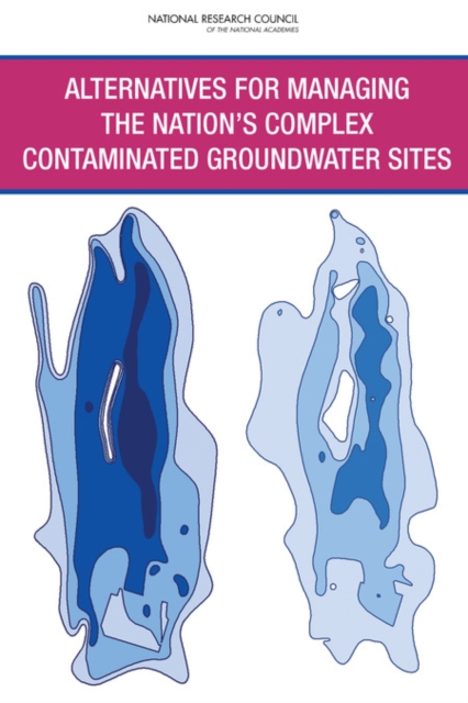
Alternatives for Managing the Nation's Complex Contaminated Groundwater Sites
Across the United States, thousands of hazardous waste sites are contaminated with chemicals that prevent the underlying groundwater from meeting drinking water standards. These include Superfund sites and other facilities that handle and dispose of hazardous waste, active and inactive dry cleaners, and leaking underground storage tanks; many are at federal facilities such as military installations. While many sites have been closed over the past 30 years through cleanup programs run by the U.S. Department of Defense, the U.S. EPA, and other state and federal agencies, the remaining caseload is much more difficult to address because the nature of the contamination and subsurface conditions make it difficult to achieve drinking water standards in the affected groundwater.
Alternatives for Managing the Nation's Complex Contaminated Groundwater Sites estimates that at least 126,000 sites across the U.S. still have contaminated groundwater, and their closure is expected to cost at least $110 billion to $127 billion. About 10 percent of these sites are considered \"complex,\" meaning restoration is unlikely to be achieved in the next 50 to 100 years due to technological limitations. At sites where contaminant concentrations have plateaued at levels above cleanup goals despite active efforts, the report recommends evaluating whether the sites should transition to long-term management, where risks would be monitored and harmful exposures prevented, but at reduced costs.
eBook