Catalogue Search | MBRL


Are you sure you want to remove the book from the shelf?

{{itemTitle}}
900
result(s) for
"Geographic information systems Computer programs."
Sort by:

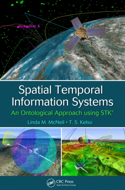
Spatial Temporal Information Systems
This book discusses the many applications of space technologies by using mission-proven software for timely and cost-effective development that serves public interests in civil, commercial, academic, national, and international space communities. It explains the dynamics of object interaction from signal analysis to trajectory design, spatial modeling, and other spatial analytics by using STK platform, a general-purpose modeling and analysis application for any type of space, defense or intelligence system.
eBook

QGIS Quick Start Guide
Step through loading GIS data, creating GIS data, styling GIS and making maps with QGIS following a simple narrative that will allow you to build confidence as you progress. Key Features * Work with GIS data, a step by step guide from creation to making a map * Perform geoprocessing tasks and automate them using model builder * Explore a range of features in QGIS 3.4, discover the power behind open source desktop GIS Book Description QGIS is a user friendly, open source geographic information system (GIS). The popularity of open source GIS and QGIS, in particular, has been growing rapidly over the last few years. This book is designed to help beginners learn about all the tools required to use QGIS 3.4. This book will provide you with clear, step-by-step instructions to help you apply your GIS knowledge to QGIS. You begin with an overview of QGIS 3.4 and its installation. You will learn how to load existing spatial data and create vector data from scratch. You will then be creating styles and labels for maps. The final two chapters demonstrate the Processing toolbox and include a brief investigation on how to extend QGIS. Throughout this book, we will be using the GeoPackage format, and we will also discuss how QGIS can support many different types of data. Finally, you will learn where to get help and how to become engaged with the GIS community. What you will learn * Use existing data to interact with the canvas via zoom/pan/selection * Create vector data and a GeoPackage and build a simple project around it * Style data, both vector and raster data, using the Layer Styling Panel * Design, label, save, and export maps using the data you have created * Analyze spatial queries using the Processing toolbox * Expand QGIS with the help of plugins, model builder, and the command line Who this book is for If you know the basic functions and processes of GIS, and want to learn to use QGIS to analyze geospatial data and create rich mapping applications, then this is the book for you.
eBook


Beginning ArcGIS for Desktop Development Using . NET
Get the very most out of the ArcGIS for Desktop products through ArcObjects and.NET ArcGIS for Desktop is a powerful suite of software tools for creating and using maps, compiling, analyzing and sharing geographic information, using maps and geographic information in applications, and managing geographic databases.
eBook

Web cartography : map design for interactive and mobile devices
\"Written for those with a basic understanding of map making, but without knowledge of Web design, this textbook explains how to create effective interaction, animation, and layouts for maps to put online or into a mobile platform. Concept driven and product free, this reference emphasizes cartographic principles for Web and mobile map design over specific software techniques. The first of its kind to address map design and layout styles for Web and mobile mapping, this book includes many examples from the real world. Labs introduce students to software used by and freely available at most universities\"-- Provided by publisher.
Book

Mapping
Mapping: A Critical Introduction to Cartography and GIS is an introduction to the critical issues surrounding mapping and Geographic Information Systems (GIS) across a wide range of disciplines for the non-specialist reader. Examines the key influences Geographic Information Systems (GIS) and cartography have on the study of geography and other related disciplines Represents the first in-depth summary of the \"new cartography\" that has appeared since the early 1990s Provides an explanation of what this new critical cartography is, why it is important, and how it is relevant to a broad, interdisciplinary set of readers Presents theoretical discussion supplemented with real-world case studies Brings together both a technical understanding of GIS and mapping as well as sensitivity to the importance of theory.
eBook

HBIM for Conservation: A New Proposal for Information Modeling
Thanks to its capability of archiving and organizing all the information about a building, HBIM (Historical Building Information Modeling) is considered a promising resource for planned conservation of historical assets. However, its usage remains limited and scarcely adopted by the subjects in charge of conservation, mainly because of its rather complex 3D modeling requirements and a lack of shared regulatory references and guidelines as far as semantic data are concerned. In this study, we developed an HBIM methodology to support documentation, management, and planned conservation of historic buildings, with particular focus on non-geometric information: organized and coordinated storage and management of historical data, easy analysis and query, time management, flexibility, user-friendliness, and information sharing. The system is based on a standalone specific-designed database linked to the 3D model of the asset, built with BIM software, and it is highly adaptable to different assets. The database is accessible both with a developed desktop application, which acts as a plug-in for the BIM software, and through a web interface, implemented to ensure data sharing and easy usability by skilled and unskilled users. The paper describes in detail the implemented system, passing by semantic breaking down of the building, database design, as well as system architecture and capabilities. Two case studies, the Cathedral of Parma and Ducal Palace of Mantua (Italy), are then presented to show the results of the system’s application.
Journal Article

TerraBrasilis: A Spatial Data Analytics Infrastructure for Large-Scale Thematic Mapping
The physical phenomena derived from an analysis of remotely sensed imagery provide a clearer understanding of the spectral variations of a large number of land use and cover (LUC) classes. The creation of LUC maps have corroborated this view by enabling the scientific community to estimate the parameter heterogeneity of the Earth’s surface. Along with descriptions of features and statistics for aggregating spatio-temporal information, the government programs have disseminated thematic maps to further the implementation of effective public policies and foster sustainable development. In Brazil, PRODES and DETER have shown that they are committed to monitoring the mapping areas of large-scale deforestation systematically and by means of data quality assurance. However, these programs are so complex that they require the designing, implementation and deployment of a spatial data infrastructure based on extensive data analytics features so that users who lack a necessary understanding of standard spatial interfaces can still carry out research on them. With this in mind, the Brazilian National Institute for Space Research (INPE) has designed TerraBrasilis, a spatial data analytics infrastructure that provides interfaces that are not only found within traditional geographic information systems but also in data analytics environments with complex algorithms. To ensure it achieved its best performance, we leveraged a micro-service architecture with virtualized computer resources to enable high availability, lower size, simplicity to produce an increment, reliable to change and fault tolerance in unstable computer network scenarios. In addition, we tuned and optimized our databases both to adjust to the input format of complex algorithms and speed up the loading of the web application so that it was faster than other systems.
Journal Article