Catalogue Search | MBRL


Are you sure you want to remove the book from the shelf?

{{itemTitle}}
11,359
result(s) for
"Geological data"
Sort by:

Mapping Critical Raw Materials (CRM) hard rock deposits in Europe
This article presents the new version of the map of critical raw materials hard rock deposits that has been produced in the frame of the GSEU project (Geological Service for Europe). The map displays over 800 medium to very large deposits for 30 Critical Raw Materials (CRM) from the 2023 list of the European Commission, in 33 European countries. We explain the objective of this work and the process and methodology for collecting, compiling and harmonizing CRM data from multiple providers. We also describe the map itself, the information it carries and its availability. As an example of added-value output, we present a pan-European assessment of CRM potential, classified in 4 categories of confidence from “historical or non-compliant resource estimates” to “mineral reserves”. This assessment provides an image of the current known potential for CRM in Europe. Based on this exercise, we discuss the challenges and barriers of compiling and harmonizing mineral resources data at continental scale, and the future perspectives of this work we envision through the EGDI (European Geological Data Infrastructure). We also discuss the limitations of the map and dataset to raise awareness on their proper interpretation and use.
Journal Article

Landslide monitoring techniques in the Geological Surveys of Europe
Landslide monitoring is a mandatory step in landslide risk assessment. It requires collecting data on landslide conditions (e.g., areal extent, landslide kinematics, surface topography, hydrogeometeorological parameters, and failure surfaces) from different time periods and at different scales, from site-specific to local, regional, and national, to assess landslide activity. In this analysis, we collected information on landslide monitoring techniques from 17 members of the Earth Observation and Geohazards Expert Group (from EuroGeoSurveys) deployed between 2005 and 2021. We examined the types of the 75 recorded landslides, the landslide techniques, spatial resolution, temporal resolution, status of the technique (operational, non-operational), time of using (before the event, during the event, after the event), and the applicability of the technique in early warning systems. The research does not indicate the accuracy of each technique but, rather, the extent to which Geological Surveys conduct landslide monitoring and the predominant techniques used. Among the types of landslides, earth slides predominate and are mostly monitored by geological and engineering geological mapping. The results showed that Geological Surveys mostly utilized more traditional monitoring techniques since they have a broad mandate to collect geological data. In addition, this paper provides new insights into the role of the Geological Surveys on landslide monitoring in Europe and contributes to landslide risk reduction initiatives and commitments (e.g., the Kyoto Landslide Commitment 2020).
Journal Article

Automated Recognition Model of Geomechanical Information Based on Operational Data of Tunneling Boring Machines
When a tunnel boring machine (TBM) is applied to the tunnel constructed in the mixed-face ground, the ground conditions ahead of tunnel face have a key impact on the operation performance and safety. Aiming to establish an automatic prediction model for geological conditions based on the operational data of TBM, the first step is to conduct clustering analysis using Canopy and K-means algorithms to recognize ground types based on geological data. Then, the ground type obtained by clustering analysis and corresponding operational parameters of tunneling machine are combined to construct a sample set. The outlier detection and synthetic minority oversampling technique (SMOTE) were used to preprocess the sample set. To obtain the best prediction effect, three different classifiers were applied for the model selection. By comparing the prediction performance of these three classifiers models, the gradient boosting decision tree (GBDT) model with accuracy of 0.804 shows the best performance as the geological prediction model. The test results of the prediction model show a low sensitivity when training set is small (set as 20%). The analysis of the importance of the model inputs showed that among the six machine parameters used in this study, the total thrust force, penetration rate and ratio of thrust to torque, are the three most influential inputs on the ground condition prediction results. Hence, the proposed prediction procedure can be applied to characterized and predicted ground conditions to ensure the safety and efficiency of tunneling.HighlightsClustering algorithms are used to distinguish the geological types of tunneling faces.A GBDT-based recognize model for geological conditions in TBMs tunneling process is developed.The proposed model is examined by different sizes of training sets for testing sensibility.The importance analysis of TBM operational parameters is conducted.
Journal Article

CONSTRUCTION AND APPLICATION OF THE GEOTECHNICAL AND GEOLOGICAL SPATIOTEMPORAL BIG DATA PLATFORM IN XIONGAN NEW AREA
As an important foundation for the construction of smart cities, spatiotemporal Big data plays a significant role in promoting intelligent urban management and enhancing urban governance capabilities, among which geotechnical and geological data is an indispensable component. Currently, with the implementation of geological investigation and underground space development in Xiongan New Area, a large amount of geotechnical and geological data has been accumulated. However, these data have the characteristics of multiple sources, multiple categories, multi-dimensions, and multiple formats, resulting in isolated and dispersed data, poor integration, and difficulty in achieving data sharing and comprehensive application. In response to the above issues, we have utilized new technologies such as the Internet of Things, Big data, and cloud computing, as well as key technologies such as integration, modeling, visualization, and sharing of geotechnical and geological spatiotemporal Big data, to construct the geotechnical and geological spatiotemporal Big data platform system with the \"Three Ones\" as the core, namely \"a net\", \"a database\", and \"a information system\". The integrated application of multi-source and heterogeneous geotechnical and geological Big data has been achieved, and a three-dimensional underground digital base has been built in Xiongan New Area. Through the integration of three-dimensional spatiotemporal big aboveground and underground data, the perspective management and auxiliary decision-making of aboveground and underground integration have been achieved, providing strong support for the high-quality development of smart citiy in Xiongan New Area.
Journal Article

The assessment of landslide susceptibility mapping using random forest and decision tree methods in the Three Gorges Reservoir area, China
Landslide susceptibility mapping is an indispensable prerequisite for landslide prevention and reduction. At present, research into landslide susceptibility mapping has begun to combine machine learning with remote sensing and geographic information system (GIS) techniques. The random forest model is a new integrated classification method, but its application to landslide susceptibility mapping remains limited. Landslides represent a serious threat to the lives and property of people living in the Zigui–Badong area in the Three Gorges region of China, as well as to the operation of the Three Gorges Reservoir. However, the geological structure of this region is complex, involving steep mountains and deep valleys. The purpose of the current study is to produce a landslide susceptibility map of the Zigui–Badong area using a random forest model, multisource data, GIS, and remote sensing data. In total, 300 pre-existing landslide locations were obtained from a landslide inventory map. These landslides were identified using visual interpretation of high-resolution remote sensing images, topographic and geologic data, and extensive field surveys. The occurrence of landslides is closely related to a series of environmental parameters. Topographic, geologic, Landsat-8 image, raining data, and seismic data were used as the primary data sources to extract the geo-environmental factors influencing landslides. Thirty-four layers of causative factors were prepared as predictor variables, which can mainly be categorized as topographic, geological, hydrological, land cover, and environmental trigger parameters. The random forest method is an ensemble classification technique that extends diversity among the classification trees by resampling the data with replacement and randomly changing the predictive variable sets during the different tree induction processes. A random forest model was adopted to calculate the quantitative relationships between the landslide-conditioning factors and the landslide inventory map and then generate a landslide susceptibility map. The analytical results were compared with known landslide locations in terms of area under the receiver operating characteristic curve. The random forest model has an area ratio of 86.10%. In contrast to the random forest (whole factors, WF), random forest (12 major factors, 12F), decision tree (WF), decision tree (12F), the final result shows that random forest (12F) has a higher prediction accuracy. Meanwhile, the random forest models have higher prediction accuracy than the decision tree model. Subsequently, the landslide susceptibility map was classified into five classes (very low, low, moderate, high, and very high). The results demonstrate that the random forest model achieved a reasonable accuracy in landslide susceptibility mapping. The landslide hazard zone information will be useful for general development planning and landslide risk management.
Journal Article

Integrated framework for geological modeling: integration of data, knowledge, and methods
Three-dimensional (3D) geological modeling from limited and scattered information is essential for engineering geological investigation and design. Previous studies have encountered limitations when using a single modeling approach in complex tasks involving diverse geological structures, due to difficulties in accommodating the heterogeneity of geological structures and data imbalances. In response to this situation, this work presented an integrated geological modeling framework enabling the fusion of multi-source data, the integration of data and knowledge, and the combination of multiple modeling methods. Initially, multi-source data were merged into a unified format and integrated with knowledge extracted from geological texts to create a geological knowledge graph and a geospatial database for modeling. The complexity of the geological setting was then quantified by constructing a joint influence function, which informed the division of the modeling area into several subregions with geological significance. According to the geological characteristics and data conditions, the appropriate method for each subregion was automatically matched for independent modeling and finally integrated into a complete 3D geological model. The results indicated that the proposed integrated framework provided a flexible solution for complex modeling tasks, simplifying the process by addressing simpler subtasks while retaining the ability to capture structural information in geological domains with diverse characteristics. Moreover, the integration of geological data and knowledge promoted the structured representation and utilization of geological knowledge, promising to provide richer information for model construction and validation. This is crucial for the developed model to be able to effectively support engineering geological exploration.
Journal Article
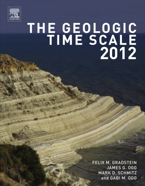
The geologic time scale 2012
The Geologic Time Scale 2012, winner of a 2012 PROSE Award Honorable Mention for Best Multi-volume Reference in Science from the Association of American Publishers, is the framework for deciphering the history of our planet Earth.
eBook
Characterization and formation mechanism of the catastrophic flash flood-debris flow hazard triggered by the July 2023 extreme rainstorm in Hantai Gully of Beijing, China
Recent extreme rainfall events have led to frequent flash flood-debris flow hazards in the mountainous regions of western and northern Beijing, China, resulting in significant loss of life and property. To decipher the formation mechanism and hazard characteristics of these local disasters, the July 2023 flash flood-debris flow in Hantai Village (HTV) and Hantai Gully (HTG) of Changping District, Beijing, was selected as the focus of this study. This study acquired topographic and geological data of the study area through regional disaster investigation, field surveys in severely affected regions, and indoor assessments and analyses, utilizing 1: 1000 topographic maps and 1: 20,000 geological maps sourced from unmanned aerial vehicle (UAV) remote sensing images. Then, the characteristics of rainfall and the associated hazard processes (flash flood and debris flow) were systematically investigated and analyzed. By further exploring the formation mechanism of these events, relevant hazard prevention and mitigation suggestions were proposed. The results indicate that the total flood volume in the upstream channel of HTG is approximately 6870 m3 within 1 h, demonstrating significant destructive power. The leading edge of the flash flood/debris flow exits the gully (the southern entrance of HTV) at an instantaneous speed of 74.47 km/h and maintained a speed of 16.42 km/h by the time it reached the northern exit of HTV (outlet of the HTG), with a movement time of 1.83 min. This brief event duration presents significant challenges for timely evacuation. This catastrophic flash flood-debris flow event is identified as a compound hazard triggered by extreme rainfall from the remnant circulation of Typhoon Doksuri, with the sudden increase in surface runoff amount due to short-term heavy rainfall being the primary cause. It is hypothesized that the debris flow occurred later than the flash flood or during the weakening period of the flash flood and was subsequently eroded by weak flood flows, demonstrating clear characteristics of a mutual transformation between flash flood and debris flow. This study provides fundamental support and reference for hazard prevention and response improvement in other small watersheds.
Journal Article

The Malawi Active Fault Database: An Onshore‐Offshore Database for Regional Assessment of Seismic Hazard and Tectonic Evolution
We present the Malawi Active Fault Database (MAFD), an open‐access (https://doi.org/10.5281/zenodo.5507190) geospatial database of 113 fault traces in Malawi and neighboring Tanzania and Mozambique. Malawi is located within the East African Rift's (EAR) Western Branch where active fault identification is challenging because chronostratigraphic data are rare, and/or faults are buried and so do not have a surface expression. The MAFD therefore includes any fault that has evidence for displacement during Cenozoic East African rifting or is buried beneath the rift valley and is favorably oriented to the regional stresses. To identify such faults, we consider a multidisciplinary data set: high‐resolution digital elevation models, previous geological mapping, field observations, seismic reflection surveys from offshore Lake Malawi, and aeromagnetic and gravity data. The MAFD includes faults throughout Malawi, where seismic risk is increasing because of population growth and its seismically vulnerable building stock. We also investigate the database as a sample of the normal fault population in an incipient continental rift. We cannot reject the null hypothesis that the distribution of fault lengths in the MAFD is described by a power law, which is consistent with Malawi's relatively thick seismogenic layer (30–40 km), low (<8%) regional extensional strain, and regional deformation localization (50%–75%) across relatively long hard‐linked border faults. Cumulatively, we highlight the importance of integrating onshore and offshore geological and geophysical data to develop active fault databases along the EAR and similar continental settings both to understand the regional seismic hazard and tectonic evolution. Plain Language Summary Earthquakes represent the occurrence of slip along cracks in the Earth's crust. Therefore, mapping these cracks, or “faults,” is important when assessing earthquake hazards. However, faults are challenging to identify as they may not be visible at the surface. Fault mapping also requires recognizing which faults have slipped in earthquakes in the recent geologic past, as these “active” faults are the most likely faults to have future earthquakes. Here, we describe how we identified active faults in Malawi, which is located along the tectonically active East African Rift. Faults under Lake Malawi were mapped using images of lake sediments that were generated from sound waves. Onshore, some faults were mapped from their expression in the landscape. Other faults, not visible at the surface, were identified from aeromagnetic data, which image the spatial distributions of magnetic minerals in the Earth's crust. Faults are considered active if that show evidence for slip during East African rifting in Malawi. We combined the active faults identified from these analyses into the Malawi Active Fault Database, a freely available geospatial database. We suggest that this database will be useful for seismic hazard planning in Malawi, where population growth and vulnerable buildings are increasing earthquake risk. Key Points Digital elevation models, offshore seismic reflection surveys, and aeromagnetic data are combined to identify active faults in Malawi Mapped faults are incorporated into the Malawi Active Fault Database, an open‐access geospatial database The mapped faults follow a power law length distribution, which is consistent with strain localization onto a few long (>50 km) faults
Journal Article

Assessing the Impact of Geological Map Detail on Process‐Based and Data‐Driven Hydrological Models
Although large‐sample hydrology data sets are increasingly used to advance predictions in ungauged basins, the influence of landscape data quality on model regionalization remains insufficiently explored. This study investigates whether geological catchment attributes derived from maps of increasing detail—global, continental, and regional—improve parameter transfer and model regionalization. To ensure robustness across model approaches, we applied both a semi‐distributed process‐based hydrological model using hydrological response units (HRUs) and a data‐driven Long Short‐Term Memory (LSTM) model. The analysis covered a total of 130 catchments in the Moselle (Central Europe) and Garonne (southwestern France) basins. We conducted five model experiments differing only in the representation of geological information: a benchmark without geology, a benchmark with random geology classes, and configurations based on the global‐, continental‐, and regional‐scale geological maps. Model performance was evaluated using a modified Nash‐Sutcliffe (NSE) metric for daily streamflow, as well as Pearson correlation and relative bias for three streamflow signatures: baseflow index, slope of the flow duration curve, and half‐flow date. Across both basins and modeling frameworks, increasing geological detail consistently improved predictive performance under space–time evaluation. While differences in NSE were modest, improvements were pronounced for streamflow signatures: only models using the more detailed geological information, especially the regional map, consistently reproduced spatial variability in baseflow and flow regime characteristics. These findings highlight the importance of integrating high‐quality geological data into hydrological modeling, particularly for improving predictions in ungauged basins through more reliable parameter transfer and regionalization.
Journal Article