Catalogue Search | MBRL


Are you sure you want to remove the book from the shelf?

{{itemTitle}}
50
result(s) for
"Geospatial data Technological innovations."
Sort by:

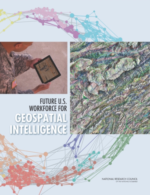
Future U.S. Workforce for Geospatial Intelligence
We live in a changing world with multiple and evolving threats to national security, including terrorism, asymmetrical warfare (conflicts between agents with different military powers or tactics), and social unrest. Visually depicting and assessing these threats using imagery and other geographically-referenced information is the mission of the National Geospatial-Intelligence Agency (NGA). As the nature of the threat evolves, so do the tools, knowledge, and skills needed to respond. The challenge for NGA is to maintain a workforce that can deal with evolving threats to national security, ongoing scientific and technological advances, and changing skills and expectations of workers.
Future U.S. Workforce for Geospatial Intelligence assesses the supply of expertise in 10 geospatial intelligence (GEOINT) fields, including 5 traditional areas (geodesy and geophysics, photogrammetry, remote sensing, cartographic science, and geographic information systems and geospatial analysis) and 5 emerging areas that could improve geospatial intelligence (GEOINT fusion, crowdsourcing, human geography, visual analytics, and forecasting). The report also identifies gaps in expertise relative to NGA's needs and suggests ways to ensure an adequate supply of geospatial intelligence expertise over the next 20 years.
eBook

Learning Progressions for Maps, Geospatial Technology, and Spatial Thinking
As an approach to educational research, learning progressions offer considerable potential for investigating how children develop an understanding of geographic concepts and practices across grade bands and in relation to national geography standards. With funding support from the US National Science Foundation, this book was created as a resource for researching learning progressions for maps, geospatial technology and spatial thinking. Featuring contributions from experts in geography, math and science education, the book's chapters offer advice, examples and guidance on the following topics: * Definitions of learning progressions with examples from geography, math and science education;* Discussion of relevant research on spatial cognition, map learning and GIS education;* Approaches to constructing samples and assessment items for quantitative studies;* Demonstration of how to perform validity tests of research instruments;* Demonstration and practice of qualitative methods, including clinical interviews;* How to interpret quantitative and qualitative data;* Common errors, pitfalls and obstacles in learning progressions research;* Strategies for working with teachers and students in K-12 classrooms.The interdisciplinary nature of the book will appeal to graduate students, higher education faculty and school teachers in several subject areas.
eBook

Advanced geoinformation science
Many of the challenges of the next century will have physical dimensions, such as tsunamis, hurricanes, and climate change as well as human dimensions such as economic crises, epidemics, and emergency responses. With pioneering editors and expert contributors, Advanced Geoinformation Science explores how certain technical aspects of geoinformation have been used and could be used to address such global issues. The editors and chapter authors have been involved in global initiatives such as Global Earth Observation System of Systems (GEOSS) and Digital Earth, and research problems such as air quality, public health, and cloud computing. The book delineates the problems communities are likely to face and how advanced geoinformation science can be a part of their solution. It introduces different methods in collecting spatial data as the initial feeds to geoinformation science and computing platforms. It discusses systems for data management, data integration and analysis, the geoinformation infrastructure, as well as knowledge capture, formatting, and utilization. The book then explores a variety of geoinformation applications, highlighting environmental, agriculture, and urban planning uses.--Publisher's description.
Book
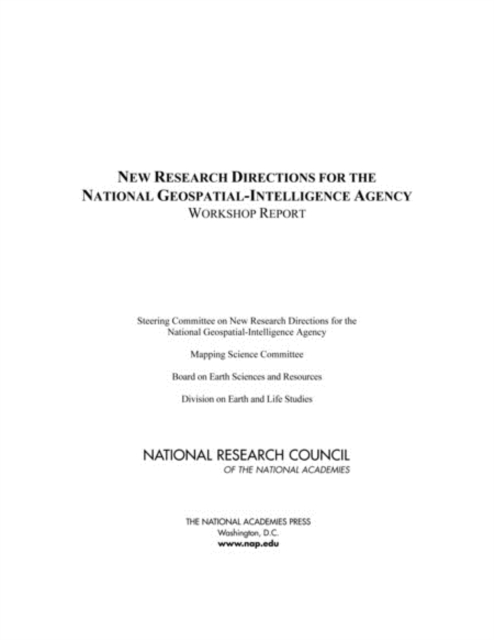
New Research Directions for the National Geospatial-Intelligence Agency
The National Geospatial-Intelligence Agency (NGA) within the Department of Defense has the primary mission of providing timely, relevant, and accurate imagery, imagery intelligence, and geospatial information--collectively known as geospatial intelligence (GEOINT)--in support of national security.
eBook

The future of open data
\"The Future of Open Data flows from a multi-year Social Sciences and Humanities Research Council (SSHRC) Partnership Grant project that set out to explore open government geospatial data from an interdisciplinary perspective. Researchers on the grant adopted a critical social science perspective grounded in the imperative that the research should be relevant to government and civil society partners in the field. This book builds on the knowledge developed during the course of the grant and asks the question, \"What is the future of open data?\" The contributors' insights into the future of open data combine observations from five years of research about the Canadian open data community with a critical perspective on what could and should happen as open data efforts evolve. Each of the chapters in this book addresses different issues and each is grounded in distinct disciplinary or interdisciplinary perspectives. The opening chapter reflects on the origins of open data in Canada and how it has progressed to the present date, taking into account how the Indigenous data sovereignty movement intersects with open data. A series of chapters address some of the pitfalls and opportunities of open data and consider how the changing data context may impact sources of open data, limits on open data, and even liability for open data. Another group of chapters considers new landscapes for open data, including open data in the global South, the data priorities of local governments, and the emerging context for rural open data.\"-- Provided by publisher
Book

YOLOv8-C2f-Faster-EMA: An Improved Underwater Trash Detection Model Based on YOLOv8
Anthropogenic waste deposition in aquatic environments precipitates a decline in water quality, engendering pollution that adversely impacts human health, ecological integrity, and economic endeavors. The evolution of underwater robotic technologies heralds a new era in the timely identification and extraction of submerged litter, offering a proactive measure against the scourge of water pollution. This study introduces a refined YOLOv8-based algorithm tailored for the enhanced detection of small-scale underwater debris, aiming to mitigate the prevalent challenges of high miss and false detection rates in aquatic settings. The research presents the YOLOv8-C2f-Faster-EMA algorithm, which optimizes the backbone, neck layer, and C2f module for underwater characteristics and incorporates an effective attention mechanism. This algorithm improves the accuracy of underwater litter detection while simplifying the computational model. Empirical evidence underscores the superiority of this method over the conventional YOLOv8n framework, manifesting in a significant uplift in detection performance. Notably, the proposed method realized a 6.7% increase in precision (P), a 4.1% surge in recall (R), and a 5% enhancement in mean average precision (mAP). Transcending its foundational utility in marine conservation, this methodology harbors potential for subsequent integration into remote sensing ventures. Such an adaptation could substantially enhance the precision of detection models, particularly in the realm of localized surveillance, thereby broadening the scope of its applicability and impact.
Journal Article

Progress and Limitations in Forest Carbon Stock Estimation Using Remote Sensing Technologies: A Comprehensive Review
Forests play a key role in carbon sequestration and oxygen production. They significantly contribute to carbon peaking and carbon neutrality goals. Accurate estimation of forest carbon stocks is essential for a precise understanding of the carbon sequestration capacity of forest ecosystems. Remote sensing technology, with its wide observational coverage, strong timeliness, and low cost, is essential for carbon stock estimation research. However, challenges in data acquisition and processing include data variability, signal saturation in dense forests, and environmental limitations. These factors hinder accurate carbon stock estimation. This review summarizes the current state of research on forest carbon stock estimation from two aspects, namely remote sensing data and estimation methods, highlighting both the advantages and the limitations of various data sources and models. It also explores technological innovations and cutting-edge research in the field, focusing on deep learning techniques, optical vegetation thickness estimation methods, and the impact of forest–climate interactions on carbon stock estimation. Finally, the review discusses the current challenges in the field, including issues related to remote sensing data quality, model adaptability, forest stand complexity, and uncertainties in the estimation process. Based on these challenges, the paper looks ahead to future trends, proposing potential technological breakthroughs and pathways. The aim of this study is to provide theoretical support and methodological guidance for researchers in related fields.
Journal Article

Challenges and Strategies for Educational Virtual Reality
Virtual reality (VR) is a rich visualization and analytic platform that furthers the library’s mission of providing access to all forms of information and supporting pedagogy and scholarship across disciplines. Academic libraries are increasingly adopting VR technology for a variety of research and teaching purposes, which include providing enhanced access to digital collections, offering new research tools, and constructing new immersive learning environments for students. This trend suggests that positive technological innovation is flourishing in libraries, but there remains a lack of clear guidance in the library community on how to introduce these technologies in effective ways and make them sustainable within different types of institutions. In June 2018, the University of Oklahoma hosted the second of three forums on the use of 3D and VR for visualization and analysis in academic libraries, as part of the project Developing Library Strategy for 3D and Virtual Reality Collection Development and Reuse(LIB3DVR), funded by a grant from the Institute of Museum and Library Services. This qualitative study invited experts from a range of disciplines and sectors to identify common challenges in the visualization and analysis of 3D data, and the management of VR programs, for the purpose of developing a national library strategy.
Journal Article