Catalogue Search | MBRL


Are you sure you want to remove the book from the shelf?

{{itemTitle}}
310
result(s) for
"Graphic methods History."
Sort by:


Data Visualization in Sociology
Visualizing data is central to social scientific work. Despite a promising early beginning, sociology has lagged in the use of visual tools. We review the history and current state of visualization in sociology. Using examples throughout, we discuss recent developments in ways of seeing raw data and presenting the results of statistical modeling. We make a general distinction between those methods and tools designed to help explore data sets and those designed to help present results to others. We argue that recent advances should be seen as part of a broader shift toward easier sharing of code and data both between researchers and with wider publics, and we encourage practitioners and publishers to work toward a higher and more consistent standard for the graphical display of sociological insights.
Journal Article


Shedding new light on the context and temporality of Iberian warrior stelae: The Cañaveral de León 2 Stela and Las Capellanías burial complex (Huelva, SW Spain)
Iberian late prehistoric stelae stand out as a significant expression of European prehistoric art. For well over a hundred years, the context of use of the c. 300 Iberian stelae known to this date has been intensely discussed. This debate, however, was inherently flawed and limited in its scope, as almost all the available examples were found by chance, and no good-quality empirical evidence was available to understand their primary context. In this paper, we present the first conclusive scientific evidence demonstrating that Iberian late prehistoric stelae were used both as grave markers and landscape landmarks associated with pathways. This incontrovertible evidence stems from fieldwork undertaken in June 2022 and September 2023 at the site of Las Capellanías (Cañaveral de León, Huelva) in south-west Spain, including field walking, geophysics and excavation. The ground-breaking discoveries made at this remarkable site within barely a year reveal the contextual association of three different stelae to as many graves within the context of a large long-standing burial complex. Specifically, in this paper we study Stela #2 through a broad combination of methods ranging from geoarchaeology to luminescence dating and archaeoastronomy, as well as multiple digital visualization and remote sensing techniques. This multidisciplinary approach provide s data that reveal multiple lines of evidence concerning the context and temporality of the stela, its manufacture and its graphic design. Altogether, this lays out a much needed and long-awaited reliable empirical base to understand where, when and how Iberian prehistoric stelae were used. “We hewed logs and built his pyre upon the tallest headland where it runs out above the sea: duly we made his funeral, bewailing him with bitter tears. After body and armour were quite burned away, we piled a mound over them and to crown it dragged up a monolith”, Homer, The Odyssey (London, Arcturus, 2021. Trans. by Alexander Pope). “As he spoke he began stripping the spoils from the son of Paeon, but Alexandrus husband of lovely Helen aimed an arrow at him, leaning against a pillar of the monument which men had raised to Ilus son of Dardanus, a ruler in days of old”, Homer, The Illiad (Project Gutenberg, 2022. Trans. by Samuel Butler).
Journal Article


Comic connections
With the popularity of comic adaptations on television and at the movies, these current topics can be a great way to engage students by bringing characters and stories they connect with into the classroom to help them build the skills that they need to be successful. Comic Connections: Reflecting on Women in Popular Culture is designed to help teachers from middle school through college find exciting new strategies that they can use right away as part of their curricular goals. Each chapter has three pieces: comic relevance, classroom connections, and concluding thoughts; this format allows a reader to pick-and-choose where to start. Some readers might want to delve into the history of a comic to better understand characters and their usefulness, while other readers might want to pick up an activity, presentation, or project that they can fold into that day’s lesson. This volume in Comic Connections series focuses on female characters—Wonder Woman, Peggy Carter, and Lois Lane, to name a few—with each chapter deconstructing a specific character to help students engage in meaningful conversations, writing projects, and other activities that will complement and enhance their literacy skills.
eBook

AncesTree: An interactive immunoglobulin lineage tree visualizer
High-throughput sequencing of human immunoglobulin genes allows analysis of antibody repertoires and the reconstruction of clonal lineage evolution. The study of antibodies (Abs) affinity maturation is of specific interest to understand the generation of Abs with high affinity or broadly neutralizing activities. Moreover, phylogenic analysis enables the identification of the key somatic mutations required to achieve optimal antigen binding. The Immcantation framework provides a start-to-finish set of analytical methods for high-throughput adaptive immune receptor repertoire sequencing (AIRR-Seq; Rep-Seq) data. Furthermore, Immcantation's Change-O package has developed IgPhyML, an algorithm designed to build specifically immunoglobulin (Ig) phylogenic trees. Meanwhile Phylip, an algorithm that has been originally developed for applications in ecology and macroevolution, can also be used for the phylogenic reconstruction of antibodies maturation pathway. To complement Ig lineages made by IgPhyML or Dnaml (Phylip), we developed AncesTree, a graphic user interface (GUI) that aims to give researchers the opportunity to interactively explore antibodies clonal evolution. AncesTree displays interactive immunoglobulins phylogenic tree, Ig related mutations and sequence alignments using additional information coming from specialized antibody tools. The GUI is a Java standalone application allowing interaction with Ig tree that can run under Windows, Linux and Mac OS.
Journal Article

150 years of Nature: a data graphic charts our evolution
An analysis of the archive shows how the contributors and content have varied over the decades.
An analysis of the archive shows how the contributors and content have varied over the decades.
Journal Article

Detecting Polygenic Adaptation in Admixture Graphs
Polygenic adaptation occurs when natural selection changes the average value of a complex trait in a population, via small shifts in allele frequencies at many loci. Here, Racimo, Berg, and Pickrell present a method... An open question in human evolution is the importance of polygenic adaptation: adaptive changes in the mean of a multifactorial trait due to shifts in allele frequencies across many loci. In recent years, several methods have been developed to detect polygenic adaptation using loci identified in genome-wide association studies (GWAS). Though powerful, these methods suffer from limited interpretability: they can detect which sets of populations have evidence for polygenic adaptation, but are unable to reveal where in the history of multiple populations these processes occurred. To address this, we created a method to detect polygenic adaptation in an admixture graph, which is a representation of the historical divergences and admixture events relating different populations through time. We developed a Markov chain Monte Carlo (MCMC) algorithm to infer branch-specific parameters reflecting the strength of selection in each branch of a graph. Additionally, we developed a set of summary statistics that are fast to compute and can indicate which branches are most likely to have experienced polygenic adaptation. We show via simulations that this method—which we call PolyGraph—has good power to detect polygenic adaptation, and applied it to human population genomic data from around the world. We also provide evidence that variants associated with several traits, including height, educational attainment, and self-reported unibrow, have been influenced by polygenic adaptation in different populations during human evolution.
Journal Article
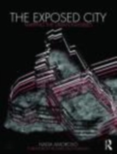
The Exposed City
There is a vast amount of information about a city which is invisible to the human eye – crime levels, transportation patterns, cell phone use and air quality to name just a few. If a city was able to be defined by these characteristics, what form would it take? How could it be mapped?
Nadia Amoroso tackles these questions by taking statistical urban data and exploring how they could be transformed into innovative new maps. The \"unseen\" elements of the city are examined in groundbreaking images throughout the book, which are complemented by interviews with Winy Maas and James Corner, comments by Richard Saul Wurman, and sections by the SENSEable City Lab group and Mark Aubin, co-founder of Google Earth.
Foreword Richard Saul Wurman Part 1: Essays 1. Map or Drawing? The Visual Expressions of Hugh Ferriss 2. Graphic Integrity of the Urban Complexity- Lynch, Wurman and Tufte 3. The DATAscapes: the Works of MVRDV 4. The Map-Art: Creative Measures in Landscape Mapping, the Works of James Corner Part 2: Drawings: the Map-Landscape 5.1 The Creative Map 5.2 The Map-Landscapes Afterword Mapping the Invisibles by SENSEable City Lab Carlo Ratti Google Earth: the Global Mapping Search Tool Mark Aubin
Nadia Amoroso specializes in visual representation as it relates to architecture, landscape architecture and the urban environment. She is a Lecturer at the University of Toronto, John H. Daniels Faculty of Architecture, Landscape, and Design. Amoroso was also a recent Visiting Fellow at Cornell University and Visiting Professor at the University of Arkansas. She has a Ph.D. in Architectural Studies, and degrees in Urban Design and Landscape Architecture. Amoroso is a principal of Orange + Blue Consulting, specializing in urban design, mapping and visual representation (digital and traditional means).
'[Amoroso] has brought to the forefront a visually exciting way to view information that has spatial, creative and suggestive outcomes. With a background in landscape architecture, urban design and architecture, she crafts maps as some kind of landscape form perceived by the data type. Maps as metaphor, the data as metaphor, map as art, data as art.' – Richard Saul Wurman, Information Architect
'We are on a cusp and Nadia Amoroso is one of the team players on this cusp of the New Map ... showing patterns with great clarity and singularity, combining scientific, physical structures, atmospheric conditions and showing these patterns over time, a day, a week, a month, a year or a decade.' – Richard Saul Wurman, Information Architect
'Nadia Amoroso takes the art and science of transforming statistical urban data into innovative maps to the next level in her recent book The Exposed City: Mapping the Urban Invisibles ... The author provides guiding principles to suggest a selection process that proves useful to achieving the right balance between aesthetics and empirical evidence in the process of creating a a map.' - Amit Patel, Journal of Planning Education and Research
eBook