Catalogue Search | MBRL


Are you sure you want to remove the book from the shelf?

{{itemTitle}}
26
result(s) for
"Indian Ocean - Navigation - History"
Sort by:

The Indian Ocean
In this stimulating and authoritative overview, Michael Pearson reverses the traditional angle of maritime history and looks from the sea to its shores - its impact on the land through trade, naval power, travel and scientific exploration. This vast ocean, both connecting and separating nations, has shaped many countries' cultures and ideologies through the movement of goods, people, ideas and religions across the sea.
The Indian Ocean moves from a discussion of physical elements, its shape, winds, currents and boundaries, to a history from pre-Islamic times to the modern period of European dominance. Going far beyond pure maritime history, this compelling survey is an invaluable addition to political, cultural and economic world history.
eBook


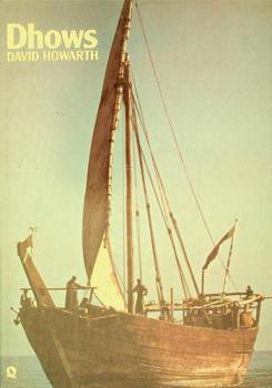
“No country but the ocean”: Reading International Law from the Deck of an Indian Ocean Dhow, ca. 1900
This paper engages in a microhistory of international law, grounded in the contests surrounding the Muscat Dhows case brought by Great Britain against France in 1905. At the heart of the case was the question of whether the French consul had the right to grant flags and navigation passes to dhows from the southern Omani port of Sur that were suspected of transporting slaves. The case became foundational to studies of the law of the sea, and the ruling is still cited in footnotes in law school textbooks. Buried in the case's proceedings, however, are a series of petitions by the dhow captains that give historians a window into the legal imaginaries of Indian Ocean mariners in an age of empire. Through a close reading of the petitions, I explore how captains located themselves within an imperial legal geography, and appropriated legal technologies—passes and flags—to help them shape the legal possibilities of a changing political and economic seascape. I argue that the claims the captains articulated and the practices they engaged in at sea reveal a maritime legal culture at work, one animated by a long history of encountering regional and global empires at sea. Their documentary practices illuminate how they engaged in and domesticated a body of international law, and illustrate how the regime manifested itself in an ocean that ran thick with legal idioms.
Journal Article

Preliminary Seismo-Tectonic Analysis of the Catastrophic Earthquake in South-Eastern Turkey on February 6, 2023
In this paper, we kinematically analyze the movements of plates and blocks of the region of southeastern Turkey, where strong earthquakes occurred on February 6, 2023, based on a homogeneous database of displacement velocities of GNSS permanent monitoring stations. Along the East Anatolian fault zone from 2008 to 2018, the Arabian Plate was established to shift relative to the Anatolian Plate, which corresponds to a left shift (without a normal component) at a rate from 1 cm/yr in the eastern part to 0.8 cm/yr in the western part. Along the Chardak fault, displacements corresponding to the left shift occurred at a rate of less than 0.7 cm/year. The revealed kinematics is confirmed by focal mechanisms and cosesismic displacements of the studied earthquakes. The
M
7.5 earthquake that occurred directly on the Chardak fault is not an aftershock of the
M
7.8 earthquake, but is a relatively independent event. An analysis of the seismic regime shows that the stresses on the East Anatolian fault after the main
M
7.8 event are relieved by the first large latitudinal fault zone (the Chardak fault). The results of our study suggest that the counterclockwise rotation of the Anatolian and Arabian plates associated with the opening of the Red Sea Rift is most likely decisive for the general kinematics of the plates in the region.
Journal Article

The Itineraries of Geography: Jan Huygen van Linschoten's Itinerario and Dutch Expeditions to the Indian Ocean, 1594-1602
Jan Huygen van Linschoten's 1596 Itinerario, published in Amsterdam just before Dutch world hegemony, opened the Indian Ocean world for the European geographical imagination, especially regarding its spice markets and non-Christian cultures. Linschoten confirmed rumors in Europe that the Portuguese Estado da Índia had become decadent and unstable, especially in its capital Goa. He also mentioned the absence of Portuguese control in the market of Bantam, which would become the capital of Dutch Indonesia. In addition, the book disclosed nautical and economic information about the Indian Ocean until then carefully guarded by the Portuguese, especially about the Spice Islands. In fact, the book's navigational section was published early so it could be on board the so-called First Voyage organized by the Dutch. This article discusses the main features that made the cartographic, cultural, and economic information of the Itinerario crucial to this historical expedition. Historicizing the discipline of geography is indispensable for understanding how travel and technology affect what can be known of the planet. Following Foucault's understanding of the production of knowledge, the central argument is that the Itinerario inaugurated a leap in the Dutch geographical \"episteme\" and a new struggle for the Indian Ocean. Linschoten's humanist scholarship was from the start a multiplicity of knowledges and voices that could be read and used in many ways.
Journal Article

The Persian Gulf or the Red Sea? Two axes in ancient Indian Ocean trade, where to go and why
From the first century bce until the third century ce, Roman trade with the Indian Ocean passed by way of two major axes: the Red Sea-Nile and the Persian Gulf-Syrian Desert. The overall distance by way of the Persian Gulf-Syrian Desert route was considerably shorter, but the overland part of the journey was almost four times longer, and goods had to pass through politically tense border regions between the Parthian and Roman empires. Although the relative importance of the two routes probably varied, both were in operation at the same time and for a prolonged period. How can this be explained? This article explores the passages from India to the Mediterranean in the Roman imperial period and argues that a relatively straightforward answer is to be found in the annual rhythms of movement responding to ocean winds, desert weather and river floods.
Journal Article

A Gujarati Map and Pilot Book of the Indian Ocean, c.1750
An unusual eighteenth-century Gujarati manuscript (St John's College, Oxford, MS 254 (45)) that includes a grid-line map of Gujarat, sailing directions and a list of Indian Ocean ports throws light on the history of Indian cartography and navigation. The manuscript, which is bound into the scrapbook of an eighteenth-century English clergyman, is examined in detail and compared with other maps and charts originating in Gujarat. The map suggests that nautical cartography in western India may have benefited from the exchange of technical information that prevailed among mariners of the Indian ocean.
Journal Article

Mapping an Interoceanic Landscape
Building on existing scholarship in the field of Indian Ocean studies, this paper argues that through two major historic figures, namely John Langalibalele Dube (1871-1946) and Mohandas Karamchand Gandhi (1869-1948), the Indian Ocean and the Black Atlantic converged in Inanda (Durban), where notions of nation, nationalism, modernity and civilization were articulated and defined. In doing so, this paper offers a South African vantage point from which to understand the Indian and Atlantic Oceans’ role in the intellectualization of the imperial context in South Africa, as part of a set of South-South exchanges and connections. Following a brief historical overview of 20thcentury Natal, the differences, parallels and interactions between Dube and Gandhi’s personas and ideologies, and the influence of religion on their work, are discussed and supported through an examination of the Ohlange Institute and the Phoenix Settlement, as well as a comparative analysis ofIlangaandIndian Opinionarchival material, as physical and written expressions of their respective outlook on life. Finally, this case study suggests an understanding of the emergence of African and Indian nationalism and modernity in 20thcentury South Africa as a transnational phenomenon.
Journal Article