Catalogue Search | MBRL


Are you sure you want to remove the book from the shelf?

{{itemTitle}}
66
result(s) for
"Japan Maps History."
Sort by:


Printing Landmarks
Printing Landmarks tells the story of the late Tokugawa period’s most distinctive form of popular geography: meisho zue. Beginning with the publication of Miyako meisho zue in 1780, these monumental books deployed lovingly detailed illustrations and informative prose to showcase famous places (meisho) in ways that transcended the limited scope, quality, and reliability of earlier guidebooks and gazetteers. Putting into spellbinding print countless landmarks of cultural significance, the makers of meisho zue created an opportunity for readers to experience places located all over the Japanese archipelago.In this groundbreaking multidisciplinary study, Robert Goree draws on diverse archival and scholarly sources to explore why meisho zue enjoyed widespread and enduring popularity. Examining their readership, compilation practices, illustration techniques, cartographic properties, ideological import, and production networks, Goree finds that the appeal of the books, far from accidental, resulted from specific choices editors and illustrators made about form, content, and process. Spanning the fields of book history, travel literature, map history, and visual culture, Printing Landmarks provides a new perspective on Tokugawa-period culture by showing how meisho zue depicted inspiring geographies in which social harmony, economic prosperity, and natural stability made for a peaceful polity.
eBook
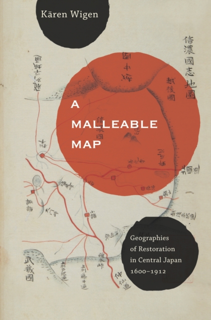
A malleable map
Kären Wigen probes regional cartography, choerography, and statecraft to redefine restoration (ishin) in modern Japanese history. As developed here, that term designates not the quick coup d’état of 1868 but a three-centuries-long project of rehabilitating an ancient map for modern purposes. Drawing on a wide range of geographical documents from Shinano (present-day Nagano Prefecture), Wigen argues that both the founder of the Tokugawa Shogunate (1600–1868) and the reformers of the Meiji era (1868–1912) recruited the classical map to serve the cause of administrative reform. Nor were they alone; provincial men of letters played an equally critical role in bringing imperial geography back to life in the countryside. To substantiate these claims, Wigen traces the continuing career of the classical court’s most important unit of governance—the province—in central Honshu.
eBook


Minimum of the order parameter fluctuations of seismicity before major earthquakes in Japan
It has been shown that some dynamic features hidden in the time series of complex systems can be uncovered if we analyze them in a time domain called natural time χ . The order parameter of seismicity introduced in this time domain is the variance of χ weighted for normalized energy of each earthquake. Here, we analyze the Japan seismic catalog in natural time from January 1, 1984 to March 11, 2011, the day of the M9 Tohoku earthquake, by considering a sliding natural time window of fixed length comprised of the number of events that would occur in a few months. We find that the fluctuations of the order parameter of seismicity exhibit distinct minima a few months before all of the shallow earthquakes of magnitude 7.6 or larger that occurred during this 27-y period in the Japanese area. Among the minima, the minimum before the M9 Tohoku earthquake was the deepest. It appears that there are two kinds of minima, namely precursory and nonprecursory, to large earthquakes.
Journal Article

The National Map of Japan in the Tokugawa Shogunate (1633-1725): Misunderstandings Corrected
In early modern Japan, the central government was traditionally responsible for creating a national map and accompanying cadastre (an account book listing rice production village by village), as I related in Imago Mundi in 1989. Here I present the results of subsequent research that has allowed me to correct a number of misunderstandings about the first maps produced during the Tokugawa Shogunate (1603-1725).
Journal Article

River state classification combining patch-based processing and CNN
This paper proposes a method for classifying the river state (a flood risk exists or not) from river surveillance camera images by combining patch-based processing and a convolutional neural network (CNN). Although CNN needs much training data, the number of river surveillance camera images is limited because flood does not frequently occur. Also, river surveillance camera images include objects that are irrelevant to the flood risk. Therefore, the direct use of CNN may not work well for the river state classification. To overcome this limitation, this paper develops patch-based processing for adjusting CNN to the river state classification. By increasing training data via the patch segmentation of an image and selecting patches that are relevant to the river state, the adjustment of general CNNs to the river state classification becomes feasible. The proposed patch-based processing and CNN are developed independently. This yields the practical merits that any CNN can be used according to each user’s purposes, and the maintenance and improvement of each component of the whole system can be easily performed. In the experiment, river state classification is defined as the following problems using two datasets, to verify the effectiveness of the proposed method. First, river images from the public dataset called Places are classified to images with Muddy labels and images with Clear labels. Second, images from the river surveillance camera in Nagaoka City, Japan are classified to images captured when the government announced heavy rain or flood warning and the other images.
Journal Article

Japan in print
A quiet revolution in knowledge separated the early modern period in Japan from all previous time. After 1600, self-appointed investigators used the model of the land and cartographic surveys of the newly unified state to observe and order subjects such as agronomy, medicine, gastronomy, commerce, travel, and entertainment. They subsequently circulated their findings through a variety of commercially printed texts: maps, gazetteers, family encyclopedias, urban directories, travel guides, official personnel rosters, and instruction manuals for everything from farming to lovemaking. In this original and gracefully written book, Mary Elizabeth Berry considers the social processes that drove the information explosion of the 1600s. Inviting readers to examine the contours and meanings of this transformation, Berry provides a fascinating account of the conversion of the public from an object of state surveillance into a subject of self-knowledge.
eBook

Island narratives in the making of Japan: The Kojiki in geocultural context
Shintō, the national religion of Japan, is grounded in the mythological narratives that are found in the 8th-Century chronicle, Kojiki 古事記 (712). Within this early source book of Japanese history, myth, and national origins, there are many accounts of islands (terrestrial and imaginary), which provide a foundation for comprehending the geographical cosmology (i.e., sacred space) of Japan’s territorial boundaries and the nearby region in the 8th Century, as well as the ritualistic significance of some of the country’s islands to this day. Within a complex geocultural genealogy of gods that links geography to mythology and the Japanese imperial line, land and life were created along with a number of small and large islands. Drawing on theoretical work and case studies that explore the geopolitics of border islands, this article offers a critical study of this ancient work of Japanese history with specific reference to islands and their significance in mapping Japan. Arguing that a characteristic of islandness in Japan has an inherent connection with Shintō religious myth, the article shows how mythological islanding permeates geographic, social, and cultural terrains. The discussion maps the island narratives found in the Kojiki within a framework that identifies and discusses toponymy, geography, and meaning in this island nation’s mythology.
Journal Article