Catalogue Search | MBRL


Are you sure you want to remove the book from the shelf?

{{itemTitle}}
223
result(s) for
"Landscape archaeology Case studies."
Sort by:


Least cost analysis of social landscapes : archaeological case studies
A growing number of archaeologists are applying Geographic Information Science (GIS) technologies to their research problems and questions. Advances in GIS and its use across disciplines allows for collaboration and enables archaeologists to ask ever more sophisticated questions and develop increasingly elaborate models on numerous aspects of past human behavior. Least cost analysis (LCA) is one such avenue of inquiry. While least cost studies are not new to the social sciences in general, LCA is relatively new to archaeology; until now, there has been no systematic exploration of its use within the field.
This edited volume presents a series of case studies illustrating the intersection of archaeology and LCA modeling at the practical, methodological, and theoretical levels. Designed to be a guidebook for archaeologists interested in using LCA in their own research, it presents a wide cross-section of practical examples for both novices and experts. The contributors to the volume showcase the richness and diversity of LCA’s application to archaeological questions, demonstrate that even simple applications can be used to explore sophisticated research questions, and highlight the challenges that come with injecting geospatial technologies into the archaeological research process.
eBook


Archaeology in Environment and Technology
Environments, landscapes, and ecological systems are often seen as fundamental by archaeologists, but how they relate to society is understood in very different ways. The chapters in this book take environment, culture, and technology together. All have been the focus of much attention; often one or other has been seen as the starting point for analysis, but this volume argues that it is the study of the inter-relationships between these three factors that offers a way forward. The contributions to this book pick up different strands within the tangled web of intersections between environment, technology, and society, providing a series of case studies which explore facets of this common theme in different settings and circumstances and from different perspectives. As well as addressing themes of theoretical and methodological interest, these case studies draw on primary research dealing with time periods from the late Pleistocene glacial maximum to the very recent past, and involve societies of very different types. Running through all the contributions, however, is a concern with the archaeological record and the ways in which scales of observation and availability of evidence affect the development of questions and explanations.
The diversity of the chapters in this volume demonstrates the inherent weakness in any attempt to prioritise environment, technology, or society. These three factors are all embedded in any human activity, as change in one will result in change in the others: social and technical changes alter relations with the environment-and indeed the environment itself-and as environmental change drives changes in society and technology. As this book shows, it is possible to consider the relationship between the three factors from different perspectives, but any attempt to consider one or even two in isolation will mean that valuable insights will be missed.
eBook
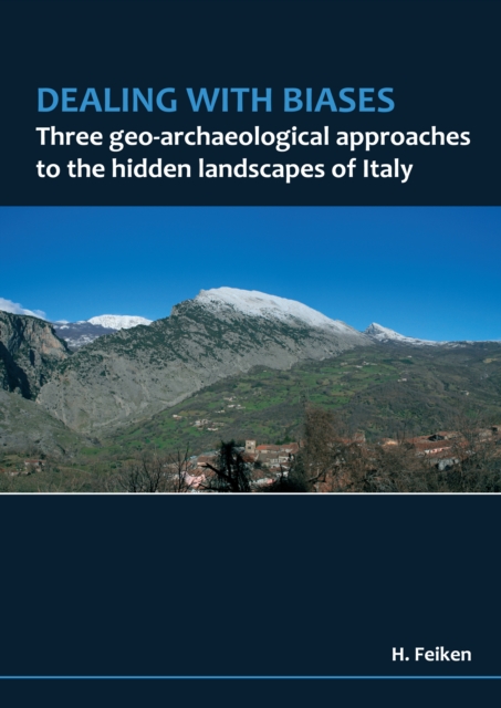
Dealing with biases
This books explores the bias that is introduced by erosion and sedimentation on the distribution of archaeological materials in Mediterranean landscapes. It describes innovative and interdisciplinary work that led to the formulation of a broad range of geo-archeological approaches that are applied to two Italian areas, studied intensively by the Groningen Institute of Archaeology: the Pontine Region in South Lazio, and the Raganello Basin in North Calabria. The approaches deal with geological biases affecting the study of protohistoric remains in the sedimentary part of the Pontine plain; the development of a detailed landscape classification approach to predict and test site location preferences and survey biases in the uplands of both study areas; and the development and evaluation of an innovative computerised landscape evolution model for a test area in the Raganello Basin uplands. In addition to the presented case study, this book also shows how the three geo-archaeological approaches can be applied in a wider context to quantitatively understand how erosion and sedimentation bias our understanding of archaeological records.
eBook

Processes and driving forces in changing cultural landscapes across Europe
Context
Cultural landscapes evolve over time. However, the rate and direction of change might not be in line with societal needs and more information on the forces driving these changes are therefore needed.
Objectives
Filling the gap between single case studies and meta-analyses, we present a comparative study of landscape changes and their driving forces based in six regions across Europe conducted using a consistent method.
Methods
A LULC analysis based on historical and contemporary maps from the nineteenth and twentieth century was combined with oral history interviews to learn more about perceived landscape changes, and remembered driving forces. Land cover and landscape changes were analysed regarding change, conversions and processes. For all case study areas, narratives on mapped land cover change, perceived landscape changes and driving forces were compiled.
Results
Despite a very high diversity in extent, direction and rates of change, a few dominant processes and widespread factors driving the changes could be identified in the six case study areas, i.e. access and infrastructure, political shifts, labor market, technological innovations, and for the more recent period climate change.
Conclusions
Grasping peoples’ perception supplements the analyses of mapped land use and land cover changes and allows to address perceived landscape changes. The list of driving forces determined to be most relevant shows clear limits in predictability: Whereas changes triggered by infrastructural developments might be comparatively easy to model, political developments cannot be foreseen but might, nevertheless, leave major marks in the landscape.
Journal Article

Succeeding CORONA: declassified HEXAGON intelligence imagery for archaeological and historical research
Over the past 25 years, CORONA satellite imagery has become an integral part of archaeological research, especially for arid, sparsely vegetated regions such as the Middle East. Since 2020, a new archive of satellite imagery gathered by the US spy satellite programme that succeeded CORONA—HEXAGON—has become widely available for download via the United States Geological Survey. This photographic archive has enormous potential for archaeological research. Here, the authors seek to lower the barriers to accessing and using this imagery by detailing the background, technical specifications and history of the HEXAGON archive. Four case studies illustrate the benefits and limitations of HEXAGON imagery for archaeological and historical research in the Middle East and beyond.
Journal Article
Agricultural terraces in the Mediterranean: medieval intensification revealed by OSL profiling and dating
The history of agricultural terraces remains poorly understood due to problems in dating their construction and use. This has hampered broader research on their significance, limiting knowledge of past agricultural practices and the long-term investment choices of rural communities. The authors apply OSL profiling and dating to the sediments associated with agricultural terraces across the Mediterranean region to date their construction and use. Results from five widely dispersed case studies reveal that although many terraces were used in the first millennium AD, the most intensive episodes of terrace-building occurred during the later Middle Ages (c. AD 1100–1600). This innovative approach provides the first large-scale evidence for both the longevity and medieval intensification of Mediterranean terraces.
Journal Article

A Spatial Connectivity Approach to Landscapes of Conflict: Julius Caesar and the Assault to Puig Ciutat (NE Iberian Peninsula)
Landscape plays a vital role in the development of military campaigns through the definition of geostrategic landmarks that structure the control of the territory, the imposition of constraints to the movement of armies and the identification of features that facilitate defence against attackers. These factors are linked to the study of past spatial mobility which is typically done by finding optimal pathways between pairs of points using Least-Cost Path analysis. This emphasis on optimality may not be ideal for case studies that need a general approach to spatial connectivity such as the study of conflict-related dynamics. Connectivity modelling based on Circuit Theory (CT) is an alternative approach to spatial mobility that captures the connectivity of an entire region identifying not only optimal paths but also bottlenecks, dead-ends and any other spatial feature that may impact movement. We present here a framework to study landscapes of conflict using connectivity modelling; the framework combines CT, visibility analysis and statistical hypothesis testing to understand the reasons behind the assault and destruction of Puig Ciutat (NE Iberian Peninsula) during Julius Caesar’s civil war. Results suggest that the site exerted decisive control over a highly connected area linking two possible logistical bases (Emporion and Massalia) to the armies fighting at Ilerda (49 BC).
Journal Article
Exploring the common ground of landscape ecology and landscape archaeology through a case study from eastern Anatolia, Turkey
ContextLandscape archaeology has a lot to offer to landscape ecology, being an interdisciplinary approach that emphasizes the study of long-term human–environment dynamics.ObjectivesWe outline different conceptualizations of landscape in landscape archaeology and illustrate the potential of the approach for collaborating with landscape ecologists by describing a case study from the multi-period site of Arslantepe, located in the Malatya province of eastern Anatolia, Turkey.MethodsWe use an agent-based modeling platform to understand the socio-economic transformations at Arslantepe during the Early Bronze Age-I.ResultsThese simulations revealed long-term dynamics of grassland and woodland under different climate and population scenarios. It was found that both grassland and woodland responded most strongly to changes in population, with woodlands being more sensitive. Further, it becomes evident that the adapted site-tethered pastoralism could have brought more sustainable land use practices.ConclusionsThe example shows the tremendous potential landscape archaeology has for studying long-term sustainability issues, especially related to modes of production. The landscape archaeological perspective can be linked with expertise provided by landscape ecologists, and we propose more in-depth collaboration of these two fields that offer diverse yet complementary perspectives.
Journal Article