Catalogue Search | MBRL


Are you sure you want to remove the book from the shelf?

{{itemTitle}}
71
result(s) for
"Landscape architecture Germany."
Sort by:

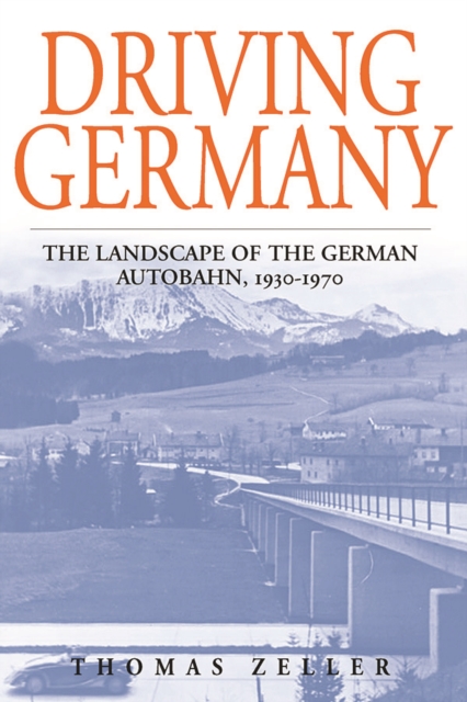
Driving Germany
Published in Association with the German Historical Institute, Washington, D.C.
Hitler's autobahn was more than just the pet project of an infrastructure-friendly dictator. It was supposed to revolutionize the transportation sector in Germany, connect the metropoles with the countryside, and encourage motorization. The propaganda machinery of the Third Reich turned the autobahn into a hyped-up icon of the dictatorship. One of the claims was that the roads would reconcile nature and technology. Rather than destroying the environment, they would embellish the landscape. Many historians have taken this claim at face value and concluded that the Nazi regime harbored an inbred love of nature. In this book, the author argues that such conclusions are misleading. Based on rich archival research, the book provides the first scholarly account of the landscape of the autobahn.
eBook


Planning nature-based solutions
Nature-based solutions (NBS) find increasing attention as actions to address societal challenges through harnessing ecological processes, yet knowledge gaps exist regarding approaches to landscape planning with NBS. This paper aims to provide suggestions of how planning NBS can be conceptualized and applied in practice. We develop a framework for planning NBS by merging insights from literature and a case study in the Lahn river landscape, Germany. Our framework relates to three key criteria that define NBS, and consists of six steps of planning: Co-define setting, Understand challenges, Create visions and scenarios, Assess potential impacts, Develop solution strategies, and Realize and monitor. Its implementation is guided by five principles, namely Place-specificity, Evidence base, Integration, Equity, and Transdisciplinarity. Drawing on the empirical insights from the case study, we suggest suitable methods and a checklist of supportive procedures for applying the framework in practice. Taken together, our framework can facilitate planning NBS and provides further steps towards mainstreaming.
Journal Article

Germany's Other Modernity
This book is about what it meant to build a city in Germany at the turn of the twentieth century. It explores the physical spaces and mental attitudes that conditioned beliefs about the past and expectations for the future in the crucial German generations that shaped the young Reich, fought the Great War, and experienced the Weimar Republic.
eBook

Landscape services: the concept and its practical relevance
Recently, in addition to the popular concept of “ecosystem services” (ES), the term “landscape services” (LS) has come into use. We are examining the question of whether a stronger focus on LS would be useful, particularly with regard to case studies carried out in Germany. Important reasons for introducing the term LS include the prominent role of spatial aspects, the reference to landscape elements and the landscape character, and the relevance of LS for landscape planning. We found no strong arguments for replacing the concept of ES by LS; however, we do prefer a situation-related use of both concepts. We propose the following definition: Landscape services are the contributions of landscapes and landscape elements to human well-being.
Journal Article

Determining urban open spaces for health-related appropriations: a qualitative analysis on the significance of blue space
Blue space can be regarded as a key component of urban development as it contributes to sustainability, landscape contextualisation, environmental quality, quality of life and human health. However, existing studies on urban blue spaces do not differentiate between size and type of space and do not explain the mechanisms of how urban blue spaces interact with appropriations that affect health. In our study, we chose seven urban open spaces in Germany with different types of urban blue (in the cities of Bielefeld, Gelsenkirchen, Dusseldorf, Cologne). We conducted standardised qualitative interviews with
n
= 211 urban blue space visitors, assessing their health-related appropriations of those spaces (use, experience, social, meaning). Via Correspondence Analysis, we profiled these seven spaces. Our results show that blue experience is an important appropriation in urban open spaces. The amount of green and blue space has a significant influence on health-related appropriative processes. Health-related appropriations shift with the profile of the blue urban open space and the proportion of land the blue space covers. Even in cities with few water features, urban blue induces intensive (restorative) experiences, creates meaning, attracts urban dwellers, promotes physical activity, and diversifies health experiences in urban contexts. We identify implications for public health, urban planning and landscape design. This paper is a valuable contribution to the current research trend in Germany to analyse the significance for human health and well-being of bodies of water in urban areas.
Journal Article

Integrating sense of place in planning and management of multifunctional river landscapes: experiences from five European case studies
River landscapes are complex social-ecological systems with many benefits for people. A common challenge is to integrate social values in river planning and management. In particular, there is a paucity of research on the meaning and significance of place in river recreation and how people feel emotionally and spiritually connected to river landscapes. Based on five European case studies, this study compares different methods and approaches for mapping sense of place in river landscapes and subsequently addresses the question of how these studies can inform participatory processes. The case studies are set in diverse geographical, institutional and policy contexts, including the planning and evaluation of river restoration projects in Switzerland, Denmark, Germany and Spain and the monitoring of the effects of newly constructed river dams in the Netherlands. This comparative study is a first step in understanding the breadth of analytical and spatial approaches that can be used to assess sense of place in river landscapes and their implications for resilient river landscape planning and management.
Journal Article

Integration of Magnetic Survey, LIDAR Data, Aerial and Satellite Image Analysis for Comprehensive Recognition and Evaluation of Neolithic Rondels in Eastern Croatia
This paper represents the results of ten years of monitoring using satellite imagery and aerial reconnaissance, followed by in-depth analysis utilizing LiDAR data and geomagnetic prospection techniques of the first two Neolithic rondels detected in Croatia—Markušica Brošov salaš and Gorjani Topole. Through the exclusive use of satellite and aerial image analysis, we were able to accurately determine the general size, shape, and number of ditches present at the sites under investigation. The wealth of information obtained from these images was sufficient for us to confidently interpret these formations as Neolithic rondels—meeting all the criteria commonly used. The addition of LiDAR data and geomagnetic prospection further enhanced our understanding by revealing a range of additional features and peculiarities across both sites, including within all identified ditch systems. These advanced methods allowed us to uncover details that would otherwise remain invisible through surface observation alone. Our research demonstrates the remarkable power of publicly available satellite imagery as a primary tool for archeological site detection and preliminary interpretation. The results from Markušica and Gorjani emphasize the scientific necessity of combining complementary remote sensing and geophysical techniques to overcome individual methodological limitations, providing robust documentation and interpretation of prehistoric enclosures in highly transformed landscapes. This research contributes novel insights into Neolithic social landscapes, monumentality, and land use strategies in Croatia while offering a methodological model for archeological prospection applicable across Central and Southeastern Europe.
Journal Article