Catalogue Search | MBRL


Are you sure you want to remove the book from the shelf?

{{itemTitle}}
383
result(s) for
"Long-range weather forecasting"
Sort by:
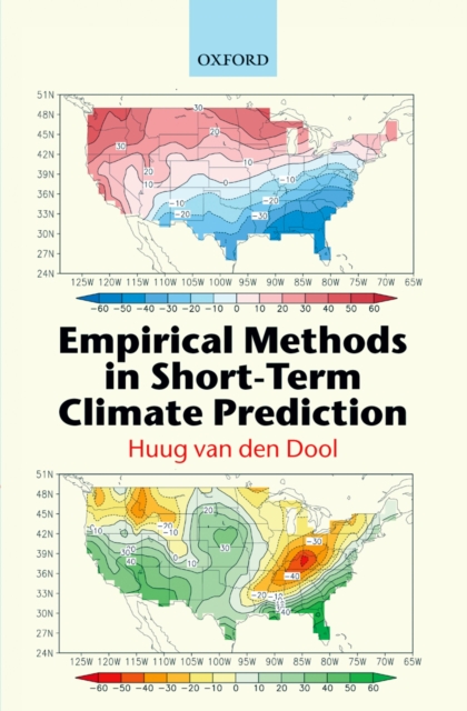
Empirical Methods in Short-Term Climate Prediction
This clear, accessible text describes the methods and advances in short-term climate prediction at time scales of 2 weeks to a year. With an emphasis on the prediction methods themselves and the use of observations, the text is ideal for students and researchers in Meteorology, Atmospheric Science, Geoscience, Mathematics, Statistics and Physics.
eBook

Conceptual Models for Exploring Sea-Surface Temperature Variability Vis-à Long-Range Weather Forecasting
This paper analyzes the ability of three conceptual stochastic models (one-box, two-box, and diffusion models) to reproduce essential features of sea surface temperature variability on intra-annual time scales. The variability of sea surface temperature, which is particularly influenced by feedback mechanisms in ocean surface–atmosphere coupling processes, is characterized by power spectral density, commonly used to analyze the response of dynamical systems to random forcing. The models are aimed at studying local effects of ocean–atmosphere interactions. Comparing observed and theoretical power spectra shows that in dynamically inactive ocean regions (e.g., north-eastern part of the Pacific Ocean), sea surface temperature variability can be described by linear stochastic models such as one-box and two-box models. In regions of the world ocean (e.g., north-western Pacific Ocean, subtropics of the North Atlantic, the Southern Ocean), in which the observed sea surface temperature spectra on the intra-annual time scales do not obey the ν−2 law (where ν is a regular frequency), the formation mechanisms of sea surface anomalies are mainly determined by ocean circulation rather than by local ocean–atmosphere interactions. The diffusion model can be used for simulating sea surface temperature anomalies in such areas of the global ocean. The models examined are not able to reproduce the variability of sea surface temperature over the entire frequency range for two primary reasons; first, because the object of study, the ocean surface mixed layer, changes during the year, and second, due to the difference in the physics of processes involved at different time scales.
Journal Article

Explainable El Niño predictability from climate mode interactions
The El Niño–Southern Oscillation (ENSO) provides most of the global seasonal climate forecast skill
1
–
3
, yet, quantifying the sources of skilful predictions is a long-standing challenge
4
–
7
. Different sources of predictability affect ENSO evolution, leading to distinct global effects. Artificial intelligence forecasts offer promising advancements but linking their skill to specific physical processes is not yet possible
8
–
10
, limiting our understanding of the dynamics underpinning the advancements. Here we show that an extended nonlinear recharge oscillator (XRO) model shows skilful ENSO forecasts at lead times up to 16–18 months, better than global climate models and comparable to the most skilful artificial intelligence forecasts. The XRO parsimoniously incorporates the core ENSO dynamics and ENSO’s seasonally modulated interactions with other modes of variability in the global oceans. The intrinsic enhancement of ENSO’s long-range forecast skill is traceable to the initial conditions of other climate modes by means of their memory and interactions with ENSO and is quantifiable in terms of these modes’ contributions to ENSO amplitude. Reforecasts using the XRO trained on climate model output show that reduced biases in both model ENSO dynamics and in climate mode interactions can lead to more skilful ENSO forecasts. The XRO framework’s holistic treatment of ENSO’s global multi-timescale interactions highlights promising targets for improving ENSO simulations and forecasts.
An extended nonlinear recharge oscillator model shows skilful and explainable El Niño–Southern Oscillation forecasts at lead times up to 16–18 months, better than global climate models and comparable to the most skilful artificial intelligence forecasts.
Journal Article

Ensemble Hydrometeorological Forecasts Using WRF Hourly QPF and TopModel for a Middle Watershed
Quantitative precipitation forecasts (QPFs) were obtained from ensembles of the weather and research forecasting (WRF) model for the Iguaçu river watershed (IRW) in southern Brazil. Thirty-two rainfall events between 2005 and 2010 were simulated with ten configurations of WRF. These rainfall events range from local to synoptic scale convection and caused a significant increase in the level of the Iguaçu river. In the average, the ensembles yielded up to 20% better skill than single WRF forecasts for the events analyzed. WRF ensembles also allow estimating the predictability through the dispersion of the forecasts providing relevant information for decision-making. Phase errors of ensemble forecasts are larger than amplitude errors. More complex microphysics parameterizations yielded better QPFs with smaller phase errors. QPFs were fed to IRW hydrological model with similar phase and amplitude errors. It is suggested that lagged QPFs might reduce phase errors.
Journal Article

MSWX
We present Multi-Source Weather (MSWX), a seamless global gridded near-surface meteorological product featuring a high 3-hourly 0.1° resolution, near-real-time updates (~3-h latency), and bias-corrected medium-range (up to 10 days) and long-range (up to 7 months) forecast ensembles. The product includes 10 meteorological variables: precipitation, air temperature, daily minimum and maximum air temperature, surface pressure, relative and specific humidity, wind speed, and downward shortwave and longwave radiation. The historical part of the record starts 1 January 1979 and is based on ERA5 data bias corrected and downscaled using high-resolution reference climatologies. The data extension to within ~3 h of real time is based on analysis data from GDAS. The 30-member medium-range forecast ensemble is based on GEFS and updated daily. Finally, the 51-member long-range forecast ensemble is based on SEAS5 and updated monthly. The near-real-time and forecast data are statistically harmonized using running-mean and cumulative distribution function-matching approaches to obtain a seamless record covering 1 January 1979 to 7 months from now. MSWX presents new and unique opportunities for hydrological modeling, climate analysis, impact studies, and monitoring and forecasting of droughts, floods, and heatwaves (within the bounds of the caveats and limitations discussed herein). The product is available at www.gloh2o.org/mswx.
Journal Article

Remote Midlatitude Control of Rainfall Onset at the Southern African Tropical Edge
Rainfall over the southern African tropical boundary is highly variable, particularly around the onset of the summer rains. However, understanding of the causes of variability in onset timing is poor. A lack of observational data in the region is compounded by the complexity of climate dynamics and variability at the interface of the tropics and the midlatitudes. The key to onset over the region is the Congo air boundary (CAB), a distinguishing circulation feature present in September and declining in frequency until November. The CAB is crucial to early season rainfall; precipitation is broadly inhibited when the CAB is present, while its breakdown allows large-scale rainfall and onset over central southern Africa. This work identifies a remote midlatitude influence on the timing of CAB breakdown using the high-resolution reanalysis dataset ERA5. Propagating and (upstream) breaking low-wavenumber Rossby waves in the Southern Hemisphere westerly jet are shown to be related to >70% of breakdown events. Breakdown is forced by 1) the replacement of subsidence over eastern southern Africa with synoptically forced ascent and 2) wind field modification that leads to positive 850-hPa continental convergence anomalies and enhanced moisture advection from the Congo basin and Indian Ocean. Upper-level anticyclonic vorticity tendency induced by enhanced convection slows Rossby wave propagation aloft, contributing to wave breaking and the persistence of conditions favorable to convection. The identification of this midlatitude influence on CAB breakdown reveals new potential sources of predictability for onset and demonstrates the significant equatorward extent of midlatitude influences to the tropical edge.Significance StatementThis study aims to improve our understanding of the causes of variability in the start date of the summer rainy season in central southern Africa. The research reveals that certain upper-level waves in the Southern Hemisphere westerly jet are associated with patterns of weather that force a large-scale transition from dry pre-onset conditions to widespread rainfall in a time scale of 2–5 days, and that these waves account for a large proportion of such transitions. This finding is of interest to subseasonal weather forecasters and may help to improve the long-range forecasting of onset date.
Journal Article
Predictability and Prediction Skill of the MJO in Two Operational Forecasting Systems
The authors examine the predictability and prediction skill of the Madden–Julian oscillation (MJO) of two ocean–atmosphere coupled forecast systems of ECMWF [Variable Resolution Ensemble Prediction System (VarEPS)] and NCEP [Climate Forecast System, version 2 (CFSv2)]. The VarEPS hindcasts possess five ensemble members for the period 1993–2009 and the CFSv2 hindcasts possess three ensemble members for the period 2000–09. Predictability and prediction skill are estimated by the bivariate correlation coefficient between the observed and predicted Wheeler–Hendon real-time multivariate MJO index (RMM). MJO predictability is beyond 32 days lead time in both hindcasts, while the prediction skill is about 27 days in VarEPS and 21 days in CFSv2 as measured by the bivariate correlation exceeding 0.5. Both predictability and prediction skill of MJO are enhanced by averaging ensembles. Results show clearly that forecasts initialized with (or targeting) strong MJOs possess greater prediction skill compared to those initialized with (or targeting) weak or nonexistent MJOs. The predictability is insensitive to the initial MJO phase (or forecast target phase), although the prediction skill varies with MJO phases.
A few common model issues are identified. In both hindcasts, the MJO propagation speed is slower and the MJO amplitude is weaker than observed. Also, both ensemble forecast systems are underdispersive, meaning that the growth rate of ensemble error is greater than the growth rate of the ensemble spread by lead time.
Journal Article

Assessing the value of seasonal hydrological forecasts for improving water resource management: insights from a pilot application in the UK
Improved skill of long-range weather forecasts has motivated an increasing effort towards developing seasonal hydrological forecasting systems across Europe. Among other purposes, such forecasting systems are expected to support better water management decisions. In this paper we evaluate the potential use of a real-time optimization system (RTOS) informed by seasonal forecasts in a water supply system in the UK. For this purpose, we simulate the performances of the RTOS fed by ECMWF seasonal forecasting systems (SEAS5) over the past 10 years, and we compare them to a benchmark operation that mimics the common practices for reservoir operation in the UK. We also attempt to link the improvement of system performances, i.e. the forecast value, to the forecast skill (measured by the mean error and the continuous ranked probability skill score) as well as to the bias correction of the meteorological forcing, the decision maker priorities, the hydrological conditions and the forecast ensemble size. We find that in particular the decision maker priorities and the hydrological conditions exert a strong influence on the forecast skill–value relationship. For the (realistic) scenario where the decision maker prioritizes the water resource availability over energy cost reductions, we identify clear operational benefits from using seasonal forecasts, provided that forecast uncertainty is explicitly considered by optimizing against an ensemble of 25 equiprobable forecasts. These operational benefits are also observed when the ensemble size is reduced up to a certain limit. However, when comparing the use of ECMWF-SEAS5 products to ensemble streamflow prediction (ESP), which is more easily derived from historical weather data, we find that ESP remains a hard-to-beat reference, not only in terms of skill but also in terms of value.
Journal Article

Joint-outcome prediction markets for climate risks
Predicting future climate requires the integration of knowledge and expertise from a wide range of disciplines. Predictions must account for climate-change mitigation policies which may depend on climate predictions. This interdependency, or “circularity”, means that climate predictions must be conditioned on emissions of greenhouse gases (GHGs). Long-range forecasts also suffer from information asymmetry because users cannot use track records to judge the skill of providers. The problems of aggregation, circularity, and information asymmetry can be addressed using prediction markets with joint-outcome spaces, allowing simultaneous forecasts of GHG concentrations and temperature. The viability of prediction markets with highly granular, joint-outcome spaces was tested with markets for monthly UK rainfall and temperature. The experiments demonstrate these markets can aggregate the judgments of experts with relevant expertise, and suggest similarly structured markets, with longer horizons, could provide a mechanism to produce credible forecasts of climate-related risks for policy making, planning, and risk disclosure.
Journal Article

Improving the fine structure of intense rainfall forecast by a designed generative adversarial network
Accurate short-term quantitative precipitation forecasting (QPF) is critical for disaster prevention, mitigation, and socio-economic activities. However, due to the inherent limitations of numerical weather prediction (NWP) models, precipitation forecasts still exhibit substantial inaccuracies. In recent years, deep learning (DL) techniques have been increasingly applied to improve precipitation forecasts, yet these approaches often produce overly smoothed outputs that fail to meet operational requirements for detail and accuracy. In this study, we propose a Generative Fusion Residual Network (GFRNet), a generative adversarial network (GAN)-based framework that integrates multi-source NWP forecasts to generate 3-hourly quantitative precipitation forecasts for North China up to 24 h in advance. GFRNet employs an adversarial learning mechanism to enhance spatial structure reconstruction, combined with a weighted loss function and carefully designed sampling strategies to address the long-tailed distribution of precipitation and improve model training efficiency. Using independent rainy-season datasets from 2022–2024, we comprehensively evaluate the performance of GFRNet against three NWP models, a linear ensemble method (MSEM), and a deep learning baseline model (FRNet). Results show that GFRNet consistently outperforms the NWPs and baseline models across light, moderate, and heavy rainfall thresholds. Compared to the China Meteorological Administration's highest-resolution regional model (CMA-3KM), GFRNet improves Threat Scores (TS) by 4 %, 28 %, 35 %, and 19 % at the 0.1, 10, 20, and 40 mm thresholds, respectively, and improves Fractions Skill Scores (FSS) by 13 %, 18 %, and 15 % at the 10, 20, and 40 mm thresholds. Moreover, GFRNet consistently achieves the highest Multi-Scale Structural Similarity (MS-SSIM) scores and significantly reduces RMSE, demonstrating robust spatial structure recovery, stable intensity control, and strong generalization ability. These advantages are particularly pronounced in systemic high-impact heavy rainfall events, underscoring the model's operational value. FRNet shows advantages in forecasting heavy precipitation but suffers from high BIAS and weaker generalization, limiting its practical applicability. MSEM exhibits robust performance in light and moderate precipitation scenarios but degrades significantly under extreme precipitation conditions. Overall, GFRNet dynamically fuses multi-source NWP information, balances precipitation intensity and spatial structure, achieves higher forecasting skill, and improves forecast quality across diverse precipitation regimes.
Journal Article