Catalogue Search | MBRL


Are you sure you want to remove the book from the shelf?

{{itemTitle}}
3,114
result(s) for
"Map drawing."
Sort by:


SLAMM: Visual monocular SLAM with continuous mapping using multiple maps
This paper presents the concept of Simultaneous Localization and Multi-Mapping (SLAMM). It is a system that ensures continuous mapping and information preservation despite failures in tracking due to corrupted frames or sensor's malfunction; making it suitable for real-world applications. It works with single or multiple robots. In a single robot scenario the algorithm generates a new map at the time of tracking failure, and later it merges maps at the event of loop closure. Similarly, maps generated from multiple robots are merged without prior knowledge of their relative poses; which makes this algorithm flexible. The system works in real time at frame-rate speed. The proposed approach was tested on the KITTI and TUM RGB-D public datasets and it showed superior results compared to the state-of-the-arts in calibrated visual monocular keyframe-based SLAM. The mean tracking time is around 22 milliseconds. The initialization is twice as fast as it is in ORB-SLAM, and the retrieved map can reach up to 90 percent more in terms of information preservation depending on tracking loss and loop closure events. For the benefit of the community, the source code along with a framework to be run with Bebop drone are made available at https://github.com/hdaoud/ORBSLAMM.
Journal Article

Talking maps
Every map tells a story. Some provide a narrative for travellers, explorers and surveyors or offer a visual account of changes to people?s lives, places and spaces, while others tell imaginary tales, transporting us to fictional worlds created by writers and artists. In turn, maps generate more stories, taking users on new journeys in search of knowledge and adventure.00Drawing on the Bodleian Library?s outstanding map collection and covering almost a thousand years, Talking Maps takes a new approach to map-making by showing how maps and stories have always been intimately entwined. Including such rare treasures as a unique map of the Mediterranean from the eleventh-century Arabic Book of Curiosities, al-Sharif al-Idrisi's twelfth-century world map, C.S. Lewis?s map of Narnia, J.R.R. Tolkien?s cosmology of Middle-earth and Grayson Perry?s twenty-first-century tapestry map, this fascinating book analyses maps as objects that enable us to cross sea and land; as windows into alternative and imaginary worlds; as guides to reaching the afterlife; as tools to manage cities, nations, even empires; as images of environmental change; and as digitized visions of the global future.00Exhibition: Bodleian Library, London, UK (05.07.2019-08.03.2020).
Book

To Master the Boundless Sea
As the United States grew into an empire in the late nineteenth century, notions like \"sea power\" derived not only from fleets, bases, and decisive battles but also from a scientific effort to understand and master the ocean environment. Beginning in the early nineteenth century and concluding in the first years of the twentieth, Jason W. Smith tells the story of the rise of the U.S. Navy and the emergence of American ocean empire through its struggle to control nature. In vividly told sketches of exploration, naval officers, war, and, most significantly, the ocean environment, Smith draws together insights from environmental, maritime, military, and naval history, and the history of science and cartography, placing the U.S. Navy's scientific efforts within a broader cultural context. By recasting and deepening our understanding of the U.S. Navy and the United States at sea, Smith brings to the fore the overlooked work of naval hydrographers, surveyors, and cartographers. In the nautical chart's soundings, names, symbols, and embedded narratives, Smith recounts the largely untold story of a young nation looking to extend its power over the boundless sea.
eBook

Making maps
Is there such a thing as a fun way to develop spatial awareness? Yes and readers can do so by reading this book! Readers will engage in and expand their understanding of the world around them through a creative, rewarding map-making activity developed with learning and fun in mind! Step-by-step instructions guide them through this rewarding exercise, while a simple history and explanation of cartography allows them to feel a part of something both fascinating and epic.
Book
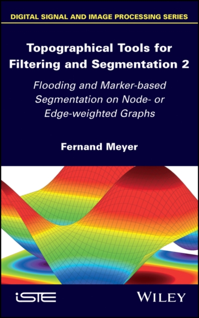
Topographical Tools for Filtering and Segmentation 2
Mathematical morphology has developed a powerful methodology for segmenting images, based on connected filters and watersheds. We have chosen the abstract framework of node- or edge-weighted graphs for an extensive mathematical and algorithmic description of these tools. Volume 2 proposes two physical models for describing valid flooding on a node- or edge-weighted graph, and establishes how to pass from one to another. Many new flooding algorithms are derived, allowing parallel and local flooding of graphs. Watersheds and flooding are then combined for solving real problems. Their ability to model a real hydrographic basin represented by its digital elevation model constitutes a good validity check of the underlying physical models. The last part of Volume 2 explains why so many different watershed partitions exist for the same graph. Marker-based segmentation is the method of choice for curbing this proliferation. This book proposes new algorithms combining the advantages of the previous methods which treated node- and edge-weighted graphs differently.
eBook

Ultimate mapping guide for kids
Provides expert guidance on reading maps and using them to navigate in the outdoors, and shares tips for drawing maps, with explanations of cartographic terminology.
Book

Drawing North America by hand
In February 2019, I put the finishing touches on a map that took four and a half years to complete. What began as a passion project ended up taking over my life, as I became utterly submerged in a cartographic odyssey: North America: Portrait of a Continent. Drawn entirely with colour pencil and fine-liner pen, this 1500 x 1200mm (59 x 47 inch) map contains tens of thousands of items of content, from the Arctic to Central America, even the deepest reaches of the ocean. 600 individualised cityscapes populate the map, and the content varies widely. All range of animals, plants, culture, history, industry, symbology, and more are laid out across a flowing terrain. It draws from a vast sweep of the physical and cultural geography of the continent and is intended to encourage geographic enthusiasm in a broad audience. Inspired by several years I spent travelling the continent, its completion has been a long time coming. As prints begin to roll out, there is much to discuss about the origins, technical execution, intents and experiences of drawing North America by hand.
Journal Article


Agurumyela's art of connection: Christopher Azaare's project of curating Gurensi history and culture
This article explores the innovative and hybrid intellectual project of Christopher Azaare Anabila. Since 1976, Azaare has been documenting the histories of the Gurensi and Boosi people of northern Ghana and has crafted genealogical maps of whole villages and clans. He has written manuscripts on taboos, totems, proverbs, missionary activities, cultural institutions and anti-colonial resistance. Because of this work, people have begun to refer to Azaare as Agurumyela, which in Gurene means ‘a person who digs into people's past’. Central to this lifelong endeavour is the museum of Gurensi culture that Azaare has been building in Gowrie. I present Azaare's views of this wide-ranging process of collection and re-casting and reflect on his motivation to reclaim history and curating authority from professional academics. I argue that Azaare's project allows us to recognize the ubiquitous existence of a vibrant strand of African intellectual creativity that combines multiple repertoires and draws on overlapping and diverse productions in different modes and media. Next, I turn to Azaare's manuscript on the institution of tindaanaship (earth custodians). I explore his genealogical method as an art of connection that highlights his role as an engaged community intellectual, weaving extensive networks between Gurensi communities, officials and academics.
Journal Article