Catalogue Search | MBRL


Are you sure you want to remove the book from the shelf?

{{itemTitle}}
11,450
result(s) for
"Maps History."
Sort by:
Maps in newspapers : approaches of study and practices in portraying war since 19th century
Maps in newspapers' generated many discussions among cartographers and geographers working from different approaches and theoretical backgrounds. This work examines these maps from a historiographical as well as a historical perspective. It considers three main questions, namely how maps in the press should be conceptualized, how cartographic images in newspapers have been studied, and how these images changed over time. In order to provide a perspective on the origins, development, and impact of war maps in the press, we will explore maps representing three geopolitical conflicts for Brazilian audiences: The War of the Triple Alliance (1864-1870), the World War II (1939-1945) and the War on Drugs in Rio de Janeiro's favelas (1994-2010). By exploring maps on these wars, we will identify specific cartographic practices used in this genre as well as the connections that this mode has with other types of map production and consumption.
Book
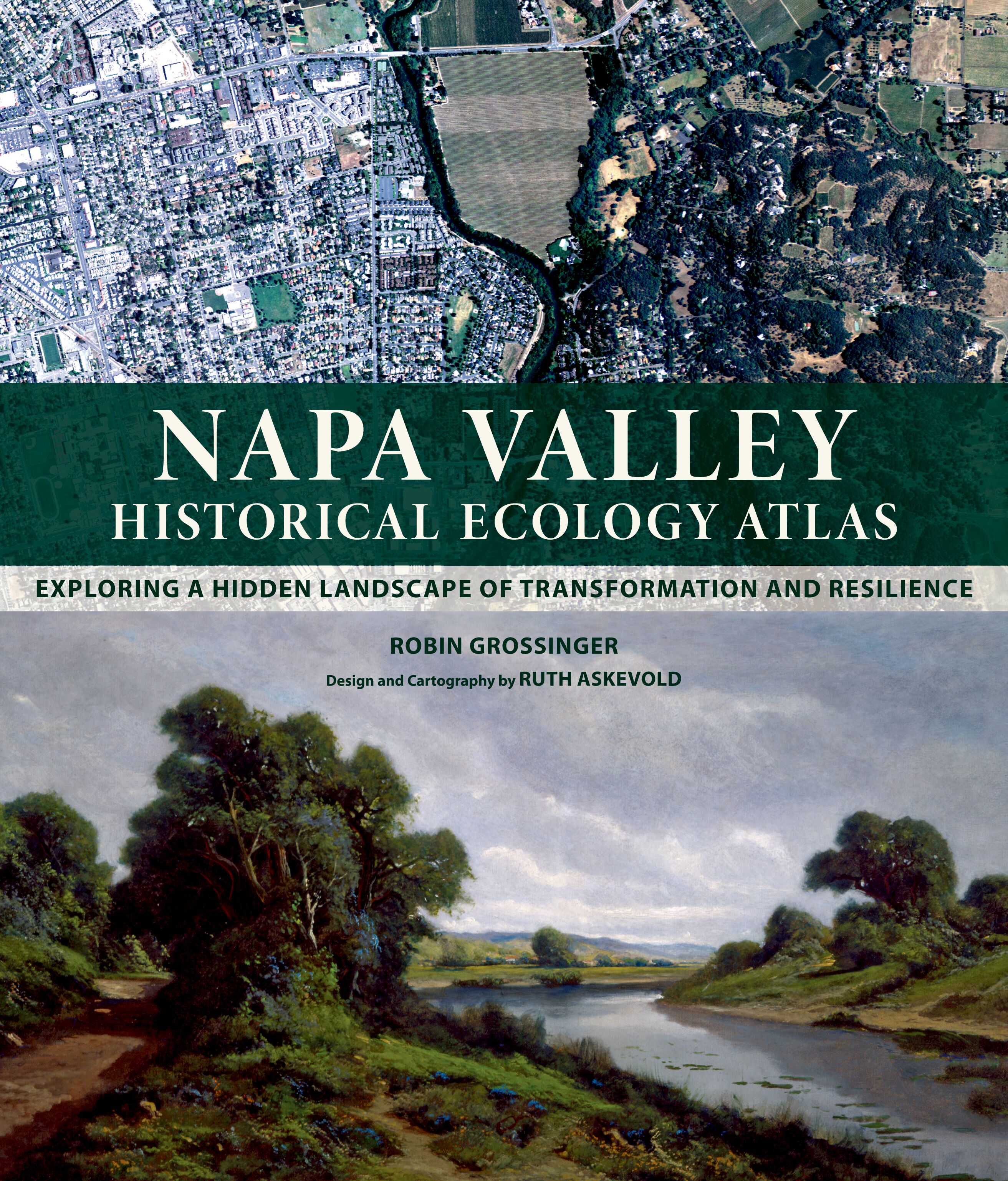
Napa Valley
How has California's landscape changed? What did now-familiar places look like during prior centuries? What can the past teach us about designing future landscapes? The Napa Valley Historical Ecology Atlas explores these questions by taking readers on a dazzling visual tour of Napa Valley from the early 1800s onward—a forgotten land of brilliant wildflower fields, lush wetlands, and grand oak savannas. Robin Grossinger weaves together rarely-seen historical maps, travelers's accounts, photographs, and paintings to reconstruct early Napa Valley and document its physical transformation over the past two centuries. The Atlas provides a fascinating new perspective on this iconic landscape, showing the natural heritage that has enabled the agricultural success of the region today. The innovative research of Grossinger and his historical ecology team allows us to visualize the past in unprecedented detail, improving our understanding of the living landscapes we inhabit and suggesting strategies to increase their health and resilience in the future.
eBook


Historical atlas of northeast Asia, 1590-2010
Four hundred years ago, indigenous peoples occupied the vast region that today encompasses Korea, Manchuria, the Mongolian Plateau, and Eastern Siberia. Over time, these populations struggled to maintain autonomy as Russia, China, and Japan sought hegemony over the region. Especially from the turn of the twentieth century onward, indigenous peoples pursued self-determination in a number of ways, and new states, many of them now largely forgotten, rose and fell as great power imperialism, indigenous nationalism, and modern ideologies competed for dominance.
This atlas tracks the political configuration of Northeast Asia in ten-year segments from 1590 to 1890, in five-year segments from 1890 to 1960, and in ten-year segments from 1960 to 2010, delineating the distinct history and importance of the region. The text follows the rise and fall of the Qing dynasty in China, founded by the semi-nomadic Manchus; the Russian colonization of Siberia; the growth of Japanese influence; the movements of peoples, armies, and borders; and political, social, and economic developments -- reflecting the turbulence of the land that was once the world's \"cradle of conflict.\" Compiled from detailed research in English, Chinese, Japanese, French, Dutch, German, Mongolian, and Russian sources, theHistorical Atlas of Northeast Asiaincorporates information made public with the fall of the Soviet Union and includes fifty-five specially drawn maps, as well as twenty historical maps contrasting local and outsider perspectives. Four introductory maps survey the region's diverse topography, climate, vegetation, and ethnicity.
eBook

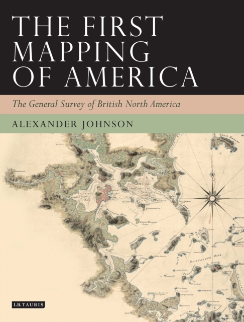
The First Mapping of America
The First Mapping of America tells the story of the General Survey. At the heart of the story lie the remarkable maps and the men who made them - the commanding and highly professional Samuel Holland, Surveyor-General in the North, and the brilliant but mercurial William Gerard De Brahm, Surveyor-General in the South. Battling both physical and political obstacles, Holland and De Brahm sought to establish their place in the firmament of the British hierarchy. Yet the reality in which they had to operate was largely controlled from afar, by Crown administrators in London and the colonies and by wealthy speculators, whose approval or opposition could make or break the best laid plans as they sought to use the Survey for their own ends.
eBook

The historical atlas of weaponry
\"Features over 100 maps that illustrate how weapons were used in key battles around the world. This title tells the story of the development of weaponry, from the earliest conflicts to modern-day warfare. It includes various illustrations and photographs, showing the weapons in action and explaining how they work.\"--Publisher's description.
Book

Mapping and Empire
From the sixteenth through the mid-nineteenth centuries, Spain, then Mexico, and finally the United States took ownership of the land from the Gulf Coast of Texas and Mexico to the Pacific Coast of Alta and Baja California—today's American Southwest. Each country faced the challenge of holding on to territory that was poorly known and sparsely settled, and each responded by sending out military mapping expeditions to set boundaries and chart topographical features. All three countries recognized that turning terra incognita into clearly delineated political units was a key step in empire building, as vital to their national interest as the activities of the missionaries, civilian officials, settlers, and adventurers who followed in the footsteps of the soldier-engineers. With essays by eight leading historians, this book offers the most current and comprehensive overview of the processes by which Spanish, Mexican, and U.S. soldier-engineers mapped the southwestern frontier, as well as the local and even geopolitical consequences of their mapping. Three essays focus on Spanish efforts to map the Gulf and Pacific Coasts, to chart the inland Southwest, and to define and defend its boundaries against English, French, Russian, and American incursions. Subsequent essays investigate the role that mapping played both in Mexico's attempts to maintain control of its northern territory and in the United States' push to expand its political boundary to the Pacific Ocean. The concluding essay draws connections between mapping in the Southwest and the geopolitical history of the Americas and Europe.
eBook

Scotland : defending the nation : mapping the military landscape
Scotland has had a uniquely important military history over the last five centuries. Conflict with England in the 16th century, Jacobite rebellions in the 18th century, 20th-century defences and the two world wars, as well as the Cold War, all resulted in significant cartographic activity. In this book, two map experts explore the extraordinary rich legacy of Scottish military mapping, showing and explaining the variety of military maps produced for different purposes, including fortification plans, reconnaissance mapping, battle plans, military roads and route-way plans,tactical maps, plans of mines, enemy maps showing targets, as well as plans showing the construction of defences. In addition to plans, elevations, and views, they also discuss unrealised proposals and projected schemes.
Book

The Mapmakers of New Zion
From their earliest days on the American frontier through their growth into a worldwide church, the spatially expansive Mormons made maps to help them create idealized communities, migrate to and colonize large parts of the American West, visualize the stories in their sacred texts, and spread their message internationally through a well-organized missionary system. This book identifies many Mormon mapmakers who played an important but heretofore unsung role in charting the course of Latter-day Saint history. For Mormons, maps had and continue to have both practical and spiritual significance. In addition to using maps to help build their new Zion and to explore the Intermountain West, Latter-day Saint mapmakers used them to depict locations and events described in the Book of Mormon.
Featuring over one hundred historical maps reproduced in full color—many never before published—
The Mapmakers of New Zion sheds new light on Mormonism and takes readers on a fascinating journey through maps as both historical documents and touchstones of faith. Winner of the Southwest Book Design and Production Award from the New Mexico Book Association. Selected as one of the American Library Association's Best of the Best from University Presses.
eBook