Catalogue Search | MBRL


Are you sure you want to remove the book from the shelf?

{{itemTitle}}
8,088
result(s) for
"Marine navigation"
Sort by:

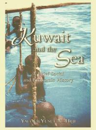
The principles of Arab navigation
Throughout History, the Indian Ocean has been a zone of interaction between far-flung civilizations served by ports, and connected with the Mediterranean by the Gulf and Red Sea. The shows that were the vehicles of commercial and cultural exchange over this vast expanse of ocean ranged from small craft rarely venturing out of sight of land, to cargo vessels carrying navigators skilled in the art of deep sea sailing. These Arab, Persian and Indian seamen used the seasonal monsoon winds, and applied navigational techniques that relied on their ability to read the stars in the night sky - skills that had developed down the generations from time immemorial. This stellar navigation, based on measuring the altitude of the Pole Star to establish latitude and on the risings and settings of certain stars to find direction, grew into a complex art, belying the simplicity of the instruments used. Bringing together six scholars specializing in the maritime history and culture of the Arabs (Anthony R. Constable, William Facey, Yacoub Al-Hijji, Paul Lunde, Hassan Salih Shihab and Eric Staples), this book makes a new and vital contribution to the study of a nautical culture that has hitherto not received its due share of attention, and which is vital to an understanding of Indian Ocean history. Drawing on source material such as the guides by the renowned southern Arabian navigators Ahmad ibn Majid and Sulayman al-Mahri in the 15th and 16th centuries AD, as well as surviving logbooks of how captains in the early 20th, the volume covers the principal ideas, techniques, instruments and calculations used, deploying astronomy, geometry and mathematics to explain their methods. It includes an account of a practical attempt to apply these methods in 2010, on an adventurous voyage from Muscat to Singapore in a reconstructed early medieval dhow, and concludes with an analysis of sailing conditions in the Red Sea.
BOOK

A Quasi-Static Motion Prediction Model of a Multi-Hull Navigation Vessel in Dynamic Positioning Mode
A Quadmaran vessel is a maritime navigation vessel with four hulls, and is expected to be utilized for high-density water quality observation in aquaculture farms. The performance of the vessel during dynamic positioning (DP) is integral to the accuracy of collected data. However, there are no models available to understand the motion characteristics of the multi-hull vessels in DP mode. Therefore, a computational model was developed to predict the DP motion of the Quadmaran vessel based on quasi-static assumptions. The fluid forces on the hulls, the thrust force of the propellers, and the external wind forces are modelled systematically, assuming the average speed while in DP does not exceed 0.25 m/s. A series of oblique towing tests and static turning tests were conducted on a 1/3 scale model to determine the hydrodynamic coefficients, while the Propeller Open Test was conducted to survey the propeller performance. The wind load was also incorporated into the computational model. Experimental validation tests were conducted in calm water and actual sea areas, and the correlation between experiment and simulation results was good. We concluded that the computational model can predict the DP motion of the Quadmaran vessel with an accuracy of roughly 2 m.
Journal Article

Managing Maritime Safety
\"Shipping is a pillar of global trade, with 90% of the world's trade in goods and raw materials carried by ship. Despite the economic benefits this delivers, maritime operations can be dangerous, and when accidents occur the consequences are serious. Consequential outcomes from hazards at sea include loss of cargo, destruction of the marine environment, serious injuries, deaths and material damage. Managing Maritime Safety will give you a thorough understanding of contemporary maritime safety and its management. It provides varying viewpoints on traditional safety topics in conjunction with critical discussions of the international safety management code and its application. The book also offers new perspectives on maritime safety such as ship and equipment design for safety and the relevance of safety management systems, in particular the application of the International Safety Management code to remote controlled or autonomous ships. The authors all work in the maritime industry, as practitioners, in education, research, government and classification. The combination of wide-ranging and extensive experience provides an unprecedented span of views with a strong connection to the real issues in the maritime domain. This book sets out to provide much needed consolidated knowledge for university level students on maritime safety management, incorporating theoretical, historical, research, operational and design perspectives.\"--Provided by publisher.
Book

The interaction of ice and law in Arctic marine accessibility
Sea ice levies an impost on maritime navigability in the Arctic, but ice cover diminution due to anthropogenic climate change is generating expectations for improved accessibility in coming decades. Projections of sea ice cover retreating preferentially from the eastern Arctic suggest key provisions of international law of the sea will require revision. Specifically, protections against marine pollution in ice-covered seas enshrined in Article 234 of the United Nations Convention on the Law of the Sea have been used in recent decades to extend jurisdictional competence over the Northern Sea Route only loosely associated with environmental outcomes. Projections show that plausible open water routes through international waters may be accessible by midcentury under all but the most aggressive of emissions control scenarios. While inter- and intraannual variability places the economic viability of these routes in question for some time, the inevitability of a seasonally ice-free Arctic will be attended by a reduction of regulatory friction and a recalibration of associated legal frameworks.
Journal Article

Performance Evaluation of IMU and DVL Integration in Marine Navigation
Global navigation satellite system (GNSS) spoofing poses a significant threat to maritime logistics. Many maritime electronic devices rely on GNSS time, positioning, and speed for safe vessel operation. In this study, inertial measurement unit (IMU) and Doppler velocity log (DVL) devices, which are important in the event of GNSS spoofing or outage, are considered in conventional navigation. A velocity integration method using IMU and DVL in terms of dead-reckoning is investigated in this study. GNSS has been widely used for ship navigation, but IMU, DVL, or combined IMU and DVL navigation have received little attention. Military-grade sensors are very expensive and generally cannot be utilized in smaller vessels. Therefore, this study focuses on the use of consumer-grade sensors. First, the performance of a micro electromechanical system (MEMS)-based yaw rate angle with DVL was evaluated using 60 min of raw data for a 50 m-long ship located in Tokyo Bay. Second, the performance of an IMU-MEMS using three gyroscopes and three accelerometers with DVL was evaluated using the same dataset. A gyrocompass, which is equipped on the ship, is used as a heading reference. The results proved that both methods could achieve less than 1 km horizontal error in 60 min.
Journal Article


ABOships—An Inshore and Offshore Maritime Vessel Detection Dataset with Precise Annotations
Availability of domain-specific datasets is an essential problem in object detection. Datasets of inshore and offshore maritime vessels are no exception, with a limited number of studies addressing maritime vessel detection on such datasets. For that reason, we collected a dataset consisting of images of maritime vessels taking into account different factors: background variation, atmospheric conditions, illumination, visible proportion, occlusion and scale variation. Vessel instances (including nine types of vessels), seamarks and miscellaneous floaters were precisely annotated: we employed a first round of labelling and we subsequently used the CSRT tracker to trace inconsistencies and relabel inadequate label instances. Moreover, we evaluated the out-of-the-box performance of four prevalent object detection algorithms (Faster R-CNN, R-FCN, SSD and EfficientDet). The algorithms were previously trained on the Microsoft COCO dataset. We compared their accuracy based on feature extractor and object size. Our experiments showed that Faster R-CNN with Inception-Resnet v2 outperforms the other algorithms, except in the large object category where EfficientDet surpasses the latter.
Journal Article

The Concept of Using the Decision-Robustness Function in Integrated Navigation Systems
The diversity and non-uniformity of the positioning systems available in maritime navigation systems often impede the watchkeeping officer in the selection of the appropriate positioning system, in particular, in restricted basins. Thus, it is necessary to introduce a mathematical apparatus to suggest, in an automated manner, which of the available systems should be used at the given moment of a sea trip. Proper selection of the positioning system is particularly important in integrated navigation systems, in which the excess of navigation information may impede the final determinations. In this article, the authors propose the use of the decision-robustness function to assist in the process of selecting the appropriate positioning system and reduce the impact of navigation observations encumbered with large errors in self-positioning accuracy. The authors present a mathematical apparatus describing the decision function (a priori object), with the determination of decision-assistance criteria, and the robustness function (a posteriori object), with different types of attenuation function. In addition, the authors present a computer application integrating both objects in the decision-robustness function. The study was concluded by a test showing the practical application of the decision-robustness function proposed in the title.
Journal Article