Catalogue Search | MBRL


Are you sure you want to remove the book from the shelf?

{{itemTitle}}
1,886
result(s) for
"Meteorological instruments"
Sort by:

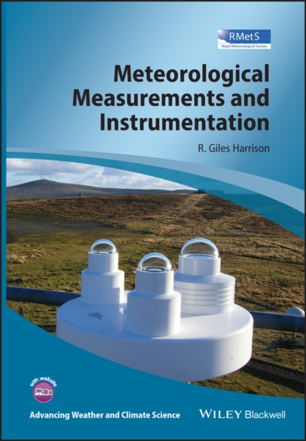
Meteorological measurements and instrumentation
This book describes the fundamental scientific principles underlying high quality instrumentation used for environmental measurements. It discusses a wide range of in situ sensors employed in practical environmental monitoring and, in particular, those used in surface based measurement systems. It also considers the use of weather balloons to provide a wealth of upper atmosphere data. To illustrate the technologies in use it includes many examples of real atmospheric measurements in typical and unusual circumstances, with a discussion of the electronic signal conditioning, data acquisition considerations and data processing principles necessary for reliable measurements. This also allows the long history of atmospheric measurements to be placed in the context of the requirements of modern climate science, by building the physical science appreciation of the instrumental record and looking forward to new and emerging sensor and recording technologies.
eBook

An evaluation of the ability of the Ozone Monitoring Instrument (OMI) to observe boundary layer ozone pollution across China: application to 2005–2017 ozone trends
Nadir-viewing satellite observations of tropospheric ozone in the UV have been shown to have some sensitivity to boundary layer ozone pollution episodes, but so far they have not yet been compared to surface ozone observations collected by large-scale monitoring networks. Here we use 2013–2017 surface ozone data from China's new Ministry of Ecology and Environment (MEE) network of ∼ 1000 sites, together with vertical profiles from ozonesondes and aircraft, to quantify the ability of tropospheric ozone retrievals from the Ozone Monitoring Instrument (OMI) and to detect boundary layer ozone pollution in China. We focus on summer when ozone pollution in China is most severe and when OMI has the strongest sensitivity. After subtracting the Pacific background, we find that the 2013–2017 mean OMI ozone enhancements over eastern China have strong spatial correlation with the corresponding multiyear means in the surface afternoon observations (R=0.73), and that OMI can estimate these multiyear means in summer afternoon surface ozone with a precision of 8 ppb. The OMI data show significantly higher values on observed surface ozone episode days (>82 ppb) than on non-episode days. Day-to-day correlations with surface ozone are much weaker due to OMI noise and are stronger for sites in southern China (<34∘ N; R=0.3–0.6) than in northern China (R=0.1–0.3) because of weaker retrieval sensitivity and larger upper tropospheric variability in the north. Ozonesonde data show that much of the variability of OMI ozone over southern China in summer is driven by the boundary layer. Comparison of 2005–2009 and 2013–2017 OMI data indicates that mean summer afternoon surface ozone in southern China (including urban and rural regions) has increased by 3.5±3.0 ppb over the 8-year period and that the number of episode days per summer has increased by 2.2±0.4 (as diagnosed by an extreme value model), generally consistent with the few long-term surface records. Ozone increases have been particularly large in the Yangtze River Delta and in the Hubei, Guangxi and Hainan provinces.
Journal Article
Methodology to determine the coupling of continental clouds with surface and boundary layer height under cloudy conditions from lidar and meteorological data
The states of coupling between clouds and surface or boundary layer have been investigated much more extensively for marine stratocumulus clouds than for continental low clouds, partly due to more complex thermodynamic structures over land. A manifestation is a lack of robust remote sensing methods to identify coupled and decoupled clouds over land. Following the idea for determining cloud coupling over the ocean, we have generalized the concept of coupling and decoupling to low clouds over land, based on potential temperature profiles. Furthermore, by using ample measurements from lidar and a suite of surface meteorological instruments at the U.S. Department of Energy's Atmospheric Radiation Measurement Program's Southern Great Plains site from 1998 to 2019, we have developed a method to simultaneously retrieve the planetary boundary layer (PBL) height (PBLH) and coupled states under cloudy conditions during the daytime. The new lidar-based method relies on the PBLH, the lifted condensation level, and the cloud base to diagnose the cloud coupling. The coupled states derived from this method are highly consistent with those derived from radiosondes. Retrieving the PBLH under cloudy conditions, which has been a persistent problem in lidar remote sensing, is resolved in this study. Our method can lead to high-quality retrievals of the PBLH under cloudy conditions and the determination of cloud coupling states. With the new method, we find that coupled clouds are sensitive to changes in the PBL with a strong diurnal cycle, whereas decoupled clouds and the PBL are weakly related. Since coupled and decoupled clouds have distinct features, our new method offers an advanced tool to separately investigate them in climate systems.
Journal Article

Quality Management System for an IoT Meteorological Sensor Network—Application to Smart Seoul Data of Things (S-DoT)
Meteorological data with a high horizontal resolution are essential for user-specific weather application services, such as flash floods, heat waves, strong winds, and road ice, in urban areas. National meteorological observation networks, such as the Automated Synoptic Observing System (ASOS) and Automated Weather System (AWS), provide accurate but low horizontal resolution data to address urban-scale weather phenomena. Many megacities are constructing their own Internet of Things (IoT) sensor networks to overcome this limitation. This study investigated the status of the smart Seoul data of things (S-DoT) network and the spatial distribution of temperature on heatwave and coldwave event days. The temperature at above 90% of S-DoT stations was higher than that at the ASOS station, mainly because of different surface covers and surrounding local climate zones. A quality management system for an S-DoT meteorological sensor network (QMS-SDM) comprising pre-processing, basic quality control, extended quality control, and data reconstruction using spatial gap-filling was developed. The upper threshold temperatures for the climate range test were set higher than those adopted by the ASOS. A 10-digit flag for each data point was defined to discriminate between normal, doubtful, and erroneous data. Missing data at a single station were imputed using the Stineman method, and the data with spatial outliers were filled with values at three stations within 2 km. Using QMS-SDM, irregular and diverse data formats were changed to regular and unit-format data. QMS-SDM application increased the amount of available data by 20–30%, and significantly improved data availability for urban meteorological information services.
Journal Article

Intercomparison of MAX-DOAS vertical profile retrieval algorithms: studies on field data from the CINDI-2 campaign
The second Cabauw Intercomparison of Nitrogen Dioxide measuring Instruments (CINDI-2) took place in Cabauw (the Netherlands) in September 2016 with the aim of assessing the consistency of multi-axis differential optical absorption spectroscopy (MAX-DOAS) measurements of tropospheric species (NO2, HCHO, O3, HONO, CHOCHO and O4). This was achieved through the coordinated operation of 36 spectrometers operated by 24 groups from all over the world, together with a wide range of supporting reference observations (in situ analysers, balloon sondes, lidars, long-path DOAS, direct-sun DOAS, Sun photometer and meteorological instruments). In the presented study, the retrieved CINDI-2 MAX-DOAS trace gas (NO2, HCHO) and aerosol vertical profiles of 15 participating groups using different inversion algorithms are compared and validated against the colocated supporting observations, with the focus on aerosol optical thicknesses (AOTs), trace gas vertical column densities (VCDs) and trace gas surface concentrations. The algorithms are based on three different techniques: six use the optimal estimation method, two use a parameterized approach and one algorithm relies on simplified radiative transport assumptions and analytical calculations. To assess the agreement among the inversion algorithms independent of inconsistencies in the trace gas slant column density acquisition, participants applied their inversion to a common set of slant columns. Further, important settings like the retrieval grid, profiles of O3, temperature and pressure as well as aerosol optical properties and a priori assumptions (for optimal estimation algorithms) have been prescribed to reduce possible sources of discrepancies. The profiling results were found to be in good qualitative agreement: most participants obtained the same features in the retrieved vertical trace gas and aerosol distributions; however, these are sometimes at different altitudes and of different magnitudes. Under clear-sky conditions, the root-mean-square differences (RMSDs) among the results of individual participants are in the range of 0.01–0.1 for AOTs, (1.5–15) ×1014molec.cm-2 for trace gas (NO2, HCHO) VCDs and (0.3–8)×1010molec.cm-3 for trace gas surface concentrations. These values compare to approximate average optical thicknesses of 0.3, trace gas vertical columns of 90×1014molec.cm-2 and trace gas surface concentrations of 11×1010molec.cm-3 observed over the campaign period. The discrepancies originate from differences in the applied techniques, the exact implementation of the algorithms and the user-defined settings that were not prescribed. For the comparison against supporting observations, the RMSDs increase to a range of 0.02–0.2 against AOTs from the Sun photometer, (11–55)×1014molec.cm-2 against trace gas VCDs from direct-sun DOAS observations and (0.8–9)×1010molec.cm-3 against surface concentrations from the long-path DOAS instrument. This increase in RMSDs is most likely caused by uncertainties in the supporting data, spatiotemporal mismatch among the observations and simplified assumptions particularly on aerosol optical properties made for the MAX-DOAS retrieval. As a side investigation, the comparison was repeated with the participants retrieving profiles from their own differential slant column densities (dSCDs) acquired during the campaign. In this case, the consistency among the participants degrades by about 30 % for AOTs, by 180 % (40 %) for HCHO (NO2) VCDs and by 90 % (20 %) for HCHO (NO2) surface concentrations. In former publications and also during this comparison study, it was found that MAX-DOAS vertically integrated aerosol extinction coefficient profiles systematically underestimate the AOT observed by the Sun photometer. For the first time, it is quantitatively shown that for optimal estimation algorithms this can be largely explained and compensated by considering biases arising from the reduced sensitivity of MAX-DOAS observations to higher altitudes and associated a priori assumptions.
Journal Article

The Weather Observer's Handbook
The Weather Observer's Handbook provides a comprehensive, practical and independent guide to all aspects of making weather observations. Automatic weather stations today form the mainstay of both amateur and professional weather observing networks around the world and yet – prior to this book – there existed no independent guide to their selection and use. Traditional and modern weather instruments are covered, including how best to choose and to site a weather station, how to get the best out of your equipment, how to store and analyse your records and how to share your observations with other people and across the Internet. From amateur observers looking for help in choosing their first weather instruments on a tight budget to professional observers looking for a comprehensive and up-to-date guide covering World Meteorological Organization recommendations on observing methods and practices, all will welcome this handbook.
eBook

Response and inversion of skewness parameters to meteorological factors based on RGB model of leaf color digital image
In the natural environment, complex and changeable meteorological factors can influence changes in the internal physiology and phenotype of crops. It is important to learn how to convert complex meteorological factor stimuli into plant perception phenotypes when analyzing the biological data obtained under the natural field condition. We restored the true gradation distribution of leaf color, which is also known as the skewed distribution of color scale, and obtained 20 multi-dimensional color gradation skewness-distribution (CGSD) parameters based on the leaf color skewness parameter system. Furthermore, we analyzed the correlation between the five corresponding meteorological factors and canopy CGSD parameters of peppers growing in a greenhouse and cabbages growing in an open air environment, built response model and inversion mode of leaf color to meteorological factors. Based on the analysis, we find a new method for correlating complex environmental problems with multi-dimensional parameters. This study provides a new idea for building a correlation model that uses leaf color as a bridge between meteorological factors and plants internal physiological state.
Journal Article
Radiance-based retrieval bias mitigation for the MOPITT instrument: the version 8 product
The MOPITT (Measurements of Pollution in the Troposphere) satellite instrument has been making nearly continuous observations of atmospheric carbon monoxide (CO) since 2000. Satellite observations of CO are routinely used to analyze emissions from fossil fuels and biomass burning, as well as the atmospheric transport of those emissions. Recent enhancements to the MOPITT retrieval algorithm have resulted in the release of the version 8 (V8) product. V8 products benefit from updated spectroscopic data for water vapor and nitrogen used to develop the operational radiative transfer model and exploit a new method for minimizing retrieval biases through parameterized radiance bias correction. In situ datasets used for algorithm development and validation include the NOAA (National Oceanic and Atmospheric Administration) and HIPPO (HIAPER Pole-to-Pole Observations) datasets used for earlier MOPITT validation work in addition to measurements from the ACRIDICON-CHUVA (Aerosol, Cloud, Precipitation, and Radiation Interactions and Dynamics of Convective Cloud Systems – Cloud processes of the main precipitation systems in Brazil: A contribution to cloud resolving modeling and to the GPM (Global Precipitation Measurement)), KORUS-AQ (The Korea-United States Air Quality Study), and ATom (The Atmospheric Tomography Mission) programs. Validation results illustrate clear improvements with respect to long-term bias drift and geographically variable retrieval bias. For example, whereas bias drift for the V7 thermal-infrared (TIR)-only product exceeded 0.5 % yr−1 for levels in the upper troposphere (e.g., at 300 hPa), bias drift for the V8 TIR-only product is found to be less than 0.1 % yr−1 at all levels. Also, whereas upper-tropospheric (300 hPa) retrieval bias in the V7 TIR-only product exceeded 10 % in the tropics, corresponding V8 biases are less than 5 % (in terms of absolute value) at all latitudes and do not exhibit a clear latitudinal dependence.
Journal Article

Integrating wearable and traditional sensors for the experimental calibration and validation of a historical urban model in ENVI-met
The Urban Heat Island phenomenon significantly affects thermal comfort and air quality in densely built Mediterranean cities. Accurately modelling urban microclimates is essential for evaluating and predicting the thermal performance of historical built environments. This study focuses on calibrating and assessing the reliability of the ENVI-met simulation software by means of empirical field measurements from the surrounding areas of a historical building in Aversa, southern Italy. The research employs a wearable sensor system and traditional meteorological instruments to collect real-world data across distinct zones of the area representing different microclimatic conditions. While previous research has primarily focused on comparing air temperature between ENVI-met simulations and real-world conditions, limited studies have addressed the model’s accuracy in a shorter time span, predicting air temperature, mean radiant temperature, and relative humidity. This study aims to bridge this gap by integrating these additional parameters into the validation process. A two-step methodology is adopted: (i) conducting field measurements of air temperature, relative humidity, and Mean Radiant Temperature, at different zones of the building, and (ii) using this empirical data to calibrate and validate the ENVI-met model. The simulation is limited to a 30-minute duration, which constrains the analysis of long-term microclimatic variations. Preliminary results indicate that ENVI-met model returns a good reliability for air temperature (RMSE: 1.43–1.49 °C; r: 0.70–0.74) and relative humidity (RMSE: 4.97–5.40%; r: 0.54–0.76) for a shorter simulation time, while showing less accuracy for mean radiant temperature (RMSE: ∼7.97 °C; r: -0.35 to -0.46) for the same time period. The study underscores the limitations of ENVI-met in simulating complex microclimates within historical buildings and suggests the importance of further material refinements and calibration for its use in climate adaptation strategies.
Journal Article