
Catalogue Search | MBRL


Are you sure you want to remove the book from the shelf?

{{itemTitle}}
20
result(s) for
"Rhine River Valley"
Sort by:

Landscapes : photographs, 1926-1946
Presents forty photographs of landscapes in the Rhine region of Germany by the renowned photographer August Sander.
Book
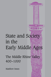
State and Society in the Early Middle Ages
This book, first published in 2000, is a pioneering study of politics and society in the early Middle Ages. Whereas it is widely believed that the source materials for early medieval Europe are too sparse to allow sustained study of the workings of social and political relationships on the ground, this book focuses on a uniquely well-documented area to investigate the basis of power. Topics covered include the foundation of monasteries, their relationship with the laity, and their role as social centres; the significance of urbanism; the control of land, the development of property rights and the organization of states; community, kinship and lordship; justice and dispute settlement; the uses of the written word; violence and the feud; and the development of political structures from the Roman empire to the high Middle Ages.
eBook
The Rhine: National tensions, Romantic visions
Of all European landscapes and regions, the Rhine is one of the most heavily overlaid with cultural and political meaning. Cradle of Romanticism, tourism, and the picturesque, bone of contention between the German and French spheres of cultural and geopolitical influence, the Rhine has attracted armies, artists, activists and tourists for centuries and has featured prominently the key writings of Europe's literary and intellectual history from Byron to Lucien Febvre. This volume brings together eminent literary and cultural historians to present materials and analyses from various of the central nexus of European culture. The volume also contains a unique and comprehensive anthology of key texts (historical, poetical and polemical) related to the Rhineland and its contested position. Contributors are: Reinhard Baumann, Manfred Beller, Hans-Werner Breunig, Giovanna Cermelli, Joep Leerssen, Elmar Scheuren, Helmut J. Schneider, and Waldemar Zacharasiewicz.
eBook


The Rhine
This volume presents documents and analyses, from various specialisms and perspectives, the cultural, political and national investments and appropriations of the Rhine, from Byron to Lucien Febvre, and from tourism to war propaganda. It includes a comprehensive anthology of original Rhine-related texts (historical, poetical and polemical).
eBook


The Castles of the Rhine
Far from being mere antiquarian or sentimental curiosities, the rebuilt or reused fortresses of the Rhine reflect major changes in Germany and Europe during the nineteenth and early twentieth centuries. Taylor begins The Castles of the Rhine with a synopsis of the major political, social and intellectual changes that influenced castle rebuilding in the nineteenth century. He then focuses on selected castles, describing their turbulent histories from the time of their original construction, through their destruction or decay, to their rediscovery in the 1800s and their continued preservation today.
Reading this book is equivalent to looking at history though a romantic-nationalist kaleidoscope. Amply illustrated with maps and photographs, The Castles of the Rhine is a wonderful companion for anyone with dreams or experience of journeying along the Rhine.
eBook

The Rhine
The Rhine River is Europe s most important commercial waterway, channeling the flow of trade among Switzerland, France, Germany, and the Netherlands. In this innovative study, Mark Cioc focuses on the river from the moment when the Congress of Vienna established a multinational commission charged with making the river more efficient for purposes of trade and commerce in 1815. He examines the engineering and administrative decisions of the next century and a half that resulted in rapid industrial growth as well as profound environmental degradation, and highlights the partially successful restoration efforts undertaken from the 1970s to the present.
The Rhine is a classic example of a multipurpose river -- used simultaneously for transportation, for industry and agriculture, for urban drinking and sanitation needs, for hydroelectric production, and for recreation. It thus invites comparison with similarly over-burdened rivers such as the Mississippi, Hudson, Colorado, and Columbia. The Rhine s environmental problems are, however, even greater than those of other rivers because it is so densely populated (50 million people live along its borders), so highly industrialized (10% of global chemical production), and so short (775 miles in length).
Two centuries of nonstop hydraulic tinkering have resulted in a Rhine with a sleek and slender profile. In their quest for a perfect canal-like river, engineers have modified it more than any other large river in the world. As a consequence, between 1815 and 1975, the river lost most of its natural floodplain, riverside vegetation, migratory fish, and biodiversity. Recent efforts to restore that biodiversity, though heartening, can have only limited success because so many of the structural changes to the river are irreversible.
The Rhine: An Eco-Biography, 1815-2000 makes clear just how central the river has been to all aspects of European political, economic, and environmental life for the past two hundred years.
eBook

High-resolution grids of hourly meteorological variables for Germany
We present a 1-km2 gridded German dataset of hourly surface climate variables covering the period 1995 to 2012. The dataset comprises 12 variables including temperature, dew point, cloud cover, wind speed and direction, global and direct shortwave radiation, down- and up-welling longwave radiation, sea level pressure, relative humidity and vapour pressure. This dataset was constructed statistically from station data, satellite observations and model data. It is outstanding in terms of spatial and temporal resolution and in the number of climate variables. For each variable, we employed the most suitable gridding method and combined the best of several information sources, including station records, satellite-derived data and data from a regional climate model. A module to estimate urban heat island intensity was integrated for air and dew point temperature. Owing to the low density of available synop stations, the gridded dataset does not capture all variations that may occur at a resolution of 1 km2. This applies to areas of complex terrain (all the variables), and in particular to wind speed and the radiation parameters. To achieve maximum precision, we used all observational information when it was available. This, however, leads to inhomogeneities in station network density and affects the long-term consistency of the dataset. A first climate analysis for Germany was conducted. The Rhine River Valley, for example, exhibited more than 100 summer days in 2003, whereas in 1996, the number was low everywhere in Germany. The dataset is useful for applications in various climate-related studies, hazard management and for solar or wind energy applications and it is available via doi:10.5676/DWD_CDC/TRY_Basis_v001.
Journal Article

Regional groundwater flow and karst evolution–theoretical approach and example from Switzerland
In regional scale aquifers in the Rhine Valley and Tabular Jura east of Basel (Switzerland), the groundwater circulation was investigated using regional-scale geological and hydraulic 3D models. The main aquifers in the area comprise the Quaternary aquifer of unconsolidated gravel deposits along the River Rhine and its tributaries, as well as the regional scale karst aquifer within the Upper Muschelkalk. Land subsidence, a process likely associated with salt solution mining, indicates further subordinate groundwater bearing segments and complex groundwater interactions along fault zones. In the aquifer systems we investigated, regional-scale groundwater circulation was simulated and visualized in relation to the geological settings. Lithostratigraphic units and fault structures were parameterized and analyzed, including the sensitivity of hydraulic properties and boundaries. Scenario calculations were used to investigate the sensitivity that the aquifer systems had to hydraulic parameter changes during Quaternary aggradation and degradation in the main valley. Those calculations were also done for base-level changes in the Rivers Rhine and Birs. For this purpose, this study considered probable historic base-levels before river regulation occurred, and before river dams and power plants were constructed. We also focused on scenarios considering increased groundwater recharge rates, e.g. due to exceptional long-lasting precipitation, or heavy rainfall events in the catchment area. Our results indicate that increased groundwater recharge rates in the catchment areas during such events (or periods) are associated with orders of magnitude increases of regional inflow into the Upper Muschelkalk karst aquifer. Furthermore, the groundwater fluctuations and groundwater saturated regions within the karst aquifer shift to places where high densities of sinkholes are documented. When the surface water base-levels adapt to probable historic levels, it leads to increased hydraulic gradients (i.e. local lowering of the groundwater level by up to 7 m). Those increased gradients are associated with increased groundwater flow within some aquifer regions that are particularly prone to karst development.
Journal Article