Catalogue Search | MBRL


Are you sure you want to remove the book from the shelf?

{{itemTitle}}
11
result(s) for
"Sailing Mediterranean Sea."
Sort by:

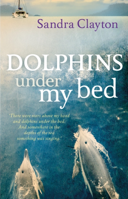
Dolphins under My Bed
A charming, gentle tale about a British couple's decision to followtheir dream and sail from the UK to the Med before it's too late. Toldfrom a woman's perspective it is entertainingly written, with livelyand humorous anecdotes that will be of interest to sailors andnon-sailors alike.
eBook

Turtles in Our Wake
'Life is not a rehearsal.' Sandra Clayton got tired of hearing it said, so she and her husband sold their house, set out on their yacht and didn't look back until they reached the Mediterranean. This sequel to Dolphins Under My Bed charts what happened next in their sailing adventure.
eBook

A near-synoptic survey of ocean microplastic concentration along an around-the-world sailing race
Litter and plastic pollution in the marine environment is of major concern when considering the health of ocean ecosystems, and have become an important focus of ocean research during recent years. There is still significant uncertainty surrounding the distribution and impact of marine plastic litter on ocean ecosystems, and in particular on the nano- and microplastic fractions that are difficult to observe and may be harmful to marine organisms. Current estimates of ocean plastic concentrations only account for a small fraction of the approximated 8 million tons of plastic litter entering the oceans on an annual basis. Here, we present the distribution of 100–500 μm microplastic particles within the ocean mixed layer, covering a significant fraction of the ocean, in a near-synoptic survey. During The Ocean Race 2017/2018 edition (formerly known as Volvo Ocean Race ), two yachts served as ships of opportunity that regularly took samples of microplastics on a regular schedule during their circumnavigation. This effort resulted in information on microplastic distribution along the race track in the ocean’s upper, well-mixed, layer. We found concentrations ranging from 0–349 particles per cubic meter, but with large spatial variability. There was a tendency toward higher concentrations off south-western Europe and in the southwest Pacific, and indications of long-range transport of microplastic with major ocean currents.
Journal Article

Nocturnal Seafaring: the Reduction of Visibility at Night and its Impact on Ancient Mediterranean Seafaring. A Study Based on 8–4th Centuries BC Evidence
The practice of nocturnal navigation in the Mediterranean Sea could be inferred from both archaeological and written records. While there is sufficient proof that the ships and their crew were quite familiar with nighttime sailing, current scholarship has not satisfactorily investigated how the reduction of visibility could have affected the nautical practice. For this reason, the aim of this contribution is twofold: (1) to evaluate to what extent visibility was reduced at night, and (2) to understand what kind of strategies (if any) could be put in place to overcome the difficulties of a low level of visibility. Amongst the strategies, we will also assess the impact on visibility of fixed and portable lighting devices, such as torches and pierced amphoras, as documented by the archaeological and literary evidence.
Journal Article

Does Astronomical and Geographical Information of Plutarch's De Facie Describe a Trip Beyond the North Atlantic Ocean?
Liritzis, I.; Preka-Papadema, P.; Antonopoulos, P.; Kalachanis, K., and Tzanis, C.G., 2018. Does astronomical and geographical information of Plutarch's De Facie describe a trip beyond the North Atlantic Ocean? In Plutarch's book On the Apparent Face in the Orb of the Moon, the interlocutors develop a dialogue about a trip to the “great continent” beyond the North Atlantic Ocean. By applying modern scientific data, the present reappraisal of the astronomical and geographical elements within this dialogue has produced a novel interpretation of the date and place of the meeting and a journey to the northern Atlantic Ocean. A described solar eclipse is dated to AD 75, making use of the National Aeronautics and Space Administration (NASA)/Espenak/Meeus list, as well as historical information. The described peculiar, recurrent trips take place every 30 years (when the planet Saturn reaches the Taurus constellation) from the Mediterranean Sea to the Cronian Open Sea, which is identified with northern Atlantic Ocean coasts. It has been suggested that the last mission had returned homeland in April AD 56. The information provided concerns, distances between coastal sites and islands, duration of sea paths in days, and the reported setting and size between the destination place and its gulf with regards to Azov (in Crimea) and the Caspian Sea. Implications of sea currents and the coastal geomorphology of those lands are given. Following strictly the Gulf Stream current, as well as other known sea currents in the northern Atlantic Ocean, and introducing estimated speed for the ship, the geographical location of destination of the Greek settlers is proposedly identified with St. Lawrence Gulf and Newfoundland island. Other unnamed islands mentioned in this dialogue are identified with Norway's islands, Azores, Iceland, Greenland, and Baffin islands. It has been shown that the journey is made with good knowledge of sea currents but by using bright stars and stellar configurations as astronomical nightscape markers that determine the exact orientation of the sailing toward the Iberian Peninsula and back to the eastern Mediterranean, making the current working hypothesis a plausible event.
Journal Article

MODELATION OF THE OSCILLATORY MOTIONS OF THE SHIP FOR THE MEDITERRANEAN SEA NAVIGATION CONDITIONS, USING THE OCTOPUS SOFTWARE
The paper presents a complex study about oscillatory motions of a ship for offshore industry in the Mediterranean Sea conditions of navigation. Geometrical, constructive and hydrodynamic particularities of these special vessels make interesting and also necessary - for safety of the navigation and operation of the ship - this study for the ships movements, considered as a rigid body with six degree of freedom. The study provides information regarding RAO (Response Amplitude Operator) operator of the ship for the displacement of gravity centre of the ship, related with the incident wave systems in the Mediterranean Sea, interpreted by the Jonswap energy spectrum, and other several conclusions. For the study, are used features offered by OCTOPUS as a tool for modelling and simulation - software that allows the study of the computerized behaviour of the ship on the waves in the real sailing conditions. Program library was used for both the vessel itself and navigation modelling environment (for regular waves as well for the irregular waves which was modelled using Jonswap energy spectrum). [PUBLICATION ABSTRACT]
Journal Article

On the Identification of the Ships of kzd/ry in the Erased Customs Account from Elephantine
Tal focuses on the identification of the ships of kzd/ry in the erased Customs Account from Elephantine. The information from the Customs Account concerning maritime trade includes the types of ships sailing to and from Egypt and the kinds of goods they carried as well as information about the system of duty of collection and the royal practice of accounting in Achaemenid Egypt in the early Persian Period. He proposes identifying the term kzd/ry, which appears in papyrus sheet FV3, 25 \"ships of kzd/ry 6,\" as a toponym, the Persian-period site of Tell Ghazza. Moreover, he notes that Tell Ghazza's lack of reliable archaeological evidence for occupation during the fourth century B.C.E. cannot be taken as a mere coincidence. In fact, from the archaeological evidence they know that the site flourished again only in the second century B.C.E.
Journal Article

The Locus of Carthage: Compounding Geographical Logic
North Africa's Phoenician city of Carthage was above all a logical place from which the well-informed maritime Phoenicians colonized and controlled the Western Mediterranean. The leading important factors affecting the founding of Carthage were mostly geographical: overall centrality along the southern coast of the Western Mediterranean; proximity to the island bridge of Italy via Sicily; nascent océanographie knowledge of water currents and wind gyres as well as shoals such as the Gulf of Sidra and the shelter of the Gulf of Tunis itself; and important local topography and religious landmarks.
Journal Article