Catalogue Search | MBRL


Are you sure you want to remove the book from the shelf?

{{itemTitle}}
2,239
result(s) for
"Sea World."
Sort by:
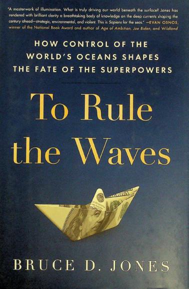
To rule the waves : how control of the world's oceans shapes the fate of the superpowers
\"For centuries, oceans were the chessboard on which empires battled for dominance. But in the nuclear age, air power and missile systems dominated our worries about security, and for the United States, the economy was largely driven by domestic production, with trucking and railways that crisscrossed the continent the primary modes of commercial transit. All that has changed, as nine-tenths of global commerce and the bulk of energy trade is today linked to sea-based flows. A brightly-painted 40-foot steel shipping container loaded in Asia with twenty tons of goods may arrive literally anywhere else in the world; how that really happens and who actually profits by it show that the struggle for power on the seas is a critical issue today. Now, in bright, closely observed prose, To Rule the Waves author Bruce Jones conducts us on a fascinating voyage through the great modern ports and naval bases of this era-from the vast container ports of Shanghai and Hong Kong to the vital naval base of the American 7th fleet in Hawaii to the sophisticated security arrangements in the port of New York. Along the way, the book illustrates how global commerce works, that we are amidst a global naval arms race, and why the oceans are so crucial to America's standing going forward. As Jones reveals, the three great geopolitical struggles of our time-for military power, for economic dominance, and over our changing climate-are playing out atop, within, and below the world's oceans. The essential question, he shows, is this: who will rule the waves and set the terms of the world to come?\"-- Provided by publisher.
Book

In Passage Perilous
By mid-1942 the Allies were losing the Mediterranean war: Malta was isolated and its civilian population faced starvation. In June 1942 the British Royal Navy made a stupendous effort to break the Axis stranglehold. The British dispatched armed convoys from Gibraltar and Egypt toward Malta. In a complex battle lasting more than a week, Italian and German forces defeated Operation Vigorous, the larger eastern effort, and ravaged the western convoy, Operation Harpoon, in a series of air, submarine, and surface attacks culminating in the Battle of Pantelleria. Just two of seventeen merchant ships that set out for Malta reached their destination. In Passage Perilous presents a detailed description of the operations and assesses the actual impact Malta had on the fight to deny supplies to Rommel's army in North Africa. The book's discussion of the battle's operational aspects highlights the complex relationships between air and naval power and the influence of geography on littoral operations.
eBook

Adriatic : a concert of civilizations at the end of the modern age
\"In this insightful travelogue, geopolitical expert Robert Kaplan turns his perceptive eye to the Adriatic Sea, a region that has always been a crossroads in trade, culture, and ideas. Kaplan undertakes a journey through Italy and the Balkan countries lining the Adriatic to reveal much more to the region than news stories about resurgent populism or the refugee crisis let on. As he travels, the stark truth emerges that the age of populism is merely an epiphenomenon--a swan song for the age of nationalism itself--and that the future of Europe lies in a different direction entirely as he observes a breaking down of the distinctions between east and west, a return to alignments of an earlier era. Traveling the coastline from Italy to Slovenia and Croatia, to Montenegro to Albania and to Greece, he engages perceptive cultural criticism and an urgent study of Europe as a whole, seen through the lens of these countries. He finds clues to what the future may hold in history as he reflects on contemporary issues like the refugee crisis, the return of populist nationalism, battles over the control of fossil fuel resources, and how the Adriatic will once again be a global trading hub as it is set to be connected to China's Belt and Road initiative. With a cross-pollination of history, literature, art, architecture, and current events along with a map and photographs throughout, Kaplan demonstrates how Europe is distilled within the geography of the Adriatic, an often-overlooked region rich with answers and insights about the fate of the continent\"-- Provided by publisher.
BOOK

Small-scale benthos distribution modelling in a North Sea tidal basin in response to climatic and environmental changes (1970s–2009)
We used small-scale species distribution models to predict the past and present spatial distribution of 7 characteristic macrofauna species in response to climatic and environmental changes that have been recorded for the Jade Bay (German Wadden Sea) over the last 4 decades (1970s to 2009). Four presence–absence modelling algorithms (Rf, Mars, Glm, Gbm) were merged within the ensemble forecasting platform ‘biomod2’. The present spatial distribution (representing 2009) was modelled based on statistical relationships between species presences, true species absences and 7 high-resolution (5 m) environmental grids. The past spatial distribution (representing the 1970s) was then hindcast in response to climate change-induced (1) sea-level rise, (2) water temperature increase and (3) seagrass recovery due to de-eutrophication. The past distribution scenario was evaluated using independent historical macrofauna data from the 1970s. Present ensemble prediction maps accurately captured the potential ecological niches of the modelled species throughout Jade Bay (i.e. good to excellent true skill statistic [TSS] and area under the receiver operating characteristic curve [AUC] evaluation measures). The predicted present macrofauna distribution correlated most significantly with hydrodynamic conditions (submergence time, shear stress) and sediment characteristics (mud content). The past distribution scenario revealed significant changes in small-scale spatial distribution patterns of the characteristic modelled species (1970s to 2009) and showed a very good match with historical macrofauna data. Climate change-induced sea-level rise and its local implications for Jade Bay (changes in topography, tidal range and submergence time), and water temperature increase explained the potential macrofauna distribution shifts over the last 4 decades.
Journal Article


Long-term response of coastal macrofauna communities to de-eutrophication and sea level rise mediated habitat changes (1980s versus 2018)
Since the last decades, previous long-term Wadden Sea studies revealed significant changes in the abundance, biomass and spatial distribution of characteristic macrofauna communities in response to environmental changes and anthropogenic stressors. In this study, we performed statistical community analysis for the East-Frisian Wadden Sea (EFWS, southern North Sea) on two reference datasets across a period with severe climatic and environmental changes (1980s-2018). Therefore, historical macrofauna data from the Quantitative Sensitivity Mapping (1980s, SENSI 1) were reanalyzed and compared with data from the Synoptic Intertidal Benthic Survey (SIBES/SENSI 3) collected in 2018. Our results revealed significant quantitative and spatial changes in the characteristic macrofauna communities between the 1980s and 2018, most likely in response to de-eutrophication and sea level rise mediated habitat changes. Since the 1980s, the total number of taxa remained relatively stable (1980s: 90, 2018: 81), but the total abundance decreased by ca. -31% and the total biomass decreased by ca. -45%, particularly in the eastern regions of the study site probably due to de-eutrophication processes. Thereby, the mean abundances/m 2 of ≥ -80% (1980s-2018) in the EFWS of several dominant species decreased: e.g. the gastropod Peringia ulvae , the polychaete Lanice conchilega and the bivalve Mya arenaria . In contrast, the mean abundance/m 2 of one dominant species increased by ≥ +80% (1980s-2018): the invasive bivalve Ensis leei . The mean biomass [g/m 2 ] of three dominant species decreased by ≥ -80% (1980s-2018): P. ulvae , L. conchilega and the amphipod Corophium volutator . In contrast, the mean biomass [g/m 2 ] of one dominant species increased by ≥ +75% (1980s-2018): the polychaete Arenicola marina . In the western part of the EFWS, not only higher abundances of A. marina, but also of L. conchilega and P. ulvae were found in 2018, caused i.a. by sea level rise mediated decreasing mud contents and sand accretion on tidal flats. At the community level, the Oligochaeta/Heteromastus community increased in spatial distribution in the western EFWS in 2018 in the vicinity of increasing mussel/oyster beds.
Journal Article

No traveller returns : a novel
\"Louis L'Amour's long-lost first novel, ... completed by his son, takes readers on a voyage into danger and violence on the high seas [as the shadows of World World II gather]\"-- Provided by publisher.
Book

New Updated World Maps of Sea-Surface Salinity
Sea surface salinity presents one of the most important chemical elements in the water. Climatic variables, included in new view of salinity distribution at a global scale, were used in this research. For the purpose of this research newly updated climate parameters for the period until 2100 were used along with (CMIP5) climatological model. The new distribution of surface salinity may show water desalination and energy potential. This map can be useful in the determination of new littoral areas or for fishermen’s routes. These data are presented in geo-tiff raster extension with the resolution of 0.1. This map could be updated with climatological parameters with obtained medium climate change effects. Some places in the world sea have low, some have high salinity. Salinity increases in accordance with the increase of precipitation and decreases with the decrease of it. The paper presents following maps; salinity world map when there is no climate change; the moderate one, if the temperature increases for 2.0 °C until 2100, and high if the increase of temperature was between 2.0 °C and 5.0 °C. The three scenarios were taken to show updated maps of world salinity in comparison with climate change effects.
Journal Article

Six victories : North Africa, Malta, and the Mediterranean Convoy War, November 1941-March 1942
\"Six Victories relates one of the most interesting and instructive naval campaigns of World War II: the Mediterranean war on traffic in the fall and winter of 1941-42. It is a cautionary tale of how sea power was practiced, and how it shifted 180 degrees overnight. The book is based on British and Italian archival sources. It emphasizes strategic context, the role of intelligence, and the campaign's logistics.\" --Provied by publisher.
Book

WATLAS: high-throughput and real-time tracking of many small birds in the Dutch Wadden Sea
Tracking animal movement is important for understanding how animals interact with their (changing) environment, and crucial for predicting and explaining how animals are affected by anthropogenic activities. The Wadden Sea is a UNESCO World Heritage Site and a region of global importance for millions of shorebirds. Due to climate change and anthropogenic activity, understanding and predicting movement and space-use in areas like the Wadden Sea is increasingly important. Monitoring and predicting animal movement, however, requires high-resolution tracking of many individuals. While high-resolution tracking has been made possible through GPS, trade-offs between tag weight and battery life limit its use to larger species. Here, we introduce WATLAS (the Wadden Sea deployment of the ATLAS tracking system) capable of monitoring the movements of hundreds of (small) birds simultaneously in the Dutch Wadden Sea. WATLAS employs an array of receiver stations that can detect and localize small, low-cost tags at fine spatial (metres) and temporal resolution (seconds). From 2017 to 2021, we tracked red knots, sanderlings, bar-tailed godwits, and common terns. We use parts of these data to give four use-cases revealing its performance and demonstrating how WATLAS can be used to study numerous aspects of animal behaviour, such as, space-use (both intra- and inter-specific), among-individual variation, and social networks across levels of organization: from individuals, to species, to populations, and even communities. After describing the WATLAS system, we first illustrate space-use of red knots across the study area and how the tidal environment affects their movement. Secondly, we show large among-individual differences in distances travelled per day, and thirdly illustrate how high-throughput WATLAS data allows calculating a proximity-based social network. Finally, we demonstrate that using WATLAS to monitor multiple species can reveal differential space use. For example, despite sanderlings and red knots roosting together, they foraged in different areas of the mudflats. The high-resolution tracking data collected by WATLAS offers many possibilities for research into the drivers of bird movement in the Wadden Sea. WATLAS could provide a tool for impact assessment, and thus aid nature conservation and management of the globally important Wadden Sea ecosystem.
Journal Article