Catalogue Search | MBRL


Are you sure you want to remove the book from the shelf?

{{itemTitle}}
9,729
result(s) for
"Sedimentology"
Sort by:

The sea floor : an introduction to marine geology
This textbook deals with the most important items in Marine Geology, including some pioneer work. The list of topics has grown greatly in the last few decades beyond the items identified by Eugen Seibold as central and now includes prominently such things as methane and climate change; that is, the carbon cycle and the Earth system as a whole. Relevant geophysical, geochemical, sedimentological and paleontological methods are shortly described. They should allow the reader to comment on new results about plate tectonics, marine sedimentation from the coasts to the deep sea, climatological aspects, paleoceanology and the use of the sea floor. The text tries to transmit to the reader excitement of marine geological research both aboard and in modern laboratories. Basic mineralogical, geochemical, biological and other relevant data and a detailed list of books and symposia are given in an Appendix. This Introduction builds on the third edition of \"The Sea Floor\" by E. Seibold and W.H. Berger. While much of the original text was written by Seibold, a considerable portion of the material presented in this edition is new, taking into account the recent great shift in marine geological research, some of it with great relevance to human concerns arising in a rapidly changing world.
Book

Sedimentary environment and provenance of sandstones from the Qadir member in the Nayband Formation, Tabas block, east-central Iran
Qadir Member of Nayband Formation, located in East of Central Iran, has developed to a great extent. Investigation of the lithofacies and sedimentary environment, resulted in identification of the deltaic and marine deposits. Based on field evidence and facies features, Qadir Member consists of two lithofacies, including carbonate and siliciclastic facies. The siliciclastic facies were identified as having four sandstone facies including Sr, Sh, Sp, St, three finegrained lithofacies, including FI, Fm, Fl (Sr) / Sr (FI) and one coal facies. Also, regarding the field, laboratory studies, and identification of lithofacies, the coastal plain, deltaic (including deltaic plain, proximal delta front, distal delta front, and prodelta) and open marine environments were identified for Qadir Member which is is under the impact of tidal currents. The chemical weathering index (71%) indicated semi-arid to semi-humid conditions and plotting the geochemical data showed the provenance of re-cycling and active continental margin and because of Chemical Index of Alteration, the weathering rate was found to be rather medium to high. The geochemical diagrams also showed a probable source of the intermediate igneous and sedimentary rocks. The active continental margin conditions for this deposit could suggest the Neotethys subduction under Iran’s plate and volcanic activity at the end of Triassic, which coincided with the early Cimmerian orogeny in Alborz and Central East Iranian Microcontinent.
El miembro Qadir de la Formación Nayband, ubicada en el este del centro de Irán, se ha desarrollado en gran medida. La investigación de la litofacies y el medio sedimentario resultó en la identificación de los depósitos deltaicos y marinos. Basado en evidencia de campo y características de facies, Qadir Member consta de dos litofacies, incluidas facies de carbonato y siliciclástico. Se identificó que las facies siliciclásticas tenían cuatro facies de arenisca, incluidas Sr, Sh, Sp, St, tres litofacies de grano fino, incluidas FI, Fm, Fl (Sr) / Sr (FI) y una facies de carbón. Además, con respecto al campo, los estudios de laboratorio y la identificación de litofacies, se identificaron la llanura costera, deltaica (incluida la llanura deltaica, frente deltaico proximal, frente delta distal y prodelta) y ambientes marinos abiertos para el Miembro Qadir que se encuentra bajo el impacto. de las corrientes de marea. El índice de meteorización química (71%) indicó condiciones semiáridas a semihúmedas y el trazado de los datos geoquímicos mostró la procedencia del reciclaje y el margen continental activo y, debido al índice químico de alteración, la tasa de meteorización resultó ser bastante media. en lo alto. Los diagramas geoquímicos también mostraron una fuente probable de rocas ígneas y sedimentarias intermedias. Las condiciones del margen continental activo para este depósito podrían sugerir la subducción de Neotethys bajo la placa de Irán y la actividad volcánica al final del Triásico, que coincidió con la orogenia cimeria temprana en Alborz y el microcontinente iraní centro-este.
Journal Article
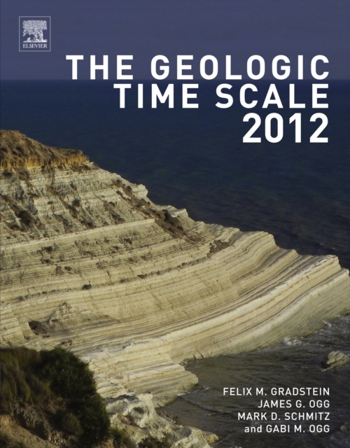
The geologic time scale 2012
The Geologic Time Scale 2012, winner of a 2012 PROSE Award Honorable Mention for Best Multi-volume Reference in Science from the Association of American Publishers, is the framework for deciphering the history of our planet Earth.
eBook


Two-billion-year-old evaporites capture Earth’s great oxidation
Major changes in atmospheric and ocean chemistry occurred in the Paleoproterozoic era (2.5 to 1.6 billion years ago). Increasing oxidation dramatically changed Earth’s surface, but few quantitative constraints exist on this important transition. This study describes the sedimentology, mineralogy, and geochemistry of a 2-billion-year-old, ~800-meter-thick evaporite succession from the Onega Basin in Russian Karelia. The deposit consists of a basal unit dominated by halite (~100 meters) followed by units dominated by anhydrite-magnesite (~500 meters) and dolomite-magnesite (~200 meters). The evaporite minerals robustly constrain marine sulfate concentrations to at least 10 millimoles per kilogram of water, representing an oxidant reservoir equivalent to more than 20% of the modern ocean-atmosphere oxidizing capacity. These results show that substantial amounts of surface oxidant accumulated during this critical transition in Earth’s oxygenation.
Journal Article

Hyperpycnal (over density) flows and deposits
A hyperpycnal flow forms when a relatively dense land-derived gravity flow enters into a marine or lacustrine water reservoir. As a consequence of its excess of density, the incoming flow plunges in coastal areas, generating a highly dynamic and often long-lived dense underflow. Depending on the characteristics of the parent flow (flow duration and flow rheology) and basin salinity, the resulting deposits (hyperpycnites) can be very variable.
According to flow duration, land-derived gravity flows can be classified into short-lived or long-lived flows. Short-lived gravity flows last for minutes or hours, and are mostly related to small mountainous river discharges, alluvial fans, collapse of natural dams, landslides, volcanic eruptions, jökulhlaups, etc. Long-lived gravity flows last for days, weeks or even months, and are mostly associated with medium- to large-size river discharges.
Concerning the rheology of the incoming flow, hyperpycnal flows can be initiated by non-Newtonian (cohesive debris flows), Newtonian supercritical (lahars, hyperconcentrated flows, and concentrated flows) or Newtonian subcritical flows (pebbly, sandy or muddy sediment-laden turbulent flows). Once plunged, non-Newtonian and Newtonian supercritical flows require steep slopes to accelerate, allow the incorporation of ambient water and develop flow transformations in order to evolve into a turbidity current and travel further basinward. Their resulting deposits are difficult to differentiate from those related to intrabasinal turbidites. On the contrary, long-lived Newtonian subcritical flows are capable of transferring huge volumes of sediment, freshwater and organic matter far from the coast even along gentle or flat slopes. In marine settings, the buoyant effect of interstitial freshwater in pebbly and sandy hyperpycnal flows can result in lofting due to flow density reversal. Since the excess of density in muddy hyperpycnal flows is provided by silt-clay sediments in turbulent suspension, lofting is not possible even in marine/saline basins. Muddy hyperpycnal flows can also erode the basin bottom during their travel basinward, allowing the incorporation and transfer of intrabasinal sediments and organic matter. Long-lived hyperpycnal flow deposits exhibit typical characteristics that allow a clear differentiation respect to those related to intrabasinal turbidites. Main features include (1) composite beds with gradual and recurrent changes in sediment grain-size and sedimentary structures, (2) mixture of extrabasinal and intrabasinal components, (3) internal and discontinuous erosional surfaces, and (4) lofting rhythmites in marine/saline basins.
Journal Article

Trace elements in magnetite as petrogenetic indicators
We have characterized the distribution of 25 trace elements in magnetite (Mg, Al, Si, P, Ca, Sc, Ti, V, Cr, Mn, Co, Ni, Cu, Zn, Ga, Ge, Y, Zr, Nb, Mo, Sn, Hf, Ta, W, and Pb), using laser ablation ICP-MS and electron microprobe, from a variety of magmatic and hydrothermal ore-forming environments and compared them with data from the literature. We propose a new multielement diagram, normalized to bulk continental crust, designed to emphasize the partitioning behavior of trace elements between magnetite, the melt/fluid, and co-crystallizing phases. The normalized pattern of magnetite reflects the composition of the melt/fluid, which in both magmatic and hydrothermal systems varies with temperature. Thus, it is possible to distinguish magnetite formed at different degrees of crystal fractionation in both silicate and sulfide melts. The crystallization of ilmenite or sulfide before magnetite is recorded as a marked depletion in Ti or Cu, respectively. The chemical signature of hydrothermal magnetite is distinct being depleted in elements that are relatively immobile during alteration and commonly enriched in elements that are highly incompatible into magnetite (e.g., Si and Ca). Magnetite formed from low-temperature fluids has the lowest overall abundance of trace elements due to their lower solubility. Chemical zonation of magnetite is rare but occurs in some hydrothermal deposits where laser mapping reveals oscillatory zoning, which records the changing conditions and composition of the fluid during magnetite growth. This new way of plotting all 25 trace elements on 1 diagram, normalized to bulk continental crust and elements in order of compatibility into magnetite, provides a tool to help understand the processes that control partitioning of a full suit of trace elements in magnetite and aid discrimination of magnetite formed in different environments. It has applications in both petrogenetic and provenance studies, such as in the exploration of ore deposits and in sedimentology.
Journal Article
The formation of authigenic deposits during Paleogene warm climatic intervals: a review
Although Paleogene warm climatic intervals have received considerable attention for atmospheric and oceanographic changes, the authigenic mineralization associated with these time spans remains overlooked. An extensive review of the literature reveals a close correspondence between the high abundance of glauconite and warm climatic intervals during the Paleogene period. The abundance of phosphorite, ironstone, lignite and black shale deposits reveals similar trends. Although investigated thoroughly, the origin of these authigenic deposits is never understood in the background of Paleogene warming climatic intervals. A combination of factors like warm seawater, hypoxic shelf, low rate of sedimentation, and enhanced rate of continental weathering facilitated the glauconitization. The last factor caused the excess supply of nutrients, including Fe, Si, K, Mg and Al through the rivers, the cations needed for the formation of glauconite. The excessive inflow of nutrient-rich freshwater into the shallow seas further ensured high organic productivity and stratification in shallow shelves, causing hypoxia. The consequent rapid rise in sea-level during the warm periods created extensive low-relief shallow marine shelves starved in sediments. Oxygen-deficiency in the shallow marine environment facilitated the fixation of Fe into the glauconite structure. The inflow of nutrient-rich water during the warm climatic intervals facilitated the formation of phosphorite, ironstone, and organic-matter-rich sedimentary deposits as well. Although global factors primarily controlled the formation of these authigenic deposits, local factors played significant roles in some of the deposits. Therefore, phosphorites formed in marine conditions with open circulation within the tropical zone. While lush growth of rainforest covers in the tropical belt facilitated the formation of coastal lignite.
Journal Article

The mechanical behaviour and failure modes of volcanic rocks: a review
The microstructure and mineralogy of volcanic rocks is varied and complex, and their mechanical behaviour is similarly varied and complex. This review summarises recent developments in our understanding of the mechanical behaviour and failure modes of volcanic rocks. Compiled data show that, although porosity exerts a first-order influence on the uniaxial compressive strength of volcanic rocks, parameters such as the partitioning of the void space (pores and microcracks), pore and crystal size and shape, and alteration also play a role. The presence of water, strain rate, and temperature can also influence uniaxial compressive strength. We also discuss the merits of micromechanical models in understanding the mechanical behaviour of volcanic rocks (which includes a review of the available fracture toughness data). Compiled data show that the effective pressure required for the onset of hydrostatic inelastic compaction in volcanic rocks decreases as a function of increasing porosity, and represents the pressure required for cataclastic pore collapse. Differences between brittle and ductile mechanical behaviour (stress-strain curves and the evolution of porosity and acoustic emission activity) from triaxial deformation experiments are outlined. Brittle behaviour is typically characterised by shear fracture formation, and an increase in porosity and permeability. Ductile deformation can either be distributed (cataclastic pore collapse) or localised (compaction bands) and is characterised by a decrease in porosity and permeability. The available data show that tuffs deform by delocalised cataclasis and extrusive volcanic rocks develop compaction bands (planes of collapsed pores connected by microcracks). Brittle failure envelopes and compactive yield caps for volcanic rocks are compared, highlighting that porosity exerts a first-order control on the stresses required for the brittle-ductile transition and shear-enhanced compaction. However, these data cannot be explained by porosity alone and other microstructural parameters, such as pore size, must also play a role. Compactive yield caps for tuffs are elliptical, similar to data for sedimentary rocks, but are linear for extrusive volcanic rocks. Linear yield caps are considered to be a result of a high pre-existing microcrack density and/or a heterogeneous distribution of porosity. However, it is still unclear, with the available data, why compaction bands develop in some volcanic rocks but not others, which microstructural attributes influence the stresses required for the brittle-ductile transition and shear-enhanced compaction, and why the compactive yield caps of extrusive volcanic rocks are linear. We also review the Young’s modulus, tensile strength, and frictional properties of volcanic rocks. Finally, we review how laboratory data have and can be used to improve our understanding of volcanic systems and highlight directions for future research. A deep understanding of the mechanical behaviour and failure modes of volcanic rock can help refine and develop tools to routinely monitor the hazards posed by active volcanoes.
Journal Article
Volcanic effects on climate: recent advances and future avenues
Volcanic eruptions have long been studied for their wide range of climatic effects. Although global-scale climatic impacts following the formation of stratospheric sulfate aerosol are well understood, many aspects of the evolution of the early volcanic aerosol cloud and regional impacts are uncertain. In the last twenty years, several advances have been made, mainly due to improved satellite measurements and observations enabling the effects of small-magnitude eruptions to be quantified, new proxy reconstructions used to investigate the impact of past eruptions, and state-of-the-art aerosol-climate modelling that has led to new insights on how volcanic eruptions affect the climate. Looking to the future, knowledge gaps include the role of co-emissions in volcanic plumes, the impact of eruptions on tropical hydroclimate and Northern Hemisphere winter climate, and the role of eruptions in long-term climate change. Future model development, dedicated model intercomparison projects, interdisciplinary collaborations, and the application of advanced statistical techniques will facilitate more complex and detailed studies. Ensuring that the next large-magnitude explosive eruption is well observed will be critical in providing invaluable observations that will bridge remaining gaps in our understanding.
Journal Article