Catalogue Search | MBRL


Are you sure you want to remove the book from the shelf?

{{itemTitle}}
18
result(s) for
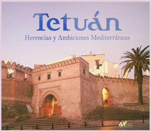
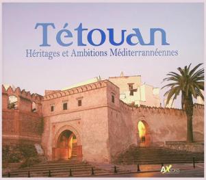
"Tétouan"
Sort by:

Charcot in Morocco
Charcot in Moroccois the first-ever publication of Dr. Jean-Martin Charcot's travel diary of his 1887 trip to Morocco. Considered the father of neuropathology, Charcot (1825-1893) is a seminal character in the history of neurology and psychology. His Moroccan travel diary includes his \"objective\" observations of the local Jewish community, which only fortified his assumptions about the relationship between race and neuropathology. These became a conspicuous feature of his ideas about the hereditary origins of nervous ailments. His ideas - taught as doctrine to a vast audience, including a young Sigmund Freud - reveal the convergence of clinical observation and European anti-Semitism at the end of the nineteenth century.Including an enlightening critical introduction by renowned Charcot expert Toby Gelfand,Charcot in Moroccoprovides new insights into the personality of this influential figure and his perspectives on the \"Orient\" and its inhabitants.
eBook

Storytelling in Chefchaouen Northern Morocco
Storytelling in Chefchaouen Northern Morocco includes two sets of tales told by two different storytellers with an annotated study of the oral performance, transliterations and translations. The purpose is to preserve a part of the region's oral tradition of storytelling in the vernacular language in which it has been transmitted, presenting the original texts with parallel English translation. In addition, the cultural, literary, and linguistic background necessary for understanding this body of oral performance is given. A combination of disciplines (anthropology, philology, sociolinguistics, dialectology, comparative literature, ethnography, typology) is applied to the linguistic and literary features of the present corpus.
eBook

Sayyida al-Ḥurra: An Early Modern Decolonial Muslim Exemplar
Five centuries ago, the Gibraltar Strait was emerging as the border zone between the core and the periphery of the modern/colonial world-system—a liminal position it continues to occupy today. During this period, Muslims on the southern shore of the Strait resisted the Portuguese and Spanish imperialism which was supported by several other Western European powers as well as the Catholic Papacy. This paper examines the life of Sayyida al-Ḥurra (c. 1491–c. 1552), who played an active role in this resistance, as Governor of the city-state of Tétouan and eventually Queen of Morocco. It summarizes years of transdisciplinary research about her life, which draws upon historical sources and popular narratives, as well as fieldwork in Northern Morocco and Southern Spain. The main finding of this research is that Sayyida al-Ḥurra is an early modern Muslim decolonial exemplar who remains significant today. She embodied an alternate way of being a ruler, a warrior, a woman, and a Muslim. Remembering her life can inspire contemporary decolonial thought, since the very fact of her existence unsettles modern colonial formations of race, ethnicity, governance, war, gender, and religion.
Journal Article

A NEW APPROACH FOR MAPPING LAND USE / LAND COVER USING GOOGLE EARTH ENGINE: A COMPARISON OF COMPOSITION IMAGES
In view of the increase in human activities, climate change and related hazards, land use and land cover (LULC) mapping is becoming a fundamental part of the process of any development or hazard prevention project. From this perspective, we propose a new approach for mapping LULC using Machine learning algorithms by comparing the result of five composition methods based on Google Earth Engine in the city of Tetouan - Morocco. To achieve this goal, considering the Sentinel S2 L2 imageries as a source data , five datasets were derived to make the classification generating by aggregating functions (median , mean , max , min and mode). Then based on the very high resolution (VHR) satellite images provided by Google Earth comes the next step that involves selecting samples that are divided into five classes (barren land, water surface, vegetation, forest, and urban areas), which will be further split into two parts: 70% as a training data -used to feed the machine learning algorithms (support vector machine (SVM), random forest (RF) and classification and regression trees (CART))- and 30% as a testing data for evaluating the models using accuracy assessments. The results for all datasets indicate that the SVM algorithm has the highest accuracy and its performance is better than the other algorithms (RF and CART). The average overall accuracy of SVM , RF , and CART was 87.99% , 87.81% and 84.72% , respectively. Furthermore, for each algorithm, the comparison between the results of the different composites indicates that the use of the mean composite is the most suitable for LULC mapping. Finally, GEE has proven to be an effective and rapid method for LULC mapping, especially with the use of compositional imagery that can assist decision makers in future planning or risk prevention.
Conference Proceeding

Territorio, turismo y sostenibilidad
El Proyecto de Cooperación Internacional Ibn Battouta. Programa de Formación e Información de Sostenibilidad Turística para la Región Tánger Tetuán subvencionado por la Agencia Española de Cooperación Internacional (AECID) ha sido una fuente de canalización y transformación de la mentalidad de los profesores participantes tanto por parte de la Universidad de Cádiz como de la Universidad Abdemalek Essâdi. En estos cuatro años de intensa cooperación hemos observado como el turismo en Marruecos ha sufrido una gran transformación tanto en su modelo como en la planificación realizada desde las instituciones. En la actualidad el reino alauita se enfrenta a un conjunto de retos socioeconómicos cuya resolución se hace cada vez más complicada, tanto desde el punto de vista social, cultural como ambiental y el turismo es una de esas actividades, que puede ayudar a mitigar dicha complejidad.
Para ello es esencial que el sector turístico en la región Tánger Tetuán desarrolle sus propios recursos convirtiéndolos, a su vez, en productos turísticos de manera sostenible, potenciando la singularidad y la durabilidad en el tiempo como elementos diferenciadores respecto a otras ofertas, cosa que en la actualidad no está sucediendo.[Texto de la editorial]
eBook

PERFORMANCE OF MACHINE LEARNING ALGORITHMS FOR MAPPING AND FORECASTING OF FLASH FLOOD SUSCEPTIBILITY IN TETOUAN, MOROCCO
Since the industrial revolution, the world is experiencing a huge change in its climate, which causes many imbalances such as flash floods (FF). The aim of this study is to propose a new approach for detection and forecasting of flash flood susceptibility in the city of Tetouan, Morocco. For this regard, support vector machine (SVM), logistic regression (LR), random forest (RF), Naïve Bayes (NB) and Artificial neural network (ANN) are used based on 1101 points (680 flood points and 421 non-flood points) and 9 flash-flood predictors (Elevation , Slope , Aspect , LU/LC , Stream Power Index , Plan curvature , Profile Curvature , Topographic Position Index and Topographic Wetness Index ) that were extracted from the DEM (10m resolution) and satellite imagery (Sentinel 2B) of the study area . Models were trained on 70% and tested on 30% of this dataset also they were evaluated using several metrics such as the Receiver Operating Characteristic (ROC) Curve, precision, recall, score and kappa index. The result demonstrated that RF (AUC = 0.99, Accuracy = 96%, Kappa statistics = 0.92) has the highest performance, followed by ANN (AUC = 0.98, Accuracy = 95%, Kappa statistics = 0.89) and SVM (AUC = 0.96, Accuracy = 92%, Kappa statistics = 0.80). The proposed approach is an effective tool for forecasting and predicting FF that can help reduce the severity of this disaster.
Journal Article

Distribution and Ecology of Phlebotomine Sand Flies (Diptera: Psychodidae) in Endemic and Nonendemic Area of Leishmaniasis in Northern Morocco
Northern Morocco is endemic for cutaneous and visceral leishmaniasis. Our entomological investigations aim to evaluate the risk of Leishmania transmission by determining the species composition, the density, and seasonal fluctuation of sand fly populations in endemic and nonendemic areas of leishmaniasis in Tetouan province (North-Western Morocco). Using Sticky-paper traps, 8,370 specimens were collected between May and November 2015 in two localities: peri-urban area of Tetouan city, where leishmaniasis is endemic and that of the Oued Laou village where no cases of leishmaniasis have been recorded. Six sand fly species were identified. The genus Phebotomus was represented by five species: Phlebotomus ariasi, Phlebotomus. longicuspis, Phlebotomus perniciosus, Phlebotomus kazeruni, and Phlebotomus sergenti, while the genus Sergentomyia was represented by only one species Sergentomyia minuta. Phlebotomus perniciosus was dominant in the nonendemic area (47%) while Phlebotomus sergenti was dominant in the endemic area (51%). The spatio-temporal distribution of sand fly populations is discussed according to biotic and abiotic variables. Seasonal fluctuation in sand fly density showed a bimodal pattern for the subgenus Larroussius and a unimodal pattern for the subgenus Paraphlebotomus in Tetouan city. But, in Oued Laou village, a unimodal density distribution for species of the Larroussius subgenus and a bimodal seasonal distribution for species of the subgenus Paraphlebotomus were identified. We affirm the coexistence, in the study area, of vectors of both cutaneous and visceral leishmaniasis, namely P. ariasi, P. longicuspis and P. perniciosus vectors of Leishmania infantum and P. sergenti vector of L. tropica. However, the geographic distribution, the specific abundance, and the activity reveal significant differences between endemic and nonendemic areas in the region.
Journal Article

Deforestation drivers in northern Morocco: an exploratory spatial data analysis
Formulating effective policies to address or mitigate deforestation requires a comprehensive understanding of the contributing factors. This study examines the drivers of deforestation from 2001 to 2020 in the Tangier-Tetouan-Al Hoceima (TTA) region, a northern Moroccan area distinguished by the country’s highest deforestation rate. Through an extensive review of existing literature and employing Geist and Lambin’s deforestation framework, we identified five key causes: infrastructure extension, agricultural expansion, logging, wildfires as direct causes, and demographic factors as an indirect cause. Data on deforestation and its contributing factors were sourced from diverse databases, including Global Forest Change (GFC), Global Land Analysis and Discovery (GLAD), Burned Area Product (MODIS Fire_CCI51), World Population, Forest Proximate People (FPP), and National Forest Inventory (NFI) datasets. Pixel-level analysis of GFC data indicated that wildfires are the primary driver of deforestation in the region, accounting for 35.2%, followed by agricultural expansion (30.6%), logging (13.2%), and infrastructure extension (10.1%). The remaining 10.9% of losses were attributed to other disturbances, such as illegal extraction, pests, and dieback. Spatial patterns were further analyzed through Exploratory Spatial Data Analysis (ESDA) methods at a 1 km 2 gridded scale, revealing strong clustering for all studied factors. Spatial relationships were explored using the bivariate local Moran’s index, which highlighted the highest spatial dependence between deforestation and fires (I = 0.21). Correlations between deforestation and other factors, including agricultural expansion, logging, infrastructure extension, and demographic pressure, were assessed at 0.18, 0.17, 0.08, and 0.05, respectively. Landscape pressures (LSP), encompassing deforestation, agricultural expansion, fires, infrastructure extension, and demographic pressure, were analyzed using the local Geary index, revealing a positive correlation in approximately 59% of spatial units. Last, a composite map of LSP clusters and an explanatory diagram illustrating dominant patterns in the TTA region were generated based on the results from local Geary’s multivariate and local Moran’s univariate tests.
Journal Article