Catalogue Search | MBRL


Are you sure you want to remove the book from the shelf?

{{itemTitle}}
887
result(s) for
"Tianjin"
Sort by:
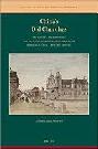
China's old churches : the history, architecture, and legacy of Catholic sacred structures in Beijing, Tianjin, and Hebei Province
\"China's Old Churches, by Alan Sweeten, examines the history of Catholicism (1600 to the present) as reflected by the location, style, and details of sacred structures in three crucial north China areas. Examined are the most famous and important churches in the urban settings of Beijing and Tianjin as well as lesser-known ones in rural Hebei Province. Missionaries built Western-looking churches to make a broad religious statement important to themselves and Chinese worshippers. Non-Catholics, however, tended to see churches as socio-politically foreign and invasive. The physical-visual impact of church structures is significant. Today, restored old and new churches are still mostly of Western style, serving a growing number of Catholics who actively support a Marian movement\"-- Provided by publisher.
Book

Carbon dioxide mitigation co-effect analysis of clean air policies: lessons and perspectives in China's Beijing-Tianjin-Hebei region
In 2018, the Beijing-Tianjin-Hebei (BTH) area launched the Blue Sky Protection Campaign (BSPC) to control atmospheric pollution. CO2 emissions could be significantly reduced due to the co-effects of implementing the BSPC. This paper employs the Greenhouse Gas and Air Pollution Interactions and Synergies Asia model to quantitatively evaluate the CO2 reductions when implementing the BSPC in the BTH region. The results indicate that CO2 emissions can be reduced by 20.7 Mt (equivalently, a 19.7% reduction in the corresponding baseline scenario), 6.8 Mt (3.8%), and 80.2 Mt (9.2%) by 2020 for Beijing, Tianjin, and Hebei, respectively, as a co-benefit of the BSPC. By 2030, it is estimated that the CO2 emission reductions will be 37.8 Mt (26.6%), 4.85 Mt (2.5%), and 69.9 Mt (8.6%) for Beijing, Tianjin, and Hebei, respectively. NOx presents the highest co-effects with CO2 in each region. From the key sector perspective, sectors of power and heating in Beijing, residential combustion in Tianjin, and industrial combustion in Hebei are the most important sector that presents the highest co-effects on CO2 emission reductions due to the application of BSPC. We suggest that the implementation of BSPC, specifically the energy control measures in the power and heating, residential combustion, and industrial combustion sectors for Beijing, Tianjin, and Hebei, respectively, have high synergies and can simultaneously reduce CO2 and other atmospheric emissions. The results contribute to city-level policymaking on facilitating air pollution control and climate change mitigation among different governmental departments.
Journal Article

Land Use Transition and Its Eco-Environmental Effects in the Beijing–Tianjin–Hebei Urban Agglomeration: A Production–Living–Ecological Perspective
With the rapid development of urbanization and industrialization, China’s metropolitan areas have experienced dramatic transitions of land use, which has had a profound impact on the eco-environment. Accordingly, the contradictions of regional production, living, and ecological spaces have intensified. In this context, analysis of the dynamics of regional production–living–ecological (PLE) spaces has become an important entry point for studying land use transition and its eco-environmental effects, by constructing a classification system of PLE land functions. Using remote sensing data from four periods from 1985 to 2018, this paper explores the spatiotemporal evolution characteristics of PLE spaces and their eco-environmental effects in the Beijing–Tianjin–Hebei (BTH) urban agglomeration, based on GIS and the InVEST model. The results revealed that from 1985 to 2018, the living space of the BTH region expanded rapidly, the production space gradually shrank, and the ecological land remained relatively stable. The eco-environmental quality index within the study area shows obvious regional differences, demonstrating the spatial distribution of “high in the northwest and low in the southeast”, and an overall deteriorating trend in the past 33 years. Moreover, the carbon density decreased gradually from northwest to southeast, and the transformations from production land into living land and from ecological land into production land were the major types of eco-environment deterioration. Our findings will provide guidelines for land use management, and offer references for the functional division of PLE spaces and ecological civilization construction, especially in terms of the coordinated development of the BTH region.
Journal Article
Impacts of urbanization on precipitation patterns in the greater Beijing-Tianjin-Hebei metropolitan region in northern China
We present a statistical method to quantify the contribution of urbanization to precipitation changes during 1958-2017 across the greater Beijing-Tianjin-Hebei metropolitan region in northern China. We find distinct trends in precipitation in the past six decades: decreasing in annual and summer while increasing in other seasons. The spatial patterns of precipitation show discernible terrain-induced characteristics with high values in the buffer zones of plain and mountain areas and low values in the northwestern mountainous regions. Our results indicate that although urbanization has limited impacts on the trends and spatial patterns of precipitation, it has a positive contribution to the changes in precipitation for about 80% of the comparisons conducted, especially in autumn (100%), with the negative contribution being dominant in summer (66.67%). In addition, these results are sensitive to the classifications of urban and rural stations, suggesting that how to classify urban/rural areas is a crucial step to estimate the potential contribution of urbanization to precipitation changes. These findings also support that urbanization can diversify and enhance the variations in precipitation, with urban areas becoming a secondary center along with more increasing or less decreasing trends in precipitation.
Journal Article

Seasonal variation of local atmospheric circulations and boundary layer structure in the Beijing‐Tianjin‐Hebei region and implications for air quality
The Beijing‐Tianjin‐Hebei (BTH) region experiences frequent heavy haze pollution in fall and winter. Pollution was often exacerbated by unfavorable atmospheric boundary layer (BL) conditions. The topography in this region impacts the BL processes in complex ways. Such impacts and implications on air quality are not yet clearly understood. The BL processes in all four seasons in BTH are thus investigated in this study using idealized simulations with the WRF‐Chem model. Results suggest that seasonal variation of thermal conditions and synoptic patterns significantly modulates BL processes. In fall, with a relatively weak northwesterly synoptic forcing, thermal contrast between the mountains and the plain leads to a prominent mountain‐plain breeze circulation (MPC). In the afternoon, the downward branch of the MPC, in addition to northwesterly warm advection, suppresses BL development over the western side of BTH. In the eastern coastal area, a sea‐breeze circulation develops late in the morning and intensifies during the afternoon. In summer, southeasterly BL winds allow the see‐breeze front to penetrate farther inland (∼150 km from the coast), and the MPC is less prominent. In spring and winter, with strong northwesterly synoptic winds, the sea‐breeze circulation is confined in the coastal area, and the MPC is suppressed. The BL height is low in winter due to strong near‐surface stability, while BL heights are large in spring due to strong mechanical forcing. The relatively low BL height in fall and winter may have exacerbated the air pollution, thus contributing to the frequent severe haze events in the BTH region. Key Points: Seasonal variation of BL processes in the BTH region is examined using idealized simulations Seasonal variation of daytime BL height over most of BTH is spring > summer > fall > winter Seasonal variation of BL processes/structure modulates seasonal variation of air pollution
Journal Article

Industrial heritage in the city landscape – introduction to research – adaptive reuse on the example of Tianjin
This study explores the adaptive reuse of industrial heritage landscapes in China, emphasizing their cultural, ecological, and urban significance. The research problem centers on the need to preserve and revitalize post-industrial areas while integrating sustainability and cultural identity. The primary objectives include a comparative analysis of strategies used in Tianjin, China. Methodologically, the study employed literature reviews, fieldwork, historical cartography, and case study analysis based on landscape representativeness and ecological design interventions. Key findings highlight the strategic role of ecological restoration, technological innovation, and creative placemaking in successful transformations. The research suggests that further studies in Poland should focus on testing adaptive reuse models in diverse regional landscapes, developing context-sensitive ecological design strategies, and evaluating long-term social and environmental impacts of post-industrial regeneration.
Journal Article
Air quality and heath co-benefits of low carbon transition policies in electricity system: the case of Beijing–Tianjin–Hebei region
Low carbon transition strategies of power plants are crucial to meet China’s ‘Dual Carbon’ targets. While the Beijing–Tianjin–Hebei (BTH) region, the ‘capital economic circles’ of China, is suffering from serious air pollution, air quality co-benefits of low carbon transition policies in electricity system in BTH area remain unclear. Here, we estimate the impacts of low carbon transition policies, including one BAU, six single and five combined scenarios, in electricity system in BTH area on installed power capacity, CO 2 emissions, air quality and human health through 2060 based on open source energy modeling system and extend response surface model ERSM models. Results show that the total installed capacity under single and combined scenarios (except RE and Tech single scenarios) fluctuates around the BAU level of 310.5 GW in 2060. While all single and combined scenarios would generally achieve ‘carbon peak’ in BTH electricity system before 2030, only S4 (combining technological progress, renewable energy development and CCUS) and S5 (in additional to S4, including gas-fired power generation instead of coal-fired power generation) scenarios have the potential to realize carbon neutrality by 2060. The magnitude of reductions in air pollutant emissions and improvement in air quality in BTH area from the BAU level in 2060 under combined scenarios, especially S4 and S5, generally exceed that of six single scenarios. Importantly, S5 in 2060 contributes to about 8528 avoided premature mortalities in BTH area, which are more effective than any other scenarios. The results suggest that S5 is a promising low carbon transition policy to achieve environmental improvement and produce health benefits.
Journal Article

Establishing an ecological security pattern for urban agglomeration, taking ecosystem services and human interference factors into consideration
The assessment of ecological security patterns is a topic of conversation in landscape ecology in recent years. However, ecosystem services and human activities are seldom considered comprehensively in the assessment of ecological security patterns. The present study employs the Beijing–Tianjin–Hebei urban agglomeration as a study area, and uses ecological services to determine the ecological sources. The importance of ecological sources is classified based on logical coding and functional types of ecological services. The research combines regional characteristics to select and quantitatively calculate three human disturbance factors: soil erosion sensitivity, geological hazard sensitivity, and night lighting. Then the basic surface resistance of land use to limit migration is modified and ecological corridors are identified by combining these three disturbance factors. The results indicate that the sources of water production, soil and water conservation, and carbon fixation are mainly provided in mountainous areas, recreation sources are mostly distributed in the plains, and these ecological sources improve the maintenance of ecological corridors. The modification of resistance surfaces significantly changes the length of ecological corridors in Tianjin, Tangshan, Cangzhou, and Beijing, and the modified resistance surface improves the recognition of ecological corridors. This study provides a new research framework for identifying the ecological security patterns of urban agglomerations and provides scientific guidance related to ecological protection and urban planning for the Beijing−Tianjin−Hebei urban agglomeration.
Journal Article

The Impact of Rationalization and Upgrading of Industrial Structure on Carbon Emissions in the Beijing-Tianjin-Hebei Urban Agglomeration
Carbon dioxide mainly comes from industrial economic activities. Industrial structure optimization is an effective way to reduce carbon dioxide emissions. This paper uses the panel data of 13 cities in the Beijing-Tianjin-Hebei urban agglomeration from 2006 to 2019, uses the Theil index to calculate the industrial structure rationalization index, and uses the proportion of industrial added value to calculate the industrial structure upgrade index. By constructing the STIRPAT model, this paper quantitatively analyzes the impact of industrial structure rationalization and upgrade on carbon emissions. The results show that the rationalization and upgrading of industrial structure in the Beijing-Tianjin-Hebei urban agglomeration significantly inhibit carbon emissions. Compared with the rationalization of the industrial structure, the upgrading of industrial structure in the Beijing-Tianjin-Hebei urban agglomeration has a better effect on carbon emission reduction. For the Beijing-Tianjin-Hebei urban agglomeration, government expenditure on science and technology can promote the upgrading of industrial structure to a certain extent, thereby reducing carbon emissions. There is a big gap between the industrial structure development level of Hebei province and that of Beijing and Tianjin. Finally, based on the conclusion, this paper puts forward the policy enlightenment of promoting the optimization process of industrial structure and reducing carbon emissions of the Beijing-Tianjin-Hebei urban agglomeration.
Journal Article

Measuring environmental efficiency in transportation sector based on a meta-frontier SBM approach: focusing on the Yangtze River Economic Belt (YEB) and Beijing–Tianjin–Hebei (JingJinJi)
Purpose – The purpose of this study is to analyze the environmental efficiency level and trend of the transportation sector in the upper–mid–downstream of the Yangtze River Economic Belt and the JingJinJi region in China and assess the effectiveness of policies for protecting the low-carbon environment. Design/methodology/approach – This study uses the meta-frontier slack-based measure (SBM) approach to evaluate environmental efficiency, which targets and classifies specific regions into regional groups. First, this study employs the SBM with the undesirable outputs to construct the environmental efficiency measurement models of the four regions under the meta-frontier and group frontiers, respectively. Then, this study uses the technology gap ratio to evaluate the gap between the group frontier and the meta-frontier. Findings – The analysis reveals several key findings: (1) the JingJinJi region and the downstream of the YEB had achieved the overall optimal production technology in transportation than the other two regions; (2) significant technology gaps in environmental efficiency were observed among these four regions in China; and (3) the downstream region of the YEB exhibited the lowest levels of energy consumption and excessive CO2 emissions. Originality/value – To evaluate the differences in environmental efficiency resulting from regions and technological gaps in transportation, this study employs the meta-frontier model, which overcomes the limitation of traditional environmental efficiency methods. Furthermore, in the practical, the study provides the advantage of observing the disparities in transportation efficiency performed by the Yangtze River Economic Belt and the Beijing–Tianjin–Hebei regions.
Journal Article