Catalogue Search | MBRL


Are you sure you want to remove the book from the shelf?

{{itemTitle}}
769
result(s) for
"World history Maps."
Sort by:

Timelines : the events that shaped history
An original new way of appreciating the vast series of events that have shaped world history, allowing complete and quick comparability between different periods and regions. In Timelines, John Haywood presents a grand sweep of global history in an immediately accessible format. Using concise, insightful, and engaging text summaries alongside timelines, maps, and illustrations, Haywood takes the reader from the origins of our first ancestors up to the present day. A short essay introduces and summarizes the most important political and cultural landmarks, with a clear timeline then presenting events in four categories: \"Politics & Economy,\" \"Religion & Philosophy,\" \"Science & Technology,\" and \"Arts & Architecture.\"
Book
Historical overview of global infectious diseases and geopolitics
Over millennia, national boundaries have largely been shaped by the retention or acquisition by discrete populations of strategically important land areas necessary to satisfy their needs for resources such as food, settled agriculture, and trade. Wars and conquest have played important roles in these processes but a number of infectious diseases, including cholera, leprosy, typhoid, typhus, plague, tuberculosis, measles, smallpox, yellow fever, and malaria, have also played their parts in important historical events. This chapter discusses some of the ways in which infectious diseases have influenced the course of history and have changed the political maps of the world.
Book Chapter


Visualizing American empire
In 1899 an American could open a newspaper and find outrageous images, such as an American soldier being injected with leprosy by Filipino insurgents. These kinds of hyperbolic accounts, David Brody argues in this illuminating book, were just one element of the visual and material culture that played an integral role in debates about empire in late nineteenth- and early twentieth-century America. Visualizing American Empire explores the ways visual imagery and design shaped the political and cultural landscape. Drawing on a myriad of sources—including photographs, tattoos, the decorative arts, the popular press, maps, parades, and material from world’s fairs and urban planners—Brody offers a distinctive perspective on American imperialism. Exploring the period leading up to the Spanish-American War, as well as beyond it, Brody argues that the way Americans visualized the Orient greatly influenced the fantasies of colonial domestication that would play out in the Philippines. Throughout, Brody insightfully examines visual culture’s integral role in the machinery that runs the colonial engine. The result is essential reading for anyone interested in the history of the United States, art, design, or empire.
eBook


REVIEW --- Books -- Holiday Gift Guide: Projecting Power
[...]the engraver and cartographer Jodocus Hondius acquired the copper plates and added a generous dose of art on the margins.
Newspaper Article
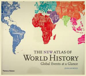
The new atlas of world history : global events at a glance
Features 55 colour maps that cover the whole of human history, from 6 million years ago to present. Timelines include important cultures, events, and developments. Maps and timelines also come with concise introductions that summarize key data such as the world's five largest cities and total world population for the relevant year. An extensive glossary of peoples, nations and cultures gives added depth to the maps and timelines.
Book

A History of the World in 12 Maps
Author Jerry Brotton's book dips into maps spanning millenia of human experience, from Ptolemy's Geography (circa 150 AD) all the way up to Google Earth, the dynamic, increasingly omnipresent Internet Age way that we answer the age-old question \"Where am I?\" As Brotton travels through his dozen maps, he leaps like a Timelord from place to place and era to era; now in 19th-century London, now in medieval Korea, now in Spain during the Age of Discovery.
Newspaper Article

History of the world map by map
\"A uniquely illustrated guide to the history of our world Witness our incredible human story unfold - from the very first people in Africa to the collapse of Communism and beyond - exquisitely charted map by map. Come on a journey through global history, told in more than 130 specially made maps that each offer a window on a key event. Step into the action and follow Ghengis Khan sweeping through China, Napoleon conquering Europe, or two world wars raging across the globe. See empires rise and fall - from the Egyptians and the Aztecs to the British Empire and the Soviet Union. History of the World Map by Map also explains how elements of civilization, such as writing, printing, and tool-making, came into being and spread from one country to another. It tells of the rise of the world's great religions and of human endeavour such as the voyages of early explorers. It charts stories of adversity such as the abolition of slavery, and shows how people have always migrated for a better life, from the very first humans moving across Africa, to millions of 19th-century Europeans crossing the Atlantic in search of the American dream. Endorsed by renowned broadcaster, historian, and author Peter Snow, this is an unmissable visual guide to ancient, medieval, and modern history in all corners of the world. This updated edition contains eight pages of brand new maps, and has been reviewed and updated for diversity and inclusion\"--Publisher's description.
BOOK

Maps navigate power, conceit of the times
Beginning with Ptolemy and his landmark 150 AD treatise, \"Guide to Geography,\" Brotton, professor of Renaissance studies at Queen Mary University of London, marches through time, surveying ancient Greek, Muslim, Chinese, and Christian mapmaking traditions, and the emergence of modern cartography.
Newspaper Article