Catalogue Search | MBRL


Are you sure you want to remove the book from the shelf?

{{itemTitle}}
16
result(s) for
"inuit settlement patterns"
Sort by:
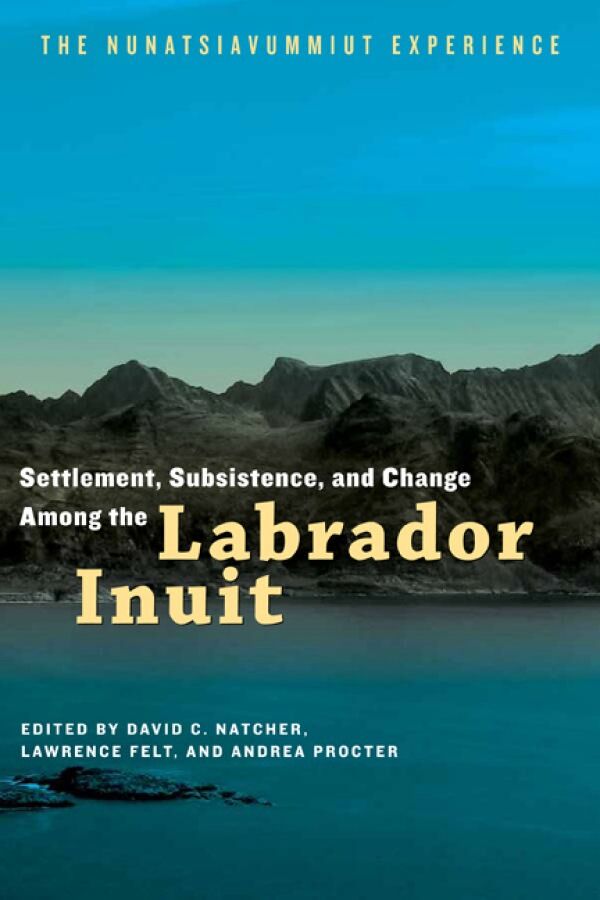
Settlement, Subsistence, and Change Among the Labrador Inuit
On January 22, 2005, Inuit from communities throughout northern and central Labrador gathered in a school gymnasium to witness the signing of the Labrador Inuit Land Claim Agreement and to celebrate the long-awaited creation of their own regional self-government of Nunatsiavut. This historic agreement defined the Labrador Inuit settlement area, beneficiary enrollment criteria, and Inuit governance and ownership rights. Settlement, Subsistence, and Change Among the Labrador Inuit explores how these boundaries—around land, around people, and around the right to self-govern—reflect the complex history of the region, of Labrador Inuit identity, and the role of migration and settlement patterns in regional politics. Comprised of twelve essays, the book examines the way of life and cultural survival of this unique indigenous population, including: household structure, social economy of wildfood production, forced relocations and land claims, subsistence and settlement patterns, and contemporary issues around climate change, urban planning, and self-government.
eBook

Paleogeography of Human Settlement at Iqaluktuuq, Victoria Island, Nunavut
Change in sea levels, be they isostatic or eustatic, impact humans and the paleogeography they inhabit. In this paper we examine paleogeography at Iqaluktuuq, a section of the Ekalluk River, Victoria Island, Nunavut, between Tahiryuaq (Ferguson Lake) and Wellington Bay. The area’s isostatic rebound impacted the Ekalluk River’s development and the use of the area by two essential subsistence resources, Arctic char (Salvelinus alpinus) and caribou (Rangifer tarandus). This, in turn, impacted the choices of Pre-Dorset, Middle and Late Dorset, and Thule/Inuit people regarding site locations. A new relative sea-level curve developed using calibrated radiocarbon dates on marine shells and terrestrial material from archaeological sites is produced for Iqaluktuuq. Based on the data, large scale (1:50,000) paleogeography maps are presented for the period of human occupation of Iqaluktuuq, 3100 calibrated years Before Present (B.P. cal) to present, revealing how paleogeography impacts people’s settlement choices.
Journal Article

Present and past dynamics of Inughuit resource spaces
Information from a collaborative GPS tracking project, Piniariarneq, involving 17 occupational hunters from Qaanaaq and Savissivik, Northwest Greenland, is used to explore the resource spaces of hunters in Avanersuaq today. By comparison with historical records from the time of the Thule Trading Station and the decades following its closure, we reveal a marked variability in resource spaces over time. It is argued that the dynamics of resources and resource spaces in Thule are not underlain by animal distribution and migration patterns, or changes in weather and sea ice conditions alone; but also by economic opportunities, human mobility, settlement patterns, particular historical events and trajectories, and not least by economic and political interests developed outside the region.
Journal Article

Influenza-Associated Mortality during the 1918-1919 Influenza Pandemic in Alaska and Labrador: A Comparison
Some of the most severely affected communities in the world during the 1918-19 influenza pandemic were in Labrador and Alaska. Although these two regions are on the opposite ends of North America, a cultural continuum in the Inuit populations extends throughout the North American Arctic. Both regions contain other population groups, however, and because of these similarities and differences, a comparison of their experiences during the pandemic provides new insights into how culture and environment may influence patterns of spread of infectious disease. We describe here analyses of the patterns of influenza mortality in 97 Alaska communities and 37 Labrador communities. The Alaska communities are divided into five geographic regions corresponding to recognized cultural groups in the region; the Labrador communities are separated into three regions that vary in the degree of admixture between European and indigenous (primarily Inuit) groups. In both Alaska and Labrador mortality was substantially higher than the worldwide average of 2.5-5 percent. Average mortality ranged from less than 1 percent to 38 percent at the regional level in Alaska and from 1 percent to 75 percent at the regional level in Labrador with up to 90 percent mortality in some local communities in both Alaska and Labrador. A number of factors influencing this heterogeneous experience are discussed, including the impact of weather and geography; attempts to protect communities by implementing quarantine policies; accessibility of health care; nutritional deficiencies; cultural factors, such as settlement patterns, seasonal activities, and ethnicity; and exposure to earlier outbreaks of influenza or other diseases that may have increased or lessened the impact of influenza in 1918-19. Adapted from the source document.
Journal Article

Paleoeskimo Demography on Western Victoria Island, Arctic Canada: Implications for Social Organization and Longhouse Development
Paleoeskimo populations on western Victoria Island reached maximum levels in Early Pre-Dorset time and declined abruptly shortly after 3800 ¹⁴C years BP. The largest subsequent recovery occurred during Dorset time, particularly during Late Dorset, about 1500 to 600 BP. Early Pre-Dorset settlement patterns were similar to those documented for the same period and culture elsewhere in Arctic Canada, with dispersed nuclear families and small extended families occupying the region for most of the year, but with annual aggregations producing sites with 15 or more dwellings. After 3800 BP, large Pre-Dorset aggregation sites are absent. Dorset settlement patterns are dominated by multi-family longhouse-hearth row aggregation sites and by sites with two to four dwellings. Possibly the Dorset were living mainly in snow dwellings on the sea ice during cold seasons, with longhouses and hearth-row sets representing coming-ashore aggregations. Architectural aspects of longhouses and hearth rows indicate a common purpose behind their construction and use throughout the region and apparently throughout Arctic Canada, but their place and time of origin remain obscure. Radiocarbon dates place most longhouses and hearth rows on western Victoria Island in Late Dorset time, as elsewhere, but some dates indicate that these structures were being used in the western Canadian Arctic by Middle Dorset time. The latest Dorset radiocarbon dates from the region overlap with the earliest of the more reliable dates on Thule houses. Les populations paléoesquimaudes de l'ouest de l'île Victoria ont atteint leur summum à l'époque pré-Dorset puis ont chuté rapidement peu après 3800 années radiocarbones ,BP. Par la suite, la plus grande reprise s'est produite à l'époque du Dorset, plus particulièrement vers la fin de celui-ci, soit entre 1500 et 600 BP. Les types de peuplements du début du Dorset étaient semblables à ceux documentés pour la même période et pour la même culture ailleurs dans l'Arctique canadien, c'est-: à-dire qu'il y avait des familles nucléaires dispersées et des petites familles étendues qui occupaient la région pendant la plus grande partie de l'année, ainsi que des agrégations annuelles composées de 15 habitations ou plus. Après 3800 BP, il y a absence de grandes agrégations telles qu'au pré-Dorset. Pendant le Dorset, les types de peuplements sont dominés par des maisons longues multifamiliales et des rangées de foyers, ainsi que par des sites de deux à quatre habitations. Il est possible qu'à l'époque du Dorset, les occupants vivaient surtout dans des habitations en neige placées sur la glace de mer en saison froide, tandis que les maisons longues et les rangées de foyers étaient installées sur la terre. Les caractéristiques architecturales des maisons longues et des rangées de foyers indiquent que leur construction et leur utilisation avaient une raison d'être commune au sein de la région et apparemment dans l'Arctique canadien, mais leur emplacement et le moment de leur origine demeurent obscurs. D'après la datation au radiocarbone, la plupart des maisons longues et des rangées de foyers de l'ouest de l'île Victoria remontent au Dorset tardif, comme ailleurs, mais certaines dates indiquent que ces structures étaient utilisées dans l'ouest de l'Arctique canadien vers le Dorset moyen. La datation au radiocarbone du Dorset tardif effectuée dans la région chevauche la plus ancienne des dates les plus fiables établies relativement aux habitations de Thulé.
Journal Article

Labrador Inuit Subsistence in the Context of Environmental Change: An Initial Landscape History Perspective
In this article, I examine the subsistence economy of the contact-period Labrador Inuit (17th to 19th century) to investigate the relationships of elements of specific cultural changes to environmental change, the effects of cultural interactions, and internal social processes. I apply paleoclimate and sea-ice records and zooarchaeological studies of life history and seasonality of ecologically sensitive species to reconstruct histories of change in particular elements of the physical landscape and of their use. I associate the use of communal houses by the Labrador Inuit and their modification of settlement patterns during the 18th century to a limited phase of environmental moderation and stability during the Little Ice Age and suggest that these changes reflect, in part, economic strategies oriented toward surplus production.
Journal Article
Influenza-Associated Mortality during the 1918–1919 Influenza Pandemic in Alaska and Labrador: A Comparison
Some of the most severely affected communities in the world during the 1918–19 influenza pandemic were in Labrador and Alaska. Although these two regions are on the opposite ends of North America, a cultural continuum in the Inuit populations extends throughout the North American Arctic. Both regions contain other population groups, however, and because of these similarities and differences, a comparison of their experiences during the pandemic provides new insights into how culture and environment may influence patterns of spread of infectious disease. We describe here analyses of the patterns of influenza mortality in 97 Alaska communities and 37 Labrador communities. The Alaska communities are divided into five geographic regions corresponding to recognized cultural groups in the region; the Labrador communities are separated into three regions that vary in the degree of admixture between European and indigenous (primarily Inuit) groups. In both Alaska and Labrador mortality was substantially higher than the worldwide average of 2.5–5 percent. Average mortality ranged from less than 1 percent to 38 percent at the regional level in Alaska and from 1 percent to 75 percent at the regional level in Labrador with up to 90 percent mortality in some local communities in both Alaska and Labrador. A number of factors influencing this heterogeneous experience are discussed, including the impact of weather and geography; attempts to protect communities by implementing quarantine policies; accessibility of health care; nutritional deficiencies; cultural factors, such as settlement patterns, seasonal activities, and ethnicity; and exposure to earlier outbreaks of influenza or other diseases that may have increased or lessened the impact of influenza in 1918–19.
Journal Article

The End of the Kachemak Tradition on the Kenai Peninsula, Southcentral Alaska
The Kachemak tradition was established by ca. 3000 B.P. in Kachemak Bay. Probably somewhat later a variant termed Riverine Kachemak, with a population adapted to salmon and terrestrial resources, appeared on the northern Kenai Peninsula. The Kachemak tradition people seem to have abandoned Kachemak Bay by ca. 1400 B.P. Seven of 12 available Kachemak tradition dates predate 1400 B.P. even at two sigma. Scattered younger dates are thus suspect outliers. The end of Riverine Kachemak tradition has been placed at ca. 1000 B.P., at which time the population was supposedly replaced by in-migrating groups ancestral to the Dena'ina Athapaskans. Close examination of the numerous available radiocarbon dates shows that most Riverine Kachemak dates cluster in the early centuries of the First Millennium A.D. and most Dena'ina dates substantially postdate 1000 A.D. Probably the Riverine Kachemak and Dena'ina peoples never met on the Kenai River. However, the correspondence in date ranges between Kachemak Bay and Riverine Kachemak is striking, suggesting their fates were linked. Both traditions collapsed by 1400–1500 B.P. The causes are probably multiple but do not include cultural replacement.
Journal Article
Archaeological Survey of Eastern Inglefield Land, Northwest Greenland
Archaeological survey by foot, boat, and helicopter was undertaken in the eastern portion of Inglefield Land, northwestern Greenland. Although the research interests of the Inglefield Land Archaeology Project (ILAP) are focused on the late Thule-early Historic contact period, all cultural features were documented. A total of 1376 features, including winter houses, tent rings, fox traps, caches, hearths, kayak stands, and burials were recorded during pedestrian survey of three broad regions, which represent the entire culture history of the High Arctic from ca. 4200 years ago to modern use of the region by Inughuit hunters. Settlement pattern analysis suggests greater use of easternmost Inglefield Land by Paleoeskimo inhabitants compared to Thule/Historic groups and overall more short-term occupation (i. e., hunting forays) during the Paleoeskimo period. Thule winter houses are concentrated in the Glacier and Marshall Bay regions and secondarily at Cape Grinnell.
Journal Article

Is the Arctic really urbanising?
Abstract
The anthropology of the Arctic (Inuit) societies is increasingly acknowledging a general urbanising trend throughout the region, encompassing small-scale, localized, communities as well as towns and cities. Inuit migrate to cities outside the Arctic and live in the North under circumstances strongly tinged by urbanism. Policy and academic literature suggests that there is an increasingly close relation between Arctic residents and cities. After an historic overview of permanent settlement in Nunavut and Greenland to illustrate the structural integration of Arctic societies, this article points to the fact that urbanisation follows historically specific trajectories and creates different urban situations. The author discusses the relevance of the concepts “urbanisation” and “urbanism” to the Arctic, and proposes an urban anthropological perspective that offers a productive way to approach the globalised social and cultural realities of the contemporary Arctic.
Journal Article