Catalogue Search | MBRL


Are you sure you want to remove the book from the shelf?

{{itemTitle}}
261
result(s) for
"movement corridors"
Sort by:
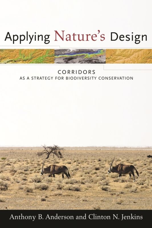
Applying nature's design
The fragmenting of habitats is endangering animal populations and degrading or destroying many plant populations throughout the world. To address this problem, conservationists have increasingly turned to biological corridors, areas of land set aside to facilitate the movement of species and ecological processes. However, while hundreds of corridor initiatives are under way worldwide, there is little practical information to guide their design, location, and management. \"Applying Nature's Design\" offers a comprehensive overview of current knowledge on corridors, their design, and their implementation. Anthony B. Anderson and Clinton N. Jenkins examine a variety of conceptual and practical issues associated with corridors and provide detailed case studies from around the world. Their work considers how to manage and govern corridors, how to build support among various interest groups for corridors, and the obstacles to implementation. In addition to assessing various environmental and ecological challenges, the authors are the first to consider the importance of socioeconomic and political issues in creating and maintaining corridors.
eBook

USING CIRCUIT THEORY TO MODEL CONNECTIVITY IN ECOLOGY, EVOLUTION, AND CONSERVATION
Connectivity among populations and habitats is important for a wide range of ecological processes. Understanding, preserving, and restoring connectivity in complex landscapes requires connectivity models and metrics that are reliable, efficient, and process based. We introduce a new class of ecological connectivity models based in electrical circuit theory. Although they have been applied in other disciplines, circuit-theoretic connectivity models are new to ecology. They offer distinct advantages over common analytic connectivity models, including a theoretical basis in random walk theory and an ability to evaluate contributions of multiple dispersal pathways. Resistance, current, and voltage calculated across graphs or raster grids can be related to ecological processes (such as individual movement and gene flow) that occur across large population networks or landscapes. Efficient algorithms can quickly solve networks with millions of nodes, or landscapes with millions of raster cells. Here we review basic circuit theory, discuss relationships between circuit and random walk theories, and describe applications in ecology, evolution, and conservation. We provide examples of how circuit models can be used to predict movement patterns and fates of random walkers in complex landscapes and to identify important habitat patches and movement corridors for conservation planning.
Journal Article

Spatially structured statistical network models for landscape genetics
A basic understanding of how the landscape impedes, or creates resistance to, the dispersal of organisms and hence gene flow is paramount for successful conservation science and management. Spatially structured ecological networks are often used to represent spatial landscape-genetic relationships, where nodes represent individuals or populations and resistance to movement is represented using non-binary edge weights. Weights are typically assigned or estimated by the user, rather than observed, and validating such weights is challenging. We provide a synthesis of current methods used to estimate edge weights and an overview of common model types, stressing the advantages and disadvantages of each approach and their ability to model landscape-genetic data. We further explore a set of spatial-statistical methods that provide ecologists with alternative approaches for modeling spatially explicit processes that may affect genetic structure. This includes an overview of spatial autoregressive models, with a particular focus on how correlation and partial correlation are used to represent neighborhood structure with the inverse of the covariance matrix (i.e., precision matrix). We then demonstrate how to model resistance by specifying an appropriate statistical model on the nodes, conditioned on the edge weights, through the precision matrix. This integration of network ecology and spatial statistics provides a practical analytical framework for landscape-genetic studies. The results can be used to make statistical inferences about the relative importance of individual landscape characteristics, such as the vegetative cover, hillslope, or the presence of roads or rivers, on gene flow. In addition, the R code we include allows readers to explore landscape-genetic structure in their own datasets, which will potentially provide new insights into the evolutionary processes that generated ecological networks, as well as valuable information about the optimal characteristics of conservation corridors.
Journal Article

Modelling jaguar gene flow in fragmented landscapes offers insights into functional population connectivity
Context
Preserving functional connectivity is a conservation priority to secure the long-term viability of geographically dispersed subpopulations, such as the jaguar (
Panthera onca
) populations in Central America. However, managing connectivity in this region is limited due to the scarcity of local assessments of the connectivity between existing populations, some of which exhibit low levels of gene flow and genetic admixture.
Objectives
We selected the jaguar as a model species to understand how gene flow of large carnivores is shaped in a heavily human-impacted landscape in the Neotropics. We assessed the impact of landscape features and spatial scale on jaguar gene flow across northern Central America, predicted synoptic, landscape-wide functional connectivity across the region; and compared connectivity predictions based on models of gene flow, habitat suitability, and expert knowledge.
Methods
We employed genetic data based on 335 faecal samples collected from 72 individual jaguars. We parameterized gene flow resistance surfaces using linear mixed effects models and the maximum likelihood population-effects method. We evaluated nine landscape variables at six spatial scales, selecting the optimal scale and transformation for each variable according to univariate models and AIC. To predict jaguar gene flow, we developed multivariate models and implemented resistant kernels to forecast functional connectivity between jaguar populations across the study region under three dispersal distance scenarios. Furthermore, we compared the connectivity estimates based on gene flow against those based on habitat suitability and the corridors delineated by expert knowledge in the region.
Results
Low resistance to jaguar gene flow was associated with greater tree cover and vegetation, lower areas of built-up, and intermediate distances from water bodies. Notably, tree cover affected jaguar gene flow on a smaller scale compared to the rest of variables. Higher connectivity, indicated by lower resistance, was found within and around the largest jaguar conservation units (JCUs) such as the Reserva-de-Biosfera-Transfronteriza, Selva-Maya and Maya-Mountains. This contrasted with the smallest JCUs, like Sierra-Santa-Cruz and Sierra-de-las-Minas in eastern Guatemala, and Cordillera-Nombre-de-Dios in Honduras. Across the region, lower connectivity was observed in the Caribbean connection between eastern Guatemala and midwestern Honduras, as well as in the Honduran and Nicaraguan Miskito area. Models based on gene flow and habitat suitability were similar in their predictions of areas of high connectivity; however, the habitat suitability models predicted larger areas of low connectivity than did the gene flow models. Moreover, the expert knowledge corridors were consistent with areas of high and medium connectivity as predicted by the gene flow model.
Conclusions
Gene flow of jaguars is positively driven by the presence of forest and water sources, while human impact (built-up and non-vegetation areas) has a negative effect. Areas of lowest resistance largely correspond to the location of JCUs, which serve as crucial reservoirs of high-quality jaguar habitat within the region. While the largest JCU in the region displayed high connectivity, the low connectivity between the smallest JCUs (i.e. Sierra-Santa-Cruz, Sierra-de-las-Minas and Cordillera-Nombre-de-Dios) underscores the need for conservation attention in these areas. Conservation and management actions such as habitat loss-prevention/restoration and anthropogenic impact mitigation should be prioritized in the binational region of Guatemala-Honduras, a key connectivity bottleneck between the species’ northern and southern ranges. Similarly, attention is warranted in the Honduran-Nicaraguan Miskito area.
Journal Article

Identifying and Prioritizing Ungulate Migration Routes for Landscape-Level Conservation
As habitat loss and fragmentation increase across ungulate ranges, identifying and prioritizing migration routes for conservation has taken on new urgency. Here we present a general framework using the Brownian bridge movement model (BBMM) that: (1) provides a probabilistic estimate of the migration routes of a sampled population, (2) distinguishes between route segments that function as stopover sites vs. those used primarily as movement corridors, and (3) prioritizes routes for conservation based upon the proportion of the sampled population that uses them. We applied this approach to a migratory mule deer (Odocoileus hemionus) population in a pristine area of southwest Wyoming, USA, where 2000 gas wells and 1609 km of pipelines and roads have been proposed for development. Our analysis clearly delineated where migration routes occurred relative to proposed development and provided guidance for on-the-ground conservation efforts. Mule deer migration routes were characterized by a series of stopover sites where deer spent most of their time, connected by movement corridors through which deer moved quickly. Our findings suggest management strategies that differentiate between stopover sites and movement corridors may be warranted. Because some migration routes were used by more mule deer than others, proportional level of use may provide a reasonable metric by which routes can be prioritized for conservation. The methods we outline should be applicable to a wide range of species that inhabit regions where migration routes are threatened or poorly understood.
Journal Article

Arthropod traits and assemblages differ between core patches, transient stepping-stones and landscape corridors
ContextRestoring landscape connectivity can mitigate fragmentation and improve population resilience, but functional equivalence of contrasting elements is poorly understood. Evaluating biodiversity outcomes requires examining assemblage-responses across contrasting taxa.ObjectivesWe compared arthropod species and trait composition between contrasting open-habitat network elements: core patches, corridors (allowing individual dispersal and population percolation), and transient stepping-stones (potentially enhancing meta-population dynamics).MethodsCarabids and spiders were sampled from core patches of grass-heath habitat (n = 24 locations across eight sites), corridors (trackways, n = 15) and recently-replanted clear-fells (transient patches, n = 19) set in a forest matrix impermeable to open-habitat arthropods. Species and trait (habitat association, diet, body size, dispersal ability) composition were compared by ordination and fourth corner analyses.ResultsEach network element supported distinct arthropod assemblages with differing functional trait composition. Core patches were dominated by specialist dry-open habitat species while generalist and woodland species contributed to assemblages in connectivity elements. Nevertheless, transient patches (and to a lesser degree, corridors) supported dry-open species characteristic of the focal grass-heath sites. Trait associations differed markedly among the three elements. Dispersal mechanisms and their correlates differed between taxa, but dry-open species in transient patches were characterised by traits favouring dispersal (large running hunter spiders and large, winged, herbivorous carabids), in contrast to wingless carabids in corridors.ConclusionsCore patches, dispersal corridors and transient stepping-stones are not functionally interchangeable within this system. Semi-natural core patches supported a filtered subset of the regional fauna. Evidence for enhanced connectivity through percolation (corridors) or meta-population dynamics (stepping stones) differed between the two taxa.
Journal Article

Stopover ecology of a migratory ungulate
1. Birds that migrate long distances use stopover sites to optimize fuel loads and complete migration as quickly as possible. Stopover use has been predicted to facilitate a time-minimization strategy in land migrants as well, but empirical tests have been lacking, and alternative migration strategies have not been considered. 2. We used fine-scale movement data to evaluate the ecological role of stopovers in migratory mule deer Odocoileus hemionus — a land migrant whose fitness is strongly influenced by energy intake rather than migration speed. 3. Although deer could easily complete migrations (range 18—144 km) in several days, they took an average of 3 weeks and spent 95% of that time in a series of stopover sites that had higher forage quality than movement corridors. Forage quality of stopovers increased with elevation and distance from winter range. Mule deer use of stopovers corresponded with a narrow phenological range, such that deer occupied stopovers 44 days prior to peak green-up, when forage quality was presumed to be highest. Mule deer used one stopover for every 5·3 and 6·7 km travelled during spring and autumn migrations, respectively, and used the same stopovers in consecutive years. 4. Study findings indicate that stopovers play a key role in the migration strategy of mule deer by allowing individuals to migrate in concert with plant phenology and maximize energy intake rather than speed. Our results suggest that stopover use may be more common among non-avian taxa than previously thought and, although the underlying migration strategies of temperate ungulates and birds are quite different, stopover use is important to both. 5. Exploring the role of stopovers in land migrants broadens the scope of stopover ecology and recognizes that the applied and theoretical benefits of stopover ecology need not be limited to avian taxa.
Journal Article
Assessing the effects of land-use intensity on small mammal community composition and genetic variation in Myodes glareolus and Microtus arvalis across grassland and forest habitats
Context
Land-use intensification can alter small mammal community composition and induce loss of genetic variation in remaining populations. Fragmented landscapes favor generalist and synanthropic species, which are potential reservoirs of pathogens and pose risks to agriculture and forestry.
Objectives
This study aimed to evaluate the effects of land-use intensity on small mammal diversity in grassland and forest habitats, as well as on genetic variation patterns driven by geographic (isolation by distance) and environmental distance (isolation by resistance) factors.
Methods
We analysed differences in small mammal community diversity on grassland and forest plots with varying land-use intensities. Genetic analyses were conducted on
Myodes glareolus
and
Microtus arvalis
populations from each habitat, using microsatellites. Maximum Likelihood Population Effects models were employed to elucidate gene flow patterns and significant differences in genetic structure based on land-use intensity.
Results
Small mammal communities in grasslands were significantly less diverse than in forests. Land-use intensity had a significant effect on diversity within grassland but not within forest habitats.
M. glareolus
showed three genetic groups, while
M. arvalis
displayed no discernible population structure or landscape-related pattern. Land-use intensity did not significantly influence the genetic structure of either species. Gene flow in
M. glareolus
is best described by the IBR model.
Conclusion
Land-use intensity significantly affects small mammal community composition, particularly in grasslands. Neither species' genetics is directly impacted by land-use intensity but rather by landscape connectivity and distance. Risk assessments for rodent-borne zoonotic pathogens and crop damage should be framed within a habitat connectivity context.
Journal Article
Applying network theory to animal movements to identify properties of landscape space use
Network (graph) theory is a popular analytical framework to characterize the structure and dynamics among discrete objects and is particularly effective at identifying critical hubs and patterns of connectivity. The identification of such attributes is a fundamental objective of animal movement research, yet network theory has rarely been applied directly to animal relocation data. We develop an approach that allows the analysis of movement data using network theory by defining occupied pixels as nodes and connection among these pixels as edges. We first quantify node-level (local) metrics and graph-level (system) metrics on simulated movement trajectories to assess the ability of these metrics to pull out known properties in movement paths. We then apply our framework to empirical data from African elephants (Loxodonta africana), giant Galapagos tortoises (Chelonoidis spp.), and mule deer (Odocoileous hemionus). Our results indicate that certain node-level metrics, namely degree, weight, and betweenness, perform well in capturing local patterns of space use, such as the definition of core areas and paths used for inter-patch movement. These metrics were generally applicable across data sets, indicating their robustness to assumptions structuring analysis or strategies of movement. Other metrics capture local patterns effectively, but were sensitive to specified graph properties, indicating case specific applications. Our analysis indicates that graph-level metrics are unlikely to outperform other approaches for the categorization of general movement strategies (central place foraging, migration, nomadism). By identifying critical nodes, our approach provides a robust quantitative framework to identify local properties of space use that can be used to evaluate the effect of the loss of specific nodes on range wide connectivity. Our network approach is intuitive, and can be implemented across imperfectly sampled or large-scale data sets efficiently, providing a framework for conservationists to analyze movement data. Functions created for the analyses are available within the R package moveNT.
Journal Article

Improving urban flyways for bats: the importance of tree canopy structure
Urbanization can hinder movement and restrict landscape permeability for wildlife. However, there is the potential to improve landscape connectivity by establishing and maintaining movement corridors throughout urban areas. One way to achieve this is through the urban forest; the collection of trees in an urban area. Specifically, it is the characteristics of trees within this forest that can provide the structural and functional connectivity that enables wildlife to move effectively through urban areas. To investigate this, we explored the influence of four tree characteristics, alone and in combination, on bat commuting activity along 30 potential movement corridors in an urban setting in north central Texas. Along 10, 30, and 50 m corridor sections, we calculated percent canopy cover, maximum gap distance between canopies, and canopy rugosity using a 60 cm resolution tree canopy layer, while maximum tree height was determined in situ. We then conducted behavioral observations using thermal cameras and acoustic monitoring along the 10 m section of each site between March and September of 2022 and 2023 to determine the amount of time bats were observed commuting/h and species present. Our analysis revealed that increasing percent canopy cover and rugosity positively influenced commuting activity up to a certain threshold (> 60% and > 1.3, respectively), beyond which they may became detrimental. In contrast, the presence of gaps in the canopy lowered commuting, while tree heights > 11 m increased this activity. When considered together, bats in our study area showed a preference for commuting routes with tall trees and straighter, less cluttered canopies with no gaps. Additionally, sites with these features had a greater species diversity. These findings suggest that we can manage and plan the urban forest by establishing an interconnecting network of tree‐lines and forest edges to enhance landscape permeability for bats and subsequently aid urban bat conservation.
Journal Article