
Catalogue Search | MBRL


Are you sure you want to remove the book from the shelf?

{{itemTitle}}
91
result(s) for
"salish sea"
Sort by:


The Nature of Borders
For centuries, borders have been central to salmon management customs on the Salish Sea, but how those borders were drawn has had very different effects on the Northwest salmon fishery. Native peoples who fished the Salish Sea--which includes Puget Sound in Washington State, the Strait of Georgia in British Columbia, and the Strait of Juan de Fuca--drew social and cultural borders around salmon fishing locations and found ways to administer the resource in a sustainable way. Nineteenth-century Euro-Americans, who drew the Anglo-American border along the forty-ninth parallel, took a very different approach and ignored the salmon's patterns and life cycle. As the canned salmon industry grew and more people moved into the region, class and ethnic relations changed. Soon illegal fishing, broken contracts, and fish piracy were endemic--conditions that contributed to rampant overfishing, social tensions, and international mistrust. The Nature of Borders is about the ecological effects of imposing cultural and political borders on this critical West Coast salmon fishery.
This transnational history provides an understanding of the modern Pacific salmon crisis and is particularly instructive as salmon conservation practices increasingly approximate those of the pre-contact Native past. The Nature of Borders reorients borderlands studies toward the Canada-U.S. border and also provides a new view of how borders influenced fishing practices and related management efforts over time.
Watch the book trailer: http://www.youtube.com/watch?v=7ffLPgtCYHA&feature=channel_video_title
eBook

Explore the Salish Sea : a nature guide for kids
\"Discover the Salish Sea and learn about its vibrant ecosystem in this engaging non-fiction narrative that inspires outdoor exploration. Filled with full-color photography, this book covers wildlife habitats, geodiversity, intertidal and subtidal sea life, and highlights what is unique to this Pacific Northwest ecosystem\"-- Provided by publisher.
Book

Simulation of annual biogeochemical cycles of nutrient balance, phytoplankton bloom(s), and DO in Puget Sound using an unstructured grid model
Nutrient pollution from rivers, nonpoint source runoff, and nearly 100 wastewater discharges is a potential threat to the ecological health of Puget Sound with evidence of hypoxia in some basins. However, the relative contributions of loads entering Puget Sound from natural and anthropogenic sources, and the effects of exchange flow from the Pacific Ocean are not well understood. Development of a quantitative model of Puget Sound is thus presented to help improve our understanding of the annual biogeochemical cycles in this system using the unstructured grid Finite-Volume Coastal Ocean Model framework and the Integrated Compartment Model (CE-QUAL-ICM) water quality kinetics. Results based on 2006 data show that phytoplankton growth and die-off, succession between two species of algae, nutrient dynamics, and dissolved oxygen in Puget Sound are strongly tied to seasonal variation of temperature, solar radiation, and the annual exchange and flushing induced by upwelled Pacific Ocean waters. Concentrations in the mixed outflow surface layer occupying approximately 5–20 m of the upper water column show strong effects of eutrophication from natural and anthropogenic sources, spring and summer algae blooms, accompanied by depleted nutrients but high dissolved oxygen levels. The bottom layer reflects dissolved oxygen and nutrient concentrations of upwelled Pacific Ocean water modulated by mixing with biologically active surface outflow in the Strait of Juan de Fuca prior to entering Puget Sound over the Admiralty Inlet. The effect of reflux mixing at the Admiralty Inlet sill resulting in lower nutrient and higher dissolved oxygen levels in bottom waters of Puget Sound than the incoming upwelled Pacific Ocean water is reproduced. By late winter, with the reduction in algal activity, water column constituents of interest, were renewed and the system appeared to reset with cooler temperature, higher nutrient, and higher dissolved oxygen waters from the Pacific Ocean.
Journal Article

Island in the Salish Sea
A picture book about the simple joys of spending summer vacation on an island in the Salish Sea with Gran.
Book
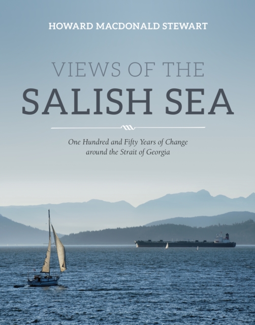
Views of the Salish Sea
It is not mere coincidence that two-thirds of the population of British Columbia occupies lands bordering its great inland sea, the Strait of Georgia, and connected waterways collectively known as the North Salish Sea. Averaging forty kilometres in width and stretching some three hundred kilometres from Vancouver and Victoria in the south to Powell River and Campbell River in the north, the North Salish Sea has long sheltered a bounty of habitable lands and rich maritime resources ideal for human settlement. While the region's intricate shoreline of peninsulas, promontories, estuaries and plains has been occupied by human communities for millennia, the last century and a half has been an unprecedented age of rapid colonization, industrialization and globalization. Many books have been written about individual communities and industries around the great waterway, but none have examined the region as a geographical unit with its own dynamic systems, which can best be understood as an interrelated whole. The Strait of Georgia has influenced human affairs, even as people have changed the Strait, in a complex relationship that continues today. British colonization and the commodification of the Strait's resources launched a resource rush around the sea that began in earnest in the decades before the First World War, often at the expense of Indigenous populations. Coal mining developed earliest and grew rapidly. Fishing, lumbering and metal mining were also established by the 1880s and soon experienced exponential growth. From the earliest salmon canneries to today's cruise ship industry, all have depended on the Strait to ensure economic prosperity and the easy movement of people and goods. As competition for space and resources increases, and as the effects of climate change are amplified, the pressure on this ecologically vulnerable area will only intensify. If this precious sea is to be passed to future generations with any semblance of its inherent richness and diversity intact, then it will need to be effectively managed and vigorously defended. The first step is to understand the complex story of the region, making this essential reading not only for history buffs but anyone with an interest in the future of British Columbia.
eBook


Hydrodynamic Zone of Influence Due to a Floating Structure in a Fjordal Estuary—Hood Canal Bridge Impact Assessment
Floating structures such as barges and ships affect near-field hydrodynamics and create a zone of influence (ZOI). Extent of the ZOI is of particular interest due to potential obstruction to and impact on out-migrating juvenile fish. Here, we present an assessment of ZOI from Hood Canal (Floating) Bridge, located within the 110-km-long fjord-like Hood Canal sub-basin in the Salish Sea, Washington. A field data collection program allowed near-field validation of a three-dimensional hydrodynamic model of Hood Canal with the floating bridge section embedded. The results confirm that Hood Canal Bridge, with a draft of 4.6 m covering ~85% of the width of Hood Canal, obstructs the brackish outflow surface layer. This induces increased local mixing near the bridge, causes pooling of water (up-current) during ebb and flood, and results in shadow/sheltering of water (down-current). The change in ambient currents, salinity, and temperature is highest at the bridge location and reduces to background levels with distance from the bridge. The ZOI extends ~20 m below the surface and varies from 2–3 km for currents, from 2–4 km for salinity, and from 2–5 km for temperature before the deviations with the bridge drop to <10% relative to simulated background conditions without the bridge present.
Journal Article
Salish Archipelago
The Salish Archipelago includes more than 400 islands in the Salish Sea, an amalgamation of Canada's Georgia Strait, the United States’ Puget Sound, and the shared Strait of Juan de Fuca. The Salish Sea and Islands are named for the Coast Salish Indigenous Peoples whose homelands extend across the region. Holiday homes and services have in many places displaced pristine ecosystems, Indigenous communities, and historic farms. Will age-old island environments and communities withstand the forces of commodity-driven economies? This new, major scholarly undertaking provides the geographical and historical background for exploring such questions. Salish Archipelago features sections on environment, history, society, and management, accompanied by numerous maps and other illustrations. This diverse collection offers an overview of an embattled, but resilient, region, providing knowledge and perspectives of interest to residents, educators, and policy makers.
eBook

Gelatinous and soft-bodied zooplankton in the Northeast Pacific Ocean
Gelatinous and soft-bodied zooplankton (GZ) have long been considered to have low energetic value (‘trophic dead end hypothesis’) and be insufficient to sustain higher trophic levels. However, the nutritional composition and energy content of GZ are often poorly known for entire groups, ignoring species-, size-, and stage-specific differences. In this study, organic matter and elemental composition (carbon and nitrogen) were measured for >1000 specimens from 34 GZ species collected from neritic and oceanic waters of the Northeast Pacific between 2014 and 2020. Species included 3 gastropods, 16 hydrozoans, 2 nude ctenophores, 6 scyphozoans, 3 tentaculate ctenophores, and 4 thaliaceans. Organic content and elemental composition were used to estimate energy content using published conversion factors and differed between and within taxonomic classes. Size-dependent variability was shown for several species. Differences in organic content and elemental composition by development stage were observed in a salp and scyphomedusa species, highlighting the need to consider life cycle stages separately. The relative energy values of GZ were generally low and highly variable, although some taxa were comparable to crustaceans. The findings of the present study emphasise the need for a more detailed consideration of GZ in marine food web models and time series analyses, to take into account their inter- and intraspecific variability.
Journal Article