Catalogue Search | MBRL


Are you sure you want to remove the book from the shelf?

{{itemTitle}}
6,567
result(s) for
"terrestrial distribution"
Sort by:

Using ancillary data to model the terrestrial distribution of gopher frogs
An inherent challenge in managing rare or cryptic species is data deficiency. For this reason, ancillary data is a potentially valuable resource for generating key population estimates for priority species. We compiled ancillary commensal data collected between 1982 and 2020 during surveys of gopher tortoise (Gopherus polyphemus) burrows to estimate the terrestrial distribution of gopher frogs (Rana capito) from potential breeding wetlands. Gopher frogs were detected in gopher tortoise burrows 30‒3,879 m from identified wetlands. A global model of all records from all sites indicated that the probability of a gopher frog residing in a gopher tortoise burrow declined with increasing distance from a wetland. This pattern also held for 4 of 5 sites with a sufficient number of gopher frog detections to model independently. Based on the full data set, we estimated that 50%, 90%, and 99% of gopher frog observations occurred within 392 m, 1,019 m, and 2,752 m of the nearest wetland, respectively. Our results indicate a higher proportion of gopher frogs emigrate longer distances from wetlands than was previously reported using other methods, such as radio-telemetry. This information can directly assist with management decisions, notably the spatial extent for application of habitat management surrounding breeding wetlands. More generally, this study illustrates the capacity of ancillary data to fill data deficiencies for a rare and cryptic species and highlights the importance of these data.
Journal Article

Terrestrial distribution of pond-breeding salamanders around an isolated wetland
Terrestrial habitats surrounding isolated wetlands are a critical resource for many pond‐breeding amphibian species, yet few studies have examined the terrestrial distribution of post‐metamorphic juveniles and adults. We used an encircling drift fence at a breeding pond in conjunction with partial fences at 90, 172, and 332 m from the wetland to estimate the terrestrial distribution of adult marbled salamanders (Ambystoma opacum; four breeding seasons) and mole salamanders (A. talpoideum; two seasons), as well as the dispersion of newly metamorphosed A. opacum (one summer). For newly metamorphosed A. opacum, 79% emigrated <90 m from the wetland, and 8% moved beyond 172 m; movement distance was unrelated to body size. Distribution of adult A. opacum varied among years, with an average of 28% (range 23–31%) occurring beyond 172 m in all years. Averaged across two years, 51% of adult A. talpoideum occurred beyond 172 m. Lognormal models provided a good fit to both the juvenile and adult ambystomatid distributions, and parameters differed between age classes, sexes, species, and years within species. For adult A. opacum a buffer radius of 300 m or 340 m, depending on the year, is estimated to include 95% of adults; for A. talpoideum the estimate is 464 m or 501 m. A reanalysis of distribution data for seven ambystomatid species shows that a previous estimate of a 164‐m radius to protect 95% of a population underestimates the needed buffer radius by 185 m. Because our study wetland requires a nearly 500 m wide radius to protect 95% of its ambystomatid adults, preservation of similar communities may require much more surrounding terrestrial habitat than previously thought.
Journal Article

Point Cloud Based Mapping of Understory Shrub Fuel Distribution, Estimation of Fuel Consumption and Relationship to Pyrolysis Gas Emissions on Experimental Prescribed Burns
Forest fires spread via production and combustion of pyrolysis gases in the understory. The goal of the present paper is to understand the spatial location, distribution, and fraction (relative to the overstory) of understory plants, in this case, sparkleberry shrub, namely its degree of understory consumption upon burn, and to search for correlations between the degree of shrub consumption to the composition of emitted pyrolysis gases. Data were collected in situ at seven small experimental prescribed burns at Ft. Jackson, an army base in South Carolina, USA. Using airborne laser scanning (ALS) to map overstory tree crowns and terrestrial laser scanning (TLS) to characterize understory shrub fuel density, both pre- and postburn estimates of sparkleberry coverage were obtained. Sparkleberry clump polygons were manually digitized from a UAV-derived orthoimage of the understory and intersected with the TLS point cloud-derived rasters of pre- and postburn shrub fuel bulk density; these were compared in relation to overstory crown cover as well as to ground truth. Shrub fuel consumption was estimated from the digitized images; sparkleberry clump distributions were generally found to not correlate well to the overstory tree crowns, suggesting it is shade-tolerant. Moreover, no relationship was found between the magnitude of the fuel consumption and the chemical composition of pyrolysis gases, even though mixing ratios of 25 individual gases were measured.
Journal Article
Ultrahd Video/TV and Satellite Implications
Summary This chapter assesses evolving Ultra High Definition video in general (known as UltraHD) and Ultra High Definition Television (UHDTV) services in particular. UltraHD affords what has been called an immersive viewing experience. Coded video content conforming to the high efficiency video coding (HEVC) recommendation uses a common syntax. To achieve a subset of the complete syntax, flags, parameters, and other syntax elements are included in the bitstream that signal the presence or absence of syntactic elements that occur later in the bitstream. The bit rates required to support UltraHD can be very high, especially if full quality is desired. Uncompressed UtraHD would require more than 50 Gbps of bandwidth. The chapter looks at the opportunities for satellite operators in providing distribution services, as well as challenges and issues. Hybrid distribution, with satellite distribution complement by terrestrial transmission either over local cable/fiber facilities or by wireless technologies, is always an option.
Book Chapter

Size–Frequency Distribution of Terrestrial Leftover Planetesimals and S-complex Implanted Asteroids
The isotopic composition of meteorites linked to S-complex asteroids has been used to suggest that these asteroids originated in the terrestrial planet’s region, i.e., within 1.5 au, and later got implanted into the main asteroid belt (MAB). Dynamical models of planet formation support this view. Yet it remains to be demonstrated whether the currently observed size–frequency distribution (SFD) of S-complex bodies in the MAB can be reproduced via this implantation process. Here we studied the evolution of the SFD of planetesimals during the accretion of terrestrial planets with the code LIPAD self-consistently accounting for growth and fragmentation of planetesimals. In our simulations we vary the initial surface density of planetesimals, the gaseous disk lifetime, and the power slope of the initial planetesimals’ SFD. We compared the final SFDs of leftover planetesimals in the terrestrial planet region with the SFD of observed S-complex MAB objects (D > 100 km). We found that the SFDs of our planetesimal populations and that of S-complex MAB objects show very similar cumulative power index (i.e., q ≈ 3.15 in N(>D) ∝ D−q) for slopes in the diameter range 100 km < D < 400 km by the end of our simulations. Our results support the hypothesis of S-complex MAB implantation from the terrestrial planet forming region, assuming implantation is size independent, and imply that implantation efficiency is smaller than O (10–2–10–4) to avoid overimplantation of (4) Vesta-sized objects or larger.
Journal Article

Reflected Spectroscopy of Small Exoplanets II: Characterization of Terrestrial Exoplanets
A space telescope capable of high-contrast imaging has been recognized as the avenue toward finding terrestrial planets around nearby Sun-like stars and characterizing their potential habitability. It is thus essential to quantify the capability of reflected light spectroscopy obtained through direct imaging for terrestrial exoplanets, and existing work focused on planetary analogs of modern Earth. Here we go beyond Earth analogs and use a Bayesian retrieval algorithm, ExoReL R , to determine what we could learn about terrestrial exoplanets from their reflected light spectra. Recognizing the potential diversity of terrestrial exoplanets, our focus is to distinguish atmospheric scenarios without any a priori knowledge of the dominant gas. We find that, while a moderate-resolution spectrum in the optical band (0.4−1.0 μm) may sufficiently characterize a modern Earth analog, it would likely result in incorrect interpretation for planets similar to Archean Earth or having CO2-dominated atmospheres. Including observations in the near-infrared bands (1.0−1.8 μm) can prevent this error, determine the main component (N2, O2, or CO2), and quantify trace gases (H2O, O3, and CH4) of the atmosphere. These results are useful to define the science requirements and design the wavelength bandwidth and observation plans of exoplanet direct imaging missions in the future.
Journal Article

Terrestrial biodiversity threatened by increasing global aridity velocity under high-level warming
Global aridification is projected to intensify. Yet, our knowledge of its potential impacts on species ranges remains limited. Here, we investigate global aridity velocity and its overlap with three sectors (natural protected areas, agricultural areas, and urban areas) and terrestrial biodiversity in historical (1979 through 2016) and future periods (2050 through 2099), with and without considering vegetation physiological response to rising CO₂. Both agricultural and urban areas showed a mean drying velocity in history, although the concurrent global aridity velocity was on average +0.05/+0.20 km/yr−1 (no CO₂ effects/with CO₂ effects; “+” denoting wetting). Moreover, in drylands, the shifts of vegetation greenness isolines were found to be significantly coupled with the tracks of aridity velocity. In the future, the aridity velocity in natural protected areas is projected to change from wetting to drying across RCP (representative concentration pathway) 2.6, RCP6.0, and RCP8.5 scenarios. When accounting for spatial distribution of terrestrial taxa (including plants, mammals, birds, and amphibians), the global aridity velocity would be -0.15/-0.02 km/yr−1 (“-” denoting drying; historical), -0.12/-0.15 km/yr−1 (RCP2.6), -0.36/-0.10 km/yr−1 (RCP6.0), and -0.75/-0.29 km/yr−1 (RCP8.5), with amphibians particularly negatively impacted. Under all scenarios, aridity velocity shows much higher multidirectionality than temperature velocity, which is mainly poleward. These results suggest that aridification risks may significantly influence the distribution of terrestrial species besides warming impacts and further impact the effectiveness of current protected areas in future, especially under RCP8.5, which best matches historical CO₂ emissions [C. R. Schwalm et al., Proc. Natl. Acad. Sci. U.S.A. 117, 19656–19657 (2020)].
Journal Article

Climate, ecosystems, and planetary futures: The challenge to predict life in Earth system models
High-quality climate predictions are crucial for understanding the impacts of different greenhouse gas emission scenarios and for mitigating and adapting to the resulting climatic changes. Bonan and Doney review advances in Earth system models that include the terrestrial and marine biosphere. Such models capture interactions between physical and biological aspects of the Earth system. This provides insight into climate impacts of societal importance, such as altered crop yields, wildfire risk, and water availability. Further research is needed to better understand model uncertainties, some of which may be unavoidable, and to better translate observations into abstract model representations. Science , this issue p. eaam8328 Many global change stresses on terrestrial and marine ecosystems affect not only ecosystem services that are essential to humankind, but also the trajectory of future climate by altering energy and mass exchanges with the atmosphere. Earth system models, which simulate terrestrial and marine ecosystems and biogeochemical cycles, offer a common framework for ecological research related to climate processes; analyses of vulnerability, impacts, and adaptation; and climate change mitigation. They provide an opportunity to move beyond physical descriptors of atmospheric and oceanic states to societally relevant quantities such as wildfire risk, habitat loss, water availability, and crop, fishery, and timber yields. To achieve this, the science of climate prediction must be extended to a more multifaceted Earth system prediction that includes the biosphere and its resources.
Journal Article
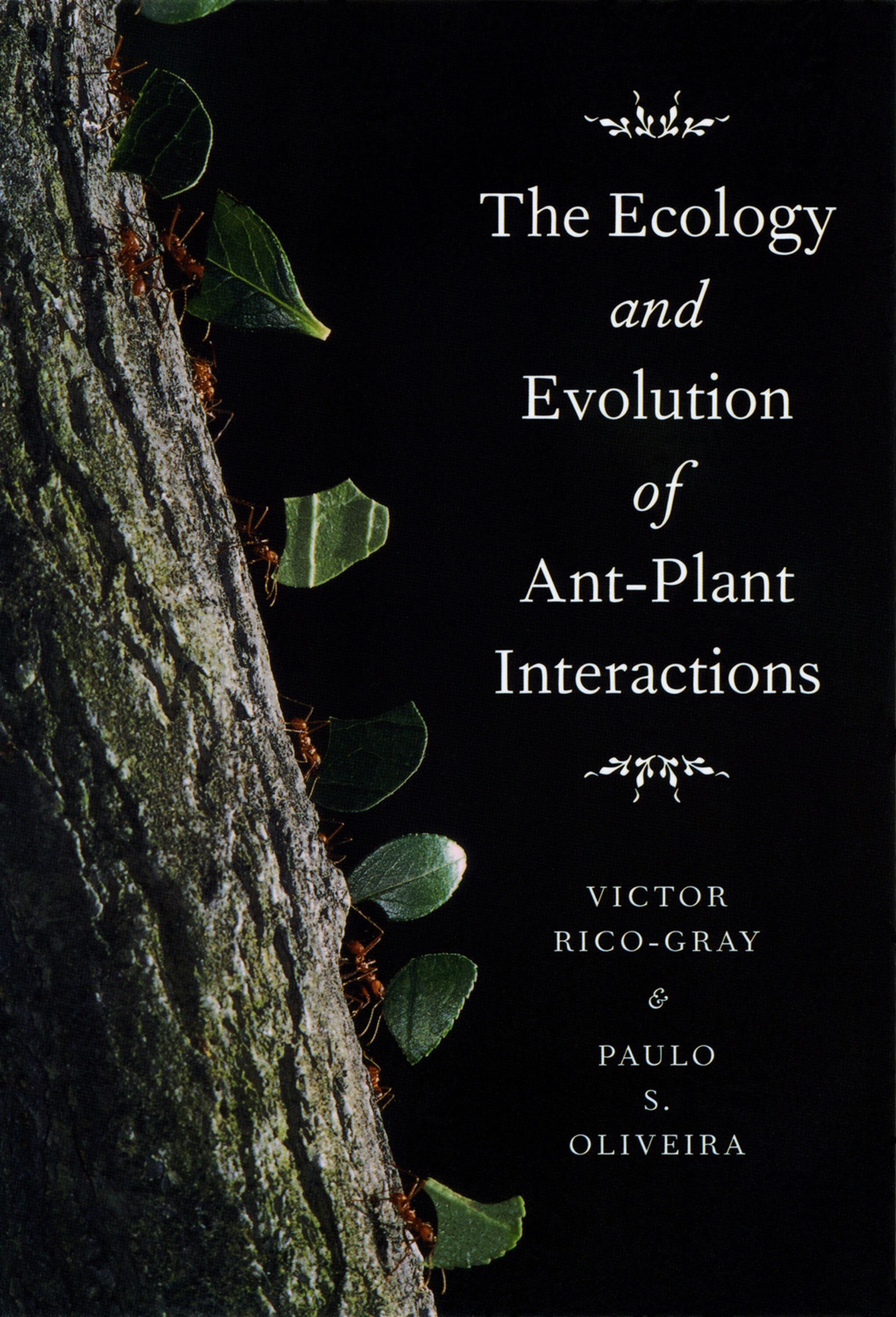
ecology and evolution of ant-plant interactions
Ants are probably the most dominant insect group on Earth, representing ten to fifteen percent of animal biomass in terrestrial ecosystems. Flowering plants, meanwhile, owe their evolutionary success to an array of interspecific interactions—such as pollination, seed dispersal, and herbivory—that have helped to shape their great diversity. The Ecology and Evolution of Ant-Plant Interactions brings together findings from the scientific literature on the coevolution of ants and plants to provide a better understanding of the unparalleled success of these two remarkable groups, of interspecific interactions in general, and ultimately of terrestrial biological communities. The Ecology and Evolution of Ant-Plant Interactions synthesizes the dynamics of ant-plant interactions, including the sources of variation in their outcomes. Victor Rico-Gray and Paulo S. Oliveira capture both the emerging appreciation of the importance of these interactions within ecosystems and the developing approaches that place studies of these interactions into a broader ecological and evolutionary context. The collaboration of two internationally renowned scientists, The Ecology and Evolution of Ant-Plant Interactions will become a standard reference for understanding the complex interactions between these two taxa.
eBook

Responses of terrestrial ecosystem phosphorus cycling to nitrogen addition: A meta-analysis
Aim: Anthropogenic additions of nitrogen (N) are expected to drive terrestrial ecosystems toward greater phosphorus (P) limitation. However, a comprehensive understanding of how an ecosystem's P cycle responds to external N inputs remains elusive, making model predictions of the anthropogenic P limitation and its impacts largely uncertain. Location: Global. Time period: 1986-2015. Major taxa studied: Terrestrial ecosystems. Methods: We conducted a meta-analysis including 288 independent study sites from 192 articles to evaluate global patterns and controls of 10 variables associated with ecosystem P cycling under N addition. Results: Overall, N addition increased biomass in plants (+34%) and litter (+15%) as well as plant P content (+17%), while decreasing P concentrations in plants and litter (-8% and -11%, respectively). N addition did not change soil labile P or microbial P, but enhanced phosphatase activity (+24%). The effects of N addition on the litter P pool and soil total P remained unclear due to significant publication biases. The response of P cycling to N addition in tropical forests was different from that in other ecosystem types. N addition did not change plant biomass or phosphatase activity in tropical forests but significantly reduced plant P and soil labile P concentrations. The shift in plant P concentration under N addition was negatively correlated with the N application rate or total N load. N-induced change in soil labile P was strongly regulated by soil pH value at the control sites, with a significant decrease of 14% only in acidic soils (pH < 5.5). Main conclusions: Our results suggest that as anthropogenic N enhancement continues in the future it could induce P limitation in terrestrial ecosystems while accelerating P cycling, particularly in tropical forests. A quantitative framework generated on the basis of this meta-analysis is useful for our understanding of ecosystem P cycling with N addition, and for incorporating the anthropogenic P limitation into ecosystem models used to analyse effects of future climate change.
Journal Article