Catalogue Search | MBRL


Are you sure you want to remove the book from the shelf?

{{itemTitle}}
62
result(s) for
"الأمواج"
Sort by:
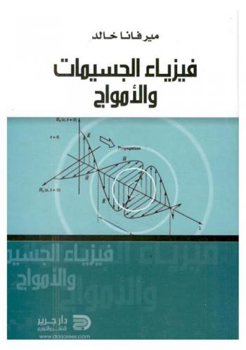
فيزياء الجسيمات والأمواج : الجسيمات والأمواج، صعود النظرة الميكانيكية، القانون الأول للديناميكا الحرارية، التكهرب، المجال المغناطيسي، فرق الكمون الكهربائي، السعة والمكثفات، حساب التغيرات الصغيرة، الاستقرار والاحتمال الإحصائي، الضغط الجوي وضغط الغازات، صور البطاقة
فيزياء الجسيمات والأمواج : الجسيمات والأمواج، صعود النظرة الميكانيكية، القانون الأول للديناميكا الحرارية، التكهرب، المجال المغناطيسي، فرق الكمون الكهربائي، السعة والمكثفات، حساب التغيرات الصغيرة، الاستقرار والاحتمال الإحصائي، الضغط الجوي وضغط الغازات، صور البطاقة للأستاذ ميرفانا خالد إشعاع بلا كتلة وهذان هما المكونان لفيزياء الجسيمات المادة والإشعاع والجسيمات مصطلح يطلق على العديد من الأجسام متناهية الصغر كجزيئات الغاز والبروتونات أو حتى الغبار المنزلي.
Book

Morphology of the Raised Shore Platforms Along the Coastline between Daghmar and Dhabab, Sultanate of Oman
Raised shore platforms are rocky surfaces formed by wave action and subaerial weathering during global high sea level stands. The present height of the raised shore platforms is attributed to several factors, mainly to eustatic sea level changes, isostatic changes in the relative level of land and sea, and vertical tectonic activities. The aim of this study is to investigate the detailed morphology of the raised shore platform along the rocky coastline between Daghmar and Dhabab, in the southeastern part of Muscat Governorate. The study also intends to establish a tentative chronology of the raised shore platforms development. The methodology is based on field observation and documentation, along with satellite and aerial photographs analysis. The results have shown that the study area has a sequence of five successive, well developed raised shore platforms that are well preserved, except the platform at 10m altitude which is only found in isolated fragments. The formation of the raised shore platforms has been affected by a number of constructive factors including tectonic activity, and destructive factors such as fluvial action and subaerial weathering. No absolute dating has been reported or can be obtained from the study area, due to its erosional nature. However, dating from the shorelines adjacent to the study area, ranging in heights from 3 to 15m above sea level, revealed a narrow range of 26,400 to 29,600 years. This period coincides with the last glaciations when the sea level was at about 75m below the present level, and thus did not match with the altitudes of the platforms. This suggests that the platforms could belong to the last interglacial high sea level, when the sea level stood at about 6m above the present level. Based on this scenario, the study concludes that the coastline of the study area has not experienced any significant uplift during the Late Quaternary.
Journal Article

Improving the Performance of Ultrasound Transducer Using Simulation and Modeling
Improving medical imaging using ultrasound is important in order to get a high- resolution medical image, this research aims to achieve a physical modeling and simulation of an ultrasound transducer (UT) showing the electrical impedance of the piezoelectric material, in order to increase the transducer performance at both high and low frequencies by choosing a suitable piezoelectric material with good impedance. we adopted in this research Lead Zirconate Titanate material (PZT4), and performed modeling using mathematical equations that describe the actual physical behavior in the transducer structure and made a graphic user interface (GUI) using Matlab environment that demonstrate it, and display the electrical impedance of the piezoelectric material. As well as using Simulation by Finite Elements Methods (FEM) using On Scale environment and comparing the results in both of them. The results matched at a certain frequency, to give a clear image in the deep areas of the body. This later enables us to make modifications to the transducer structure and add backing layer and matching layer for the piezoelectric material.
Journal Article

فاعلية استخدام استراتيجية الأمواج المتداخلة أثناء تدريس مادة الجغرافيا في اكتساب مهارات التفكير الواقعي وتحسين الاتجاهات نحوها لدى طلاب الصف السادس الأساسي في الأردن
هدفت الدراسة إلى فحص فاعلية استخدام استراتيجية الأمواج المتداخلة أثناء تدريس مادة الجغرافيا في اكتساب مهارات التفكير الواقعي وتحسين الاتجاهات نحوها لدى عينة من طلاب الصف السادس الأساسي في الأردن، وذلك باستخدام المنهج شبه التجريبي. ولتحقيق أهداف الدراسة استخدمت الطريقة القصدية في اختيار مجموعة من الصف السادس الأساسي بلغت ن=64 طالبا، وزعوا عشوائيا على مجموعتين؛ تجريبية بلغ عددها 32 طالبا، ودرست باستراتيجية..، ومجموعة ضابطة تألفت من 32 طالب، درست بالطريقة المعتادة. أعد الباحث أداتين: اختبار مهارات التفكير الواقعي بأبعاده الثلاث، وكذلك مقياس الاتجاهات نحو مادة الجغرافيا، وبعد التحقق من صدقهما وثباتهما تم تطبيقهما على أفراد الدراسة في القياسين القبلي والبعدي. وأشارت نتائج التحليلات الإحصائية إلى وجود فروق دالة إحصائيا عند مستوى α=0.05، بين متوسطي درجات المجموعة التجريبية ودرجات المجموعة الضابطة في اختبار مهارات التفكير الواقعي، والاتجاهات نحو مادة الجغرافيا في القياس البعدي لصالح المجموعة التجريبية، ما يشير إلى كفاءة استخدام إستراتيجية الأمواج المتداخلة المستخدمة في الدراسة الحالية في تعليم مادة الجغرافيا.
Journal Article

ميناء مدينة توكرة الأثرية
تعد الموانئ بالمدن القديمة من أهم المرافق، التي يدل وجودها وحجمها على أهمية وحجم المدن المرفقة بها، والتنوع في منافذ اتصالاتها الخارجية وتعاملاتها التجارية، ومدى استقلالها التجاري والخدمي، الذي يعد من المؤشرات الدالة على استقلالها السياسي. لذلك فإن الدراسات المتعلقة بإجراء مسوح ميدانية، على الشواطئ وتحت مياه البحر، لغرض الكشف عن الأدلة المادية، لإثبات حقيقة وجود ميناء بمدينة ما، ومحاولة التعرف على أقسامه، وبالتالي حجمه، تعد بالغة الأهمية، وتنعكس على فهم أكبر للمدينة نفسها. وتأسيساً على ذلك فإن هذه الدراسة ترتكز على مسح ميداني، تحت مياه البحر وخارجها قبالة مدينة توكرة، يهدف إلى توثيق كل الملامح الطبيعية والمعمارية، ومن ثم دراستها بالتحليل والمقارنة، بغية التأكد مادياً من وجود ميناء بمدينة توكرة، ومحاولة التعرف على حجمه، ومدى التنوع والتعدد في أقسامه، الأمر الذي ينعكس على تنوع وظائفه، وبالتالي على فهم نشاط المدينة، واتصالاتها الخارجية وتعاملاتها التجارية. ومن خلال إجراء هذه الدراسة، فقد تبين بالأدلة المادية، وجود ميناء ذو حجم كبير، يؤدي وظائف متعددة، منها المتعلقة بالتجارة والتواصل، ومنها المتعلقة بالصيد البحري بمدينة توكرة، تنتشر أقسامه في رقعة تحت الماء تتجاوز مساحته 2.5 هكتار.
Journal Article
The Impact of Creating Oahu Ocean Guide Magazine and Website for Tourists in Water Sport
Tourists come from all over the world to visit Hawaii. When we mention Hawaii the first thing that brings to our minds the beaches, surfing, diving, and many different water sports. As well when we mention Water sports are associated with many hazards. Which led me to do this research after living in Hawaii for 3 years. I found out high proportion of injuries, drowning and deaths, because of: 1- Lack of awareness of the dangers of water sports 2- Lack of knowledge of the beaches suitable for the exercise of any kind of sport. 3- Not take precautions of security and peace. I decided to pay back to Hawaii and for the beautiful years I spent there, by creating an educational magazine to educating tourists and those whose interested in water sports, specifically in Oahu, Hawaii. I named it \"Oahu Ocean Guide\" My research is focused on collecting information on safety tips and fishing systems as well as water activities such as swimming, windsurfing and scuba diving. Along with these activities come risks and how to prevent these dangers. In order to reach a wider audience, I have created a website that includes all ocean activities in addition to a guide explaining the risks of Hawaii's oceans. The magazine and the site together outline many risks as well as prevent them so that the tourist gets a safe holiday.
Journal Article
أمواج البحر
سلط المقال الضوء على أمواج البحر. ينتشر الماء في كوكب الأرض ليغطي (71%) من سطح الأرض، وكل الماء المحيط باليابسة هو ماء مالح، وفي البحار ملح يكفي لتغطية اليابسة بطبقة يصل سمكها إلى أكثر من مائة متر، ويكفي لتغطية إفريقيا بكاملها بجبالها وغاباتها. وأوضح أن ملوحة البحر تختلف من بحر إلى آخر، كما تختلف بين السطح والقاع، والبحر الأحمر أكثر البحار ملوحة، بينما تقل ملوحة بحر البلطيق في أوروبا عن ملوحة البحر الأحمر بستة أمثال. وأشار إلى البحيرة المالحة العظيمة في أمريكا والتي تغطي نحو (3000) كيلو متر وملوحتها أشد ملوحة مياه المحيط بستة أضعاف، ويؤخذ من البحيرة في العام ما زنته (40) ألف طن من الملح. وتطرق إلى أن الأمواج نتاج بعض حركات البحر، وتتكسر على الشواطئ الصخرية أو الرملية بقوة وعنف أحيانًا، وتصل أحيانًا أخرى على حد غمر بعض المناطق السكنية. واختتم المقال بالإشارة إلى أن الموجة التي ارتفاعها متر ونصف على الشاطئ قد يكون ارتفاعها في عرض البحر أكثر من خمسة أمتار، وهي الأمواج التي تجعل البواخر الضخمة تتأرجح صاعدة هابطة وكأنها قطعة خشب في نبع يتدفق. كُتب هذا المستخلص من قِبل المنظومة 2023
Journal Article